
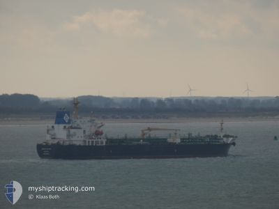
KRITI RUBY
Oil/Chemical Tanker
Current Trip
| Time Travelled | 6 days |
|---|---|
| Remaining Time | 3 days |
| Distance Travelled | 1531.07 nm |
| Remaining Distance | 982.15 nm |
| AVG Speed | 10.4 Knots |
| MAX Speed | 11.9 Knots |
| AVG Wind | 7.4 knots |
| MAX Wind | 12 knots |
| MIN Temp | 25°C / 77°F |
| MAX Temp | 27.9°C / 82.22°F |
| Draught | 8 m |
| Position Received | Now |
Current Position
| Longitude | --- |
|---|---|
| Latitude | --- |
| Status | Under way using engine |
| Speed | 10.3 Knots |
| Course | 348° |
| Area | North Atlantic Ocean |
| Station | T-AIS |
| Position Received | Now |
Info
Information
The current position of KRITI RUBY is in North Atlantic Ocean with coordinates 12.11133° / -17.43368° as reported on 2025-12-11 20:13 by AIS to our vessel tracker app. The vessel's current speed is 10.3 Knots and is heading at the port of LAS PALMAS. The estimated time of arrival as calculated by MyShipTracking vessel tracking app is 2025-12-15 19:35 LT
The vessel KRITI RUBY (IMO: 9391282, MMSI: 240941000) is a Oil/Chemical Tanker that was built in 2008 ( 17 years old ). It's sailing under the flag of [GR] Greece.
In this page you can find informations about the vessels current position, last detected port calls, and current voyage information. If the vessels is not in coverage by AIS you will find the latest position.
The current position of KRITI RUBY is detected by our AIS receivers and we are not responsible for the reliability of the data. The last position was recorded while the vessel was in Coverage by the Ais receivers of our vessel tracking app.
The current draught of KRITI RUBY as reported by AIS is 8 meters
Weather
| Temperature | 25.1°C / 77.18°F |
|---|---|
| Wind Speed | 12 knots |
| Direction | 329° NNW |
| Pressure | 1011.9 hPa |
| Humidity | 67.6 % |
| Cloud Coverage | 94 % |
Featured Company
Last Port Calls
| Port | Arrival | Departure | Time In Port |
|---|---|---|---|
| 2025-12-01 20:45 | 2025-12-05 18:17 | 3 d | |
| 2025-11-22 02:16 | 2025-11-22 09:27 | 7 h | |
| 2025-11-11 15:13 | 2025-11-19 14:27 | 7 d | |
| 2025-11-01 04:46 | 2025-11-03 09:38 | 2 d | |
| 2025-10-25 10:28 | 2025-10-27 04:07 | 1 d | |
| 2025-10-18 20:30 | 2025-10-20 18:54 | 1 d |
Last Trips
| Origin | Departure | Destination | Arrival | Distance | |
|---|---|---|---|---|---|
| 2025-11-22 09:27 | 2025-12-01 20:45 | 2579.18 nm | |||
| 2025-11-19 14:27 | 2025-11-22 02:16 | 713.59 nm | |||
| 2025-11-03 09:38 | 2025-11-11 15:13 | 2019.09 nm | |||
| 2025-10-27 04:07 | 2025-11-01 04:46 | 1305.36 nm | |||
| 2025-10-20 18:54 | 2025-10-25 10:28 | 1287.72 nm | |||
| 2025-09-27 16:25 | 2025-10-18 20:30 | 1397.97 nm |
Events
| Time | Event | Details | Position / Dest | Info |
|---|---|---|---|---|
| 2025-12-11 19:17 | Change Sea Area | Senegalese part of the North Atlantic Ocean Guinea Bissau part of the North Atlantic Ocean |
11.95627 / -17.39423
North Atlantic Ocean
LAS PALMAS
|
Speed: 10.3 kn Course: 344° |
| 2025-12-11 17:34 | Draught Changed | 8 11.1 |
11.66398 / -17.32805
LAS PALMAS
|
Speed: 10 kn Course: 348° |
| 2025-12-11 17:34 | Draught Changed | 8 11.1 |
11.66398 / -17.32805
LAS PALMAS
|
Speed: 10 kn Course: 348° |
| 2025-12-11 17:34 | Destination Changed | LAS PALMAS LAGOS,NIGERIA |
11.66398 / -17.32805
LAS PALMAS
|
Speed: 10 kn Course: 348° |
| 2025-12-11 17:34 | Destination Changed | LAS PALMAS LAGOS,NIGERIA |
11.66398 / -17.32805
LAS PALMAS
|
Speed: 10 kn Course: 348° |
| 2025-12-11 17:34 | ETA Changed | 2025/12/15 12:00 2025/11/30 20:00 |
11.66398 / -17.32805
LAS PALMAS
|
Speed: 10 kn Course: 348° |
| 2025-12-11 17:34 | ETA Changed | 2025/12/15 12:00 2025/11/30 20:00 |
11.66398 / -17.32805
LAS PALMAS
|
Speed: 10 kn Course: 348° |
| 2025-12-11 17:28 | Status Changed | Under way using engine Default |
11.64788 / -17.32477
LAGOS,NIGERIA
|
Speed: 10.1 kn Course: 347° |
| 2025-12-11 17:27 | Status Changed | Default Under way using engine |
11.64422 / -17.32402
LAGOS,NIGERIA
|
Speed: 10.1 kn Course: 347° |
| 2025-12-11 17:13 | Status Changed | Under way using engine Default |
11.60707 / -17.31588
LAGOS,NIGERIA
|
Speed: 10 kn Course: 347° |