
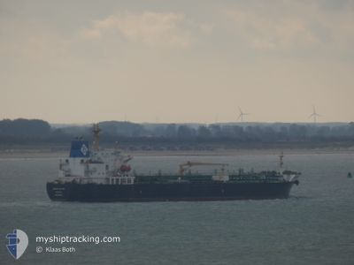
KRITI RUBY
Oil/Chemical Tanker
Current Trip
| Time Travelled | 57 days |
|---|---|
| Remaining Time | --- |
| Distance Travelled | 6078.56 nm |
| Remaining Distance | --- |
| AVG Speed | 10.8 Knots |
| MAX Speed | 15 Knots |
| AVG Wind | 7.2 knots |
| MAX Wind | 23 knots |
| MIN Temp | 19.5°C / 67.1°F |
| MAX Temp | 31.9°C / 89.42°F |
| Dybgang | 10.8 m |
| Position Modtaget | 6 d siden |
Current Position
| Longitude | 103.46300° |
|---|---|
| Latitude | 1.22572° |
| Status | Under way using engine |
| Fart | 12.4 Knots |
| Kurs | 279° |
| Område | Malacca Strait |
| Station | T-AIS |
| Position Modtaget | 6 d siden |
Info
Information
The current position of KRITI RUBY is in Malacca Strait with coordinates 1.22572° / 103.46300° as reported on 2024-05-05 01:47 by AIS to our vessel tracker app. The vessel's current speed is 12.4 Knots and is heading at the port of PORT DICKSON. The estimated time of arrival as calculated by MyShipTracking vessel tracking app is 2024-05-05 13:00 LT
The vessel KRITI RUBY (IMO: 9391282, MMSI: 240941000) is a Oil/Chemical Tanker that was built in 2008 ( 16 år gamle ). It's sailing under the flag of [GR] Greece.
In this page you can find informations about the vessels current position, last detected port calls, and current voyage information. If the vessels is not in coverage by AIS you will find the latest position.
The current position of KRITI RUBY is detected by our AIS receivers and we are not responsible for the reliability of the data. The last position was recorded while the vessel was in Coverage by the Ais receivers of our vessel tracking app.
The current draught of KRITI RUBY as reported by AIS is 10.8 meters
Weather
| Temperature | 29.9°C / 85.82°F |
|---|---|
| Wind Speed | 3 knots |
| Direction | 121° ESE |
| Pressure | 1009.6 hPa |
| Humidity | 70.4 % |
| Cloud Coverage | 45 % |
Featured Company
Last Port Calls
| Port | Arrival | Departure | Time In Port |
|---|---|---|---|
| 2024-04-01 03:12 | 2024-04-01 12:14 | 9 h | |
| 2024-03-13 07:16 | 2024-03-14 22:54 | 1 d | |
| 2024-03-09 16:21 | 2024-03-10 07:15 | 14 h |
Events
| Tid | Hændelsen | Detaljer | Position / Dest | Info |
|---|---|---|---|---|
| 2024-05-09 00:44 | START Sejllads | 3.11 nm, West of PORT DICKSON |
2.50283 / 101.74368
MY PDI
|
Fart: 4.4 kn Kurs: 89° |
| 2024-05-07 18:12 | STOP Sejllads | 3.32 nm, West of PORT DICKSON |
2.50588 / 101.73914
MY PDI
|
Fart: 0.3 kn Kurs: 146° |
| 2024-05-07 17:37 | START Sejllads | 2.71 nm, West of PORT DICKSON |
2.50978 / 101.74882
MY PDI
|
Fart: 3.4 kn Kurs: 253° |
| 2024-05-05 15:40 | STOP Sejllads | 2.41 nm, West of PORT DICKSON |
2.50490 / 101.75522
MY PDI
|
Fart: 0.1 kn Kurs: 152° |
| 2024-05-05 14:20 | START Sejllads | 3.93 nm, South West of PORT DICKSON |
2.48948 / 101.73430
MY PDI
|
Fart: 4 kn Kurs: 79° |
| 2024-05-05 12:45 | STOP Sejllads | 3.89 nm, South West of PORT DICKSON |
2.47762 / 101.74281
MY PDI
|
Fart: 0.3 kn Kurs: 312° |
| 2024-05-05 01:52 | Status er ændret | Default Under way using engine |
1.22877 / 103.44544
MY PDI
|
Fart: 12.4 kn Kurs: 279° |
| 2024-05-05 01:47 | Ændre havområde | Malaysian part of the Malacca Strait Malaysian part of the Singapore Strait |
1.22572 / 103.46300
Malacca Strait
MY PDI
|
Fart: 12.4 kn Kurs: 279° |
| 2024-05-05 01:47 | Udenfor Dækning |
1.22572 / 103.46300
Malacca Strait
MY PDI
|
Fart: 12.4 kn Kurs: 279° |
|
| 2024-05-05 01:10 | Ændre havområde | Malaysian part of the Singapore Strait Indonesian part of the Singapore Strait |
1.19792 / 103.58555
Singapore Strait
MY PDI
|
Fart: 12.5 kn Kurs: 283° |