
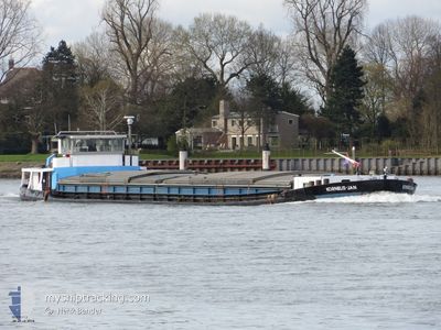
KORNELIS-JAN
Cargo
Current Trip
DEBRE03906CITYX00010
| Time Travelled | 13 h, 57 mins |
|---|---|
| Remaining Time | --- |
| Distance Travelled | 77.11 nm |
| Remaining Distance | --- |
| AVG Speed | 6.3 Knots |
| MAX Speed | 8.6 Knots |
| AVG Wind | 6.2 knots |
| MAX Wind | 9.6 knots |
| MIN Temp | 11.2°C / 52.16°F |
| MAX Temp | 20.6°C / 69.08°F |
| Draught | 0 m |
| Position Received | 1 m ago |
Current Position
| Longitude | 5.73712° |
|---|---|
| Latitude | 53.03057° |
| Status | Under way using engine |
| Speed | 5.8 Knots |
| Course | 39° |
| Area | North Sea |
| Station | T-AIS |
| Position Received | 1 m ago |
Info
Information
The current position of KORNELIS-JAN is in North Sea with coordinates 53.03057° / 5.73712° as reported on 2024-04-30 18:55 by AIS to our vessel tracker app. The vessel's current speed is 5.8 Knots
The vessel KORNELIS-JAN (MMSI: 244660942) is a Cargo It's sailing under the flag of [NL] Netherlands.
In this page you can find informations about the vessels current position, last detected port calls, and current voyage information. If the vessels is not in coverage by AIS you will find the latest position.
The current position of KORNELIS-JAN is detected by our AIS receivers and we are not responsible for the reliability of the data. The last position was recorded while the vessel was in Coverage by the Ais receivers of our vessel tracking app.
Weather
| Temperature | 18.5°C / 65.3°F |
|---|---|
| Wind Speed | 3 knots |
| Direction | 82° E |
| Pressure | 1012.6 hPa |
| Humidity | 78.4 % |
| Cloud Coverage | 87 % |
Featured Company
Last Port Calls
| Port | Arrival | Departure | Time In Port |
|---|---|---|---|
| 2024-04-29 19:07 | 2024-04-30 04:59 | 9 h | |
| 2024-04-29 14:46 | 2024-04-29 15:48 | 1 h | |
| 2024-04-26 13:49 | 2024-04-29 10:02 | 2 d | |
| 2024-04-25 20:27 | 2024-04-26 12:03 | 15 h | |
| 2024-04-25 09:56 | 2024-04-25 10:35 | 38 m | |
| 2024-04-24 08:34 | 2024-04-25 07:52 | 23 h | |
| 2024-04-23 07:24 | 2024-04-23 07:46 | 22 m | |
| 2024-04-22 19:23 | 2024-04-23 04:15 | 8 h | |
| 2024-04-22 16:55 | 2024-04-22 17:01 | 6 m | |
| 2024-04-19 07:53 | 2024-04-19 09:02 | 1 h |
Most Visited Ports (Last year)
| Port | Arrivals | |
|---|---|---|
| 16 | ||
| 11 | ||
| 8 | ||
| 7 | ||
| 7 | ||
| 6 |
Last Trips
| Origin | Departure | Destination | Arrival | Distance | |
|---|---|---|---|---|---|
| 2024-04-29 17:48 | 2024-04-29 21:07 | 26.26 nm | |||
| 2024-04-29 12:02 | 2024-04-29 16:46 | 30.55 nm | |||
| 2024-04-26 14:03 | 2024-04-26 15:49 | 8.23 nm | |||
| 2024-04-25 12:35 | 2024-04-25 22:27 | 69.88 nm | |||
| 2024-04-25 09:52 | 2024-04-25 11:56 | 7.84 nm | |||
| 2024-04-23 09:46 | 2024-04-24 10:34 | 7.38 nm | |||
| 2024-04-23 06:15 | 2024-04-23 09:24 | 17.13 nm | |||
| 2024-04-22 19:01 | 2024-04-22 21:23 | 23.80 nm | |||
| 2024-04-19 11:02 | 2024-04-22 18:55 | 58.21 nm | |||
| 2024-04-18 09:58 | 2024-04-19 09:53 | 63.79 nm |
Events
| Time | Event | Details | Position / Dest | Info |
|---|---|---|---|---|
| 2024-04-30 16:58 | START Moving | 0.88 nm, West of LEMMER |
52.85366 / 5.67779
DEBRE03906CITYX00010
|
Speed: 3.9 kn Course: 20.1° |
| 2024-04-30 16:27 | STOP Moving | 0.95 nm, West of LEMMER |
52.84740 / 5.67440
DEBRE03906CITYX00010
|
Speed: 0.2 kn Course: 511° |
| 2024-04-30 13:18 | START Moving | 0.24 nm, North West of LELYSTAD |
52.52967 / 5.43513
DEBRE03906CITYX00010
|
Speed: 4.8 kn Course: 9.6° |
| 2024-04-30 13:09 | STOP Moving | 0.17 nm, North West of LELYSTAD |
52.52768 / 5.43478
DEBRE03906CITYX00010
|
Speed: Course: 511° |
| 2024-04-30 11:17 | ETA Changed | 2025/03/28 18:00 |
52.39621 / 5.09352
DEBRE03906CITYX00010
|
Speed: 8.5 kn Course: 57° |
| 2024-04-30 10:37 | START Moving | 0.09 nm, West of SCHELLINGWOUDE |
52.38070 / 4.96233
DEBRE03906CITYX00010
|
Speed: 5 kn Course: 139.9° |
| 2024-04-30 10:15 | STOP Moving | 0.17 nm, West of SCHELLINGWOUDE |
52.38188 / 4.96011
DEBRE03906CITYX00010
|
Speed: 0.3 kn Course: 511° |
| 2024-04-30 10:11 | ETA Changed | 2025/03/28 18:00 |
52.38193 / 4.95451
DEBRE03906CITYX00010
|
Speed: 4.3 kn Course: 43° |
| 2024-04-30 09:47 | ETA Changed | 2025/03/28 18:00 |
52.34864 / 4.98763
DEBRE03906CITYX00010
|
Speed: 6.7 kn Course: 310.9° |
| 2024-04-30 09:29 | ETA Changed | 2025/03/28 18:00 |
52.32245 / 5.01822
DEBRE03906CITYX00010
|
Speed: 6.8 kn Course: 355° |