
KOCIEWIE
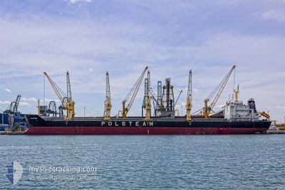
Bulk Carrier
Current Trip
| Time Travelled | 4 days |
|---|---|
| Remaining Time | --- |
| Distance Travelled | 401.17 nm |
| Remaining Distance | --- |
| AVG Speed | 5.4 Knots |
| MAX Speed | 12 Knots |
| AVG Wind | 21.6 knots |
| MAX Wind | 28.4 knots |
| MIN Temp | 2.7°C / 36.86°F |
| MAX Temp | 8.7°C / 47.66°F |
| Draught | 5.7 m |
| Position Received | 14 m ago |
Current Position
| Longitude | --- |
|---|---|
| Latitude | --- |
| Status | At anchor |
| Speed | 0.1 Knots |
| Course | 224° |
| Area | North Sea |
| Station | T-AIS |
| Position Received | 14 m ago |
Information
The current position of KOCIEWIE is in North Sea with coordinates 54.07093° / 7.42520° as reported on 2025-02-23 13:28 by AIS to our vessel tracker app. The vessel's current speed is 0.1 Knots
The vessel KOCIEWIE (IMO: 9423798, MMSI: 311014100) is a Bulk Carrier that was built in 2009 ( 16 years old ). It's sailing under the flag of [BS] Bahamas.
In this page you can find informations about the vessels current position, last detected port calls, and current voyage information. If the vessels is not in coverage by AIS you will find the latest position.
The current position of KOCIEWIE is detected by our AIS receivers and we are not responsible for the reliability of the data. The last position was recorded while the vessel was in Coverage by the Ais receivers of our vessel tracking app.
The current draught of KOCIEWIE as reported by AIS is 5.7 meters
Weather
| Temperature | 6.1°C / 42.98°F |
|---|---|
| Wind Speed | 12 knots |
| Direction | 219° SW |
| Pressure | 1025 hPa |
| Humidity | 93.3 % |
| Cloud Coverage | 100 % |
Featured Company
Last Trips
| Origin | Departure | Destination | Arrival | Distance | |
|---|---|---|---|---|---|
| 2025-02-08 12:03 | 2025-02-13 04:13 | 1052.43 nm | |||
| 2025-01-29 13:59 | 2025-02-01 07:19 | 267.95 nm | |||
| 2025-01-02 09:12 | 2025-01-21 12:05 | 2889.09 nm | |||
| 2024-12-18 11:02 | 2024-12-29 08:30 | 924.21 nm |
Events
| Time | Event | Details | Position / Dest | Info |
|---|---|---|---|---|
| 2025-02-23 13:31 | Status Changed | Default At anchor |
54.07093 / 7.42522
DEHAM
|
Speed: 0.1 kn Course: 224° |
| 2025-02-23 13:28 | Status Changed | At anchor Default |
54.07093 / 7.42520
DEHAM
|
Speed: 0.3 kn Course: 237° |
| 2025-02-23 13:25 | Status Changed | Default At anchor |
54.07078 / 7.42525
DEHAM
|
Speed: 0.3 kn Course: 250° |
| 2025-02-23 12:50 | ETA Changed | 2025/02/22 11:30 2025/02/24 01:00 |
54.07115 / 7.42462
DEHAM
|
Speed: Course: 211° |
| 2025-02-23 12:49 | Status Changed | At anchor Default |
54.07115 / 7.42462
DEHAM
|
Speed: 0.2 kn Course: 246° |
| 2025-02-23 12:49 | IN Coverage |
54.07115 / 7.42462
North Sea
DEHAM
|
Speed: Course: 298° |
|
| 2025-02-23 01:45 | Status Changed | Default At anchor |
54.07015 / 7.42543
DEHAM
|
Speed: Course: 254° |
| 2025-02-23 01:21 | Status Changed | At anchor Default |
54.07012 / 7.42542
DEHAM
|
Speed: 0.1 kn Course: 249° |
| 2025-02-22 10:06 | STOP Moving | 17.86 nm, West of HELGOLAND |
54.07142 / 7.42152
DEHAM
|
Speed: 0.2 kn Course: 157° |
| 2025-02-22 09:35 | OUT of Coverage |
54.07853 / 7.42625
North Sea
DEHAM
|
Speed: 3.5 kn Course: 192° |