
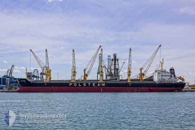
KOCIEWIE
Bulk Carrier
Current Trip
| Time Travelled | 17 days |
|---|---|
| Remaining Time | 1 day |
| Distance Travelled | 4731.84 nm |
| Remaining Distance | 332.56 nm |
| AVG Speed | 11.1 Noeuds |
| MAX Speed | 14.9 Noeuds |
| AVG Wind | 12.1 knots |
| MAX Wind | 29.8 knots |
| MIN Temp | 2.1°C / 35.78°F |
| MAX Temp | 18.9°C / 66.02°F |
| Tirant d eau | 10.6 m |
| Position reçue | 2 h, 4 m depuis |
Current Position
| Longitude | 17.73277° |
|---|---|
| Latitude | 41.22275° |
| Etat | Under way using engine |
| Vitesse | 12.1 Noeuds |
| Parcours | 311.2° |
| Zone | Adriatic Sea |
| Station | T-AIS |
| Position reçue | 2 h, 4 m depuis |
Info
Information
The current position of KOCIEWIE is in Adriatic Sea with coordinates 41.22275° / 17.73277° as reported on 2024-04-29 08:33 by AIS to our vessel tracker app. The vessel's current speed is 12.1 Noeuds and is heading at the port of VENEZIA. The estimated time of arrival as calculated by MyShipTracking vessel tracking app is 2024-04-30 13:38 LT
The vessel KOCIEWIE (IMO: 9423798, MMSI: 311014100) is a Bulk Carrier that was built in 2009 ( 15 Age ). It's sailing under the flag of [BS] Bahamas.
In this page you can find informations about the vessels current position, last detected port calls, and current voyage information. If the vessels is not in coverage by AIS you will find the latest position.
The current position of KOCIEWIE is detected by our AIS receivers and we are not responsible for the reliability of the data. The last position was recorded while the vessel was in Coverage by the Ais receivers of our vessel tracking app.
The current draught of KOCIEWIE as reported by AIS is 10.6 meters
Weather
| Temperature | 18.8°C / 65.84°F |
|---|---|
| Wind Speed | 4 knots |
| Direction | 347° NNW |
| Pressure | 1019.9 hPa |
| Humidity | 60.4 % |
| Cloud Coverage | 4 % |
Featured Company
Last Port Calls
| Port | Arrival | Departure | Time In Port |
|---|---|---|---|
| 2024-04-09 21:56 | 2024-04-12 04:34 | 2 d | |
| 2024-03-28 11:21 | 2024-03-31 17:15 | 3 d | |
| 2024-03-22 01:46 | |||
| 2024-03-08 19:12 | 2024-03-11 23:08 | 3 d | |
| 2024-02-27 04:00 | 2024-03-01 01:50 | 2 d | |
| 2024-02-01 08:49 | 2024-02-04 15:48 | 3 d |
Most Visited Ports (Last year)
| Port | Arrivals | |
|---|---|---|
| 1 | ||
| 1 | ||
| 1 | ||
| 1 | ||
| 1 | ||
| 1 |
Last Trips
| Origin | Departure | Destination | Arrival | Distance | |
|---|---|---|---|---|---|
| 2024-03-31 13:15 | 2024-04-09 17:56 | 1587.34 nm | |||
| 2024-03-21 19:46 | 2024-03-28 07:21 | 1621.22 nm | |||
| 2024-02-29 22:50 | 2024-03-08 15:12 | 1684.02 nm | |||
| 2024-02-04 12:48 | 2024-02-27 01:00 | 755.94 nm | |||
| 2024-01-18 08:14 | 2024-02-01 05:49 | 2821.76 nm |
Events
| Heure | Evenement | Détails | Position/ Destination | Info |
|---|---|---|---|---|
| 2024-04-29 08:39 | Etat Changé | Default Under way using engine |
41.23409 / 17.71434
IT VCE
|
Vitesse: 12.1 kn Parcours: 311.2° |
| 2024-04-29 08:33 | Hors de la zone couverte |
41.22275 / 17.73277
Adriatic Sea
IT VCE
|
Vitesse: 12.1 kn Parcours: 311.2° |
|
| 2024-04-29 00:04 | Changement de zone | Italian part of the Adriatic Sea Italian part of the Ionian Sea |
39.81346 / 18.70836
Adriatic Sea
IT VCE
|
Vitesse: 12.4 kn Parcours: 18.6° |
| 2024-04-29 00:03 | Etat Changé | Under way using engine Default |
39.80860 / 18.70632
IT VCE
|
Vitesse: 12.1 kn Parcours: 18° |
| 2024-04-28 23:55 | Etat Changé | Default Under way using engine |
39.78342 / 18.69581
IT VCE
|
Vitesse: 12.1 kn Parcours: 17.7° |
| 2024-04-28 22:31 | Etat Changé | Under way using engine Default |
39.56600 / 18.47507
IT VCE
|
Vitesse: 11.8 kn Parcours: 41° |
| 2024-04-28 22:16 | Dans la zone couverte |
39.56765 / 18.47693
Ionian Sea
IT VCE
|
Vitesse: 11.8 kn Parcours: 40.7° |
|
| 2024-04-28 16:36 | Etat Changé | Default Under way using engine |
38.65202 / 17.46252
IT VCE
|
Vitesse: 12.5 kn Parcours: 40.4° |
| 2024-04-28 16:28 | Etat Changé | Under way using engine Default |
38.63014 / 17.43854
IT VCE
|
Vitesse: 12.6 kn Parcours: 41° |
| 2024-04-28 16:28 | Hors de la zone couverte |
38.63014 / 17.43854
Ionian Sea
IT VCE
|
Vitesse: 12.5 kn Parcours: 40.4° |