

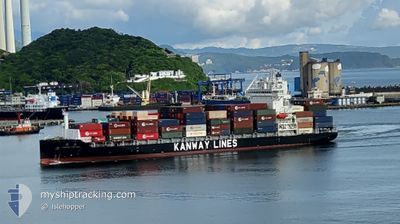
KANWAY FORTUNE
Cargo

Current Trip
| Time Travelled | 2 days |
|---|---|
| Remaining Time | 1 day |
| Distance Travelled | 1044.80 nm |
| Remaining Distance | 1421.90 nm |
| AVG Speed | 16 Knots |
| MAX Speed | 18.3 Knots |
| AVG Wind | 8.4 knots |
| MAX Wind | 14 knots |
| MIN Temp | 21.6°C / 70.88°F |
| MAX Temp | 27.1°C / 80.78°F |
| Draught | 9.2 m |
| Position Received | 2 d ago |
Current Position
| Longitude | --- |
|---|---|
| Latitude | --- |
| Status | Under way using engine |
| Speed | 14.2 Knots |
| Course | 155.2° |
| Area | South China Sea |
| Station | T-AIS |
| Position Received | 2 d ago |
Information
The current position of KANWAY FORTUNE is in South China Sea with coordinates 22.26343° / 114.10939° as reported on 2025-03-27 04:35 by AIS to our vessel tracker app. The vessel's current speed is 14.2 Knots and is heading at the port of SIRACHA. The estimated time of arrival as calculated by MyShipTracking vessel tracking app is 2025-03-31 04:43 LT
The vessel KANWAY FORTUNE (IMO: 9923968, MMSI: 477798900) is a Cargo It's sailing under the flag of [HK] Hong Kong.
In this page you can find informations about the vessels current position, last detected port calls, and current voyage information. If the vessels is not in coverage by AIS you will find the latest position.
The current position of KANWAY FORTUNE is detected by our AIS receivers and we are not responsible for the reliability of the data. The last position was recorded while the vessel was in Coverage by the Ais receivers of our vessel tracking app.
The current draught of KANWAY FORTUNE as reported by AIS is 9.2 meters
Weather
| Temperature | 26.4°C / 79.52°F |
|---|---|
| Wind Speed | 12 knots |
| Direction | 115° ESE |
| Pressure | 1009.4 hPa |
| Humidity | 80.7 % |
| Cloud Coverage | 11 % |


Featured Company
Last Port Calls
| Port | Arrival | Departure | Time In Port |
|---|---|---|---|
| 2025-03-26 23:05 | 2025-03-27 10:17 | 11 h | |
| 2025-03-25 15:42 | 2025-03-26 07:26 | 15 h | |
| 2025-03-24 15:10 | 2025-03-25 08:25 | 17 h | |
| 2025-03-16 19:43 | 2025-03-16 23:46 | 4 h | |
| 2025-03-15 16:53 | 2025-03-16 16:34 | 23 h | |
| 2025-03-14 18:15 | 2025-03-15 10:09 | 15 h | |
| 2025-03-11 00:01 | 2025-03-11 07:12 | 7 h | |
| 2025-03-09 22:17 | 2025-03-10 15:31 | 17 h | |
| 2025-03-09 05:57 | 2025-03-09 14:25 | 8 h | |
| 2025-03-02 21:17 | 2025-03-03 04:17 | 7 h |
Last Trips
| Origin | Departure | Destination | Arrival | Distance | |
|---|---|---|---|---|---|
| 2025-03-26 07:26 | 2025-03-26 23:05 | 117.52 nm | |||
| 2025-03-25 08:25 | 2025-03-25 15:42 | 100.95 nm | |||
| 2025-03-16 23:46 | 2025-03-24 15:10 | 1914.93 nm | |||
| 2025-03-16 16:34 | 2025-03-16 19:43 | 32.72 nm | |||
| 2025-03-15 10:09 | 2025-03-15 16:53 | 34.27 nm | |||
| 2025-03-11 07:12 | 2025-03-14 18:15 | 1504.53 nm | |||
| 2025-03-10 15:31 | 2025-03-11 00:01 | 93.46 nm | |||
| 2025-03-09 14:25 | 2025-03-09 22:17 | 96.41 nm | |||
| 2025-03-03 04:17 | 2025-03-09 05:57 | 1940.65 nm | |||
| 2025-03-02 17:33 | 2025-03-02 21:17 | 32.89 nm |
Events
| Time | Event | Details | Position / Dest | Info |
|---|---|---|---|---|
| 2025-03-27 04:42 | Status Changed | Default Under way using engine |
22.24462 / 114.12161
THLEM
|
Speed: 14.2 kn Course: 155.2° |
| 2025-03-27 04:35 | OUT of Coverage |
22.26343 / 114.10939
South China Sea
THLEM
|
Speed: 14.2 kn Course: 155.2° |
|
| 2025-03-27 02:25 | Draught Changed | 9.2 8.7 |
22.53338 / 113.85161
THLEM
|
Speed: 5.7 kn Course: 169.1° |
| 2025-03-27 02:25 | Destination Changed | THLEM CNSAD |
22.53338 / 113.85161
THLEM
|
Speed: 5.7 kn Course: 169.1° |
| 2025-03-27 02:25 | ETA Changed | 2025/03/30 12:00 2025/03/26 12:00 |
22.53338 / 113.85161
THLEM
|
Speed: 5.7 kn Course: 169.1° |
| 2025-03-27 02:23 | START Moving | 0.15 nm, North West of DA CHAN BAY |
22.53555 / 113.85113
CNSAD
|
Speed: 3.4 kn Course: 169° |
| 2025-03-27 02:17 | PORT DEPARTURE |
|
22.53707 / 113.85086
CNSAD
|
Speed: 1.1 kn Course: 80° |
| 2025-03-27 02:17 | Status Changed | Under way using engine Default |
22.53703 / 113.85100
[CN] DA CHAN BAY
|
Speed: 1.2 kn Course: 2° |
| 2025-03-27 02:14 | IN Coverage |
22.53704 / 113.85093
South China Sea
[CN] DA CHAN BAY
|
Speed: 1.1 kn Course: 283.5° |
|
| 2025-03-26 14:53 | OUT of Coverage |
22.53081 / 113.85304
South China Sea
[CN] DA CHAN BAY
|
Speed: 3.4 kn Course: 355.5° |