
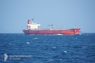
KAMOME VICTORIA
Oil Products Tanker
Current Trip
| Time Travelled | 14 h, 22 mins |
|---|---|
| Remaining Time | 1 day |
| Distance Travelled | 177.88 nm |
| Remaining Distance | 319.98 nm |
| AVG Speed | 12.5 Knots |
| MAX Speed | 13.6 Knots |
| AVG Wind | 8.2 knots |
| MAX Wind | 13 knots |
| MIN Temp | 24.5°C / 76.1°F |
| MAX Temp | 27.3°C / 81.14°F |
| Draught | 10.8 m |
| Position Received | 1 m ago |
Current Position
| Longitude | --- |
|---|---|
| Latitude | --- |
| Status | Under way using engine |
| Speed | 12.8 Knots |
| Course | 173° |
| Area | Persian Gulf |
| Station | T-AIS |
| Position Received | 1 m ago |
Info
Information
The current position of KAMOME VICTORIA is in Persian Gulf with coordinates 26.68978° / 52.71480° as reported on 2024-11-21 19:08 by AIS to our vessel tracker app. The vessel's current speed is 12.8 Knots and is heading at the port of FUJAIRAH. The estimated time of arrival as calculated by MyShipTracking vessel tracking app is 2024-11-23 00:11 LT
The vessel KAMOME VICTORIA (IMO: 9584102, MMSI: 353525000) is a Oil Products Tanker that was built in 2011 ( 13 years old ). It's sailing under the flag of [PA] Panama.
In this page you can find informations about the vessels current position, last detected port calls, and current voyage information. If the vessels is not in coverage by AIS you will find the latest position.
The current position of KAMOME VICTORIA is detected by our AIS receivers and we are not responsible for the reliability of the data. The last position was recorded while the vessel was in Coverage by the Ais receivers of our vessel tracking app.
The current draught of KAMOME VICTORIA as reported by AIS is 10.8 meters
Weather
| Temperature | 27.1°C / 80.78°F |
|---|---|
| Wind Speed | 13 knots |
| Direction | 306° NW |
| Pressure | 1014.3 hPa |
| Humidity | 66.8 % |
| Cloud Coverage | --- |
Featured Company
Last Trips
| Origin | Departure | Destination | Arrival | Distance | |
|---|---|---|---|---|---|
| 2024-10-30 10:57 | 2024-11-18 11:28 | 443.18 nm | |||
| 2024-10-26 23:45 | 2024-10-28 03:47 | 240.87 nm | |||
| 2024-09-29 09:33 | 2024-10-25 20:16 | 6892.13 nm | |||
| 2024-09-03 01:04 | 2024-09-27 15:41 | 7077.79 nm | |||
| 2024-08-13 12:04 | 2024-09-01 09:11 | 4068.64 nm |
Events
| Time | Event | Details | Position / Dest | Info |
|---|---|---|---|---|
| 2024-11-21 18:25 | Status Changed | Under way using engine Default |
26.84015 / 52.69802
AE FJR
|
Speed: 12.8 kn Course: 134° |
| 2024-11-21 18:11 | Status Changed | Default Under way using engine |
26.87247 / 52.65317
AE FJR
|
Speed: 13 kn Course: 124° |
| 2024-11-21 18:10 | Status Changed | Under way using engine Default |
26.87340 / 52.65167
AE FJR
|
Speed: 13 kn Course: 123° |
| 2024-11-21 18:07 | Status Changed | Default Under way using engine |
26.88060 / 52.63987
AE FJR
|
Speed: 13 kn Course: 124° |
| 2024-11-21 17:04 | Status Changed | Under way using engine Default |
26.99900 / 52.42830
AE FJR
|
Speed: 12.6 kn Course: 130° |
| 2024-11-21 16:56 | IN Coverage |
26.99900 / 52.42830
Persian Gulf
AE FJR
|
Speed: 12.6 kn Course: 126° |
|
| 2024-11-21 16:04 | Status Changed | Default Under way using engine |
27.08062 / 52.22553
AE FJR
|
Speed: 12.2 kn Course: 98° |
| 2024-11-21 16:01 | OUT of Coverage |
27.08215 / 52.21483
Persian Gulf
AE FJR
|
Speed: 12.2 kn Course: 98° |
|
| 2024-11-21 15:20 | Status Changed | Under way using engine Default |
27.11930 / 52.06518
AE FJR
|
Speed: 12 kn Course: 104° |
| 2024-11-21 15:14 | Status Changed | Default Under way using engine |
27.12403 / 52.04353
AE FJR
|
Speed: 12 kn Course: 100° |