
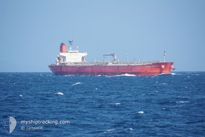
KAMOME VICTORIA
Oil Products Tanker
Current Trip
| Time Travelled | 1 day |
|---|---|
| Remaining Time | --- |
| Distance Travelled | 146.90 nm |
| Remaining Distance | --- |
| AVG Speed | 9 Knop |
| MAX Speed | 13.6 Knop |
| AVG Wind | 4.8 knots |
| MAX Wind | 13 knots |
| MIN Temp | 26.3°C / 79.34°F |
| MAX Temp | 29.3°C / 84.74°F |
| Djupgående | 14.1 m |
| Position mottagen | 1 d sen |
Current Position
| Longitud | --- |
|---|---|
| Latitude | --- |
| Status | Under way using engine |
| Fart | 11.8 Knop |
| Kurs | 83° |
| Område | Singapore Strait |
| Station | T-AIS |
| Position mottagen | 1 d sen |
Info
Information
The current position of KAMOME VICTORIA is in Singapore Strait with coordinates 1.25795° / 104.19528° as reported on 2025-02-15 12:36 by AIS to our vessel tracker app. The vessel's current speed is 11.8 Knop and is heading at the port of BOTANY. The estimated time of arrival as calculated by MyShipTracking vessel tracking app is 2025-03-03 00:01 LT
The vessel KAMOME VICTORIA (IMO: 9584102, MMSI: 353525000) is a Oil Products Tanker that was built in 2011 ( 14 År gammal ). It's sailing under the flag of [PA] Panama.
In this page you can find informations about the vessels current position, last detected port calls, and current voyage information. If the vessels is not in coverage by AIS you will find the latest position.
The current position of KAMOME VICTORIA is detected by our AIS receivers and we are not responsible for the reliability of the data. The last position was recorded while the vessel was in Coverage by the Ais receivers of our vessel tracking app.
The current draught of KAMOME VICTORIA as reported by AIS is 14.1 meters
Weather
| Temperature | 27.3°C / 81.14°F |
|---|---|
| Wind Speed | 7 knots |
| Direction | 329° NNW |
| Pressure | 1010.6 hPa |
| Humidity | 75.8 % |
| Cloud Coverage | 87 % |
Featured Company
Last Port Calls
| Port | Arrival | Departure | Time In Port |
|---|---|---|---|
| 2025-02-13 18:24 | 2025-02-15 06:27 | 1 d | |
| 2025-01-22 23:44 | 2025-01-23 19:00 | 19 h | |
| 2025-01-20 23:06 | 2025-01-22 20:09 | 1 d | |
| 2024-12-25 01:42 | 2024-12-26 09:07 | 1 d | |
| 2024-12-20 21:00 | 2024-12-21 21:27 | 1 d | |
| 2024-12-14 01:19 | 2024-12-16 02:52 | 2 d | |
| 2024-12-09 22:13 | 2024-12-12 05:49 | 2 d |
Last Trips
| Origin | Departure | Destination | Arrival | Distance | |
|---|---|---|---|---|---|
| 2025-01-24 04:00 | 2025-02-14 02:24 | 2749.31 nm | |||
| 2025-01-23 05:09 | 2025-01-23 08:44 | 13.03 nm | |||
| 2024-12-26 12:07 | 2025-01-21 08:06 | 6531.18 nm | |||
| 2024-12-22 00:27 | 2024-12-25 04:42 | 119.44 nm | |||
| 2024-12-16 06:52 | 2024-12-21 00:00 | 239.24 nm | |||
| 2024-12-12 08:49 | 2024-12-14 05:19 | 486.66 nm | |||
| 2024-11-21 07:47 | 2024-12-10 01:13 | 1957.13 nm |
Events
| Tid | Event | Detaljer | Position / Dest | Information |
|---|---|---|---|---|
| 2025-02-15 12:41 | Status ändrad | Default Under way using engine |
1.25988 / 104.21153
AU BOTANY
|
Fart: 11.8 kn Kurs: 83° |
| 2025-02-15 12:36 | UTANFÖR täckningsområde |
1.25795 / 104.19528
Singapore Strait
AU BOTANY
|
Fart: 11.8 kn Kurs: 83° |
|
| 2025-02-15 12:35 | Byter havsområde | Malaysian part of the Singapore Strait Indonesian part of the Singapore Strait |
1.25742 / 104.19040
Singapore Strait
AU BOTANY
|
Fart: 11.8 kn Kurs: 83° |
| 2025-02-15 08:32 | Status ändrad | Under way using engine Default |
1.11450 / 103.52668
AU BOTANY
|
Fart: 9.3 kn Kurs: 123° |
| 2025-02-15 08:25 | Status ändrad | Default Under way using engine |
1.12405 / 103.51260
AU BOTANY
|
Fart: 7.8 kn Kurs: 160° |
| 2025-02-15 08:15 | Byter havsområde | Indonesian part of the Singapore Strait Malaysian part of the Singapore Strait |
1.14288 / 103.51288
Singapore Strait
AU BOTANY
|
Fart: 10.6 kn Kurs: 242° |
| 2025-02-15 07:50 | Byter havsområde | Malaysian part of the Singapore Strait Indonesian part of the Singapore Strait |
1.18208 / 103.57453
Singapore Strait
AU BOTANY
|
Fart: 10.4 kn Kurs: 238° |
| 2025-02-15 07:25 | Byter havsområde | Indonesian part of the Singapore Strait Singaporean part of the Singapore Strait |
1.19788 / 103.64067
Singapore Strait
AU BOTANY
|
Fart: 8.6 kn Kurs: 240° |
| 2025-02-15 07:09 | ETA ändrat | 2025/03/03 00:01 2025/03/05 00:01 |
1.21648 / 103.66438
AU BOTANY
|
Fart: 6.5 kn Kurs: 196° |
| 2025-02-15 06:42 | STARTAR förflyttning | 1.98 nm, West of JURONG ISLAND |
1.25043 / 103.65733
AU BOTANY
|
Fart: 3.2 kn Kurs: 169° |