
JUDITH
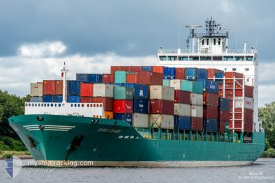
Container Ship
Current Trip
| Time Travelled | 1 day |
|---|---|
| Remaining Time | 14 h, 11 mins |
| Distance Travelled | 518.30 nm |
| Remaining Distance | 203.97 nm |
| AVG Speed | 10.3 Knots |
| MAX Speed | 17.4 Knots |
| AVG Wind | 10.1 knots |
| MAX Wind | 16.8 knots |
| MIN Temp | 3.9°C / 39.02°F |
| MAX Temp | 15.6°C / 60.08°F |
| Draught | 7.3 m |
| Position Received | 9 h, 44 m ago |
Current Position
| Longitude | 17.47841° |
|---|---|
| Latitude | 56.36890° |
| Status | Under way using engine |
| Speed | 13.6 Knots |
| Course | 53.1° |
| Area | Baltic Sea |
| Station | T-AIS |
| Position Received | 9 h, 44 m ago |
Info
Information
The current position of JUDITH is in Baltic Sea with coordinates 56.36890° / 17.47841° as reported on 2024-04-28 13:53 by AIS to our vessel tracker app. The vessel's current speed is 13.6 Knots and is heading at the port of HELSINKI. The estimated time of arrival as calculated by MyShipTracking vessel tracking app is 2024-04-29 13:49 LT
The vessel JUDITH (IMO: 9359260, MMSI: 212006000) is a Container Ship that was built in 2008 ( 16 years old ). It's sailing under the flag of [CY] Cyprus.
In this page you can find informations about the vessels current position, last detected port calls, and current voyage information. If the vessels is not in coverage by AIS you will find the latest position.
The current position of JUDITH is detected by our AIS receivers and we are not responsible for the reliability of the data. The last position was recorded while the vessel was in Coverage by the Ais receivers of our vessel tracking app.
The current draught of JUDITH as reported by AIS is 7.3 meters
Weather
| Temperature | 7.6°C / 45.68°F |
|---|---|
| Wind Speed | 15 knots |
| Direction | 150° SSE |
| Pressure | 1021.6 hPa |
| Humidity | 83.6 % |
| Cloud Coverage | 63 % |
Featured Company
Last Port Calls
| Port | Arrival | Departure | Time In Port |
|---|---|---|---|
| 2024-04-26 11:44 | 2024-04-27 03:57 | 16 h | |
| 2024-04-24 21:49 | 2024-04-25 22:29 | 1 d | |
| 2024-04-19 02:47 | 2024-04-19 02:50 | 2 m | |
| 2024-04-17 11:50 | 2024-04-18 12:00 | 1 d | |
| 2024-04-15 21:55 | 2024-04-17 02:25 | 1 d | |
| 2024-04-15 03:30 | 2024-04-15 04:23 | 53 m | |
| 2024-04-11 11:21 | 2024-04-13 09:11 | 1 d | |
| 2024-04-08 12:02 | 2024-04-08 23:46 | 11 h | |
| 2024-04-05 19:17 | 2024-04-07 14:59 | 1 d | |
| 2024-04-03 12:05 | 2024-04-04 09:18 | 21 h |
Last Trips
| Origin | Departure | Destination | Arrival | Distance | |
|---|---|---|---|---|---|
| 2024-04-26 00:29 | 2024-04-26 13:44 | 120.21 nm | |||
| 2024-04-19 04:50 | 2024-04-24 23:49 | 1290.13 nm | |||
| 2024-04-18 14:00 | 2024-04-19 04:47 | 87.58 nm | |||
| 2024-04-17 04:25 | 2024-04-17 13:50 | 114.19 nm | |||
| 2024-04-15 06:23 | 2024-04-15 23:55 | 133.09 nm | |||
| 2024-04-13 12:11 | 2024-04-15 05:30 | 650.41 nm | |||
| 2024-04-09 01:46 | 2024-04-11 14:21 | 792.36 nm | |||
| 2024-04-07 16:59 | 2024-04-08 14:02 | 117.80 nm | |||
| 2024-04-04 11:18 | 2024-04-05 21:17 | 121.28 nm | |||
| 2024-04-03 09:09 | 2024-04-03 14:05 | 56.22 nm |
Events
| Time | Event | Details | Position / Dest | Info |
|---|---|---|---|---|
| 2024-04-28 14:00 | Status Changed | Default Under way using engine |
56.38430 / 17.51741
FIHEL
|
Speed: 13.6 kn Course: 53.1° |
| 2024-04-28 13:53 | OUT of Coverage |
56.36890 / 17.47841
Baltic Sea
FIHEL
|
Speed: 13.6 kn Course: 53.1° |
|
| 2024-04-28 12:04 | Status Changed | Under way using engine Default |
56.11295 / 16.88947
FIHEL
|
Speed: 13.7 kn Course: 52° |
| 2024-04-28 11:53 | Status Changed | Default Under way using engine |
56.08764 / 16.83140
FIHEL
|
Speed: 13.7 kn Course: 52.4° |
| 2024-04-28 07:46 | Change Sea Area | Swedish part of the Baltic Sea Danish part of the Kattegat |
55.61915 / 15.39811
Baltic Sea
FIHEL
|
Speed: 14 kn Course: 60.4° |
| 2024-04-28 03:32 | Change Sea Area | Danish part of the Kattegat Swedish part of the Baltic Sea |
55.00648 / 14.05816
Kattegat
FIHEL
|
Speed: 15.4 kn Course: 71.7° |
| 2024-04-28 03:14 | Detected in Sea | Swedish part of the Baltic Sea |
54.98291 / 13.93151
Baltic Sea
FIHEL
|
Speed: 15.5 kn Course: 71.3° |
| 2024-04-27 23:20 | Change Sea Area | German part of the Baltic Sea Danish part of the Baltic Sea |
54.61418 / 12.36790
Baltic Sea
FIHEL
|
Speed: 15 kn Course: 61.7° |
| 2024-04-27 22:56 | Change Sea Area | Danish part of the Baltic Sea German part of the Baltic Sea |
54.54108 / 12.26328
Baltic Sea
FIHEL
|
Speed: 15.3 kn Course: 23.4° |
| 2024-04-27 22:16 | Change Sea Area | German part of the Baltic Sea Danish part of the Baltic Sea |
54.41399 / 12.11621
Baltic Sea
FIHEL
|
Speed: 14.5 kn Course: 88.1° |