
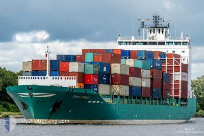
JUDITH
Container Ship
Current Trip
| Time Travelled | 9 h, 52 mins |
|---|---|
| Remaining Time | 2 h, 44 mins |
| Distance Travelled | 83.74 nm |
| Remaining Distance | 39.75 nm |
| AVG Speed | 9.1 Noeuds |
| MAX Speed | 16.7 Noeuds |
| AVG Wind | 13.8 knots |
| MAX Wind | 19 knots |
| MIN Temp | 4.4°C / 39.92°F |
| MAX Temp | 7.6°C / 45.68°F |
| Tirant d eau | 7.2 m |
| Position reçue | Maintenant |
Current Position
| Longitude | 9.11473° |
|---|---|
| Latitude | 53.87806° |
| Etat | Under way using engine |
| Vitesse | 6 Noeuds |
| Parcours | 85° |
| Zone | North Sea |
| Station | T-AIS |
| Position reçue | Maintenant |
Info
Information
The current position of JUDITH is in North Sea with coordinates 53.87806° / 9.11473° as reported on 2024-04-26 08:20 by AIS to our vessel tracker app. The vessel's current speed is 6 Noeuds and is heading at the port of HAMBURG. The estimated time of arrival as calculated by MyShipTracking vessel tracking app is 2024-04-26 11:05 LT
The vessel JUDITH (IMO: 9359260, MMSI: 212006000) is a Container Ship that was built in 2008 ( 16 Age ). It's sailing under the flag of [CY] Cyprus.
In this page you can find informations about the vessels current position, last detected port calls, and current voyage information. If the vessels is not in coverage by AIS you will find the latest position.
The current position of JUDITH is detected by our AIS receivers and we are not responsible for the reliability of the data. The last position was recorded while the vessel was in Coverage by the Ais receivers of our vessel tracking app.
The current draught of JUDITH as reported by AIS is 7.2 meters
Weather
| Temperature | 7.4°C / 45.32°F |
|---|---|
| Wind Speed | 12 knots |
| Direction | 225° SW |
| Pressure | 1002 hPa |
| Humidity | 78.5 % |
| Cloud Coverage | 72 % |
Featured Company
Last Port Calls
| Port | Arrival | Departure | Time In Port |
|---|---|---|---|
| 2024-04-24 21:49 | 2024-04-25 22:29 | 1 d | |
| 2024-04-19 02:47 | 2024-04-19 02:50 | 2 m | |
| 2024-04-17 11:50 | 2024-04-18 12:00 | 1 d | |
| 2024-04-15 21:55 | 2024-04-17 02:25 | 1 d | |
| 2024-04-15 03:30 | 2024-04-15 04:23 | 53 m | |
| 2024-04-11 11:21 | 2024-04-13 09:11 | 1 d | |
| 2024-04-08 12:02 | 2024-04-08 23:46 | 11 h | |
| 2024-04-05 19:17 | 2024-04-07 14:59 | 1 d | |
| 2024-04-03 12:05 | 2024-04-04 09:18 | 21 h | |
| 2024-04-02 10:05 | 2024-04-03 07:09 | 21 h |
Last Trips
| Origin | Departure | Destination | Arrival | Distance | |
|---|---|---|---|---|---|
| 2024-04-19 04:50 | 2024-04-24 23:49 | 1290.13 nm | |||
| 2024-04-18 14:00 | 2024-04-19 04:47 | 87.58 nm | |||
| 2024-04-17 04:25 | 2024-04-17 13:50 | 114.19 nm | |||
| 2024-04-15 06:23 | 2024-04-15 23:55 | 133.09 nm | |||
| 2024-04-13 12:11 | 2024-04-15 05:30 | 650.41 nm | |||
| 2024-04-09 01:46 | 2024-04-11 14:21 | 792.36 nm | |||
| 2024-04-07 16:59 | 2024-04-08 14:02 | 117.80 nm | |||
| 2024-04-04 11:18 | 2024-04-05 21:17 | 121.28 nm | |||
| 2024-04-03 09:09 | 2024-04-03 14:05 | 56.22 nm | |||
| 2024-04-02 02:27 | 2024-04-02 12:05 | 108.78 nm |
Events
| Heure | Evenement | Détails | Position/ Destination | Info |
|---|---|---|---|---|
| 2024-04-26 04:34 | Etat Changé | Under way using engine Default |
53.96926 / 8.03665
DEHAM
|
Vitesse: 9.3 kn Parcours: 69° |
| 2024-04-26 04:31 | Etat Changé | Default Under way using engine |
53.96620 / 8.02243
DEHAM
|
Vitesse: 9.5 kn Parcours: 61.9° |
| 2024-04-26 04:14 | Etat Changé | Under way using engine Default |
53.94371 / 7.95546
DEHAM
|
Vitesse: 10.4 kn Parcours: 56° |
| 2024-04-26 04:08 | Etat Changé | Default Under way using engine |
53.93514 / 7.93396
DEHAM
|
Vitesse: 5.1 kn Parcours: 76.8° |
| 2024-04-26 03:58 | Démarrage | 9.54 nm, North of WANGEROOGE |
53.93042 / 7.91208
DEHAM
|
Vitesse: 3.4 kn Parcours: 190° |
| 2024-04-26 03:54 | Arret | 9.67 nm, North of WANGEROOGE |
53.93243 / 7.91256
DEHAM
|
Vitesse: 0.2 kn Parcours: 173° |
| 2024-04-26 03:39 | Etat Changé | Under way using engine Default |
53.92878 / 7.91604
DEHAM
|
Vitesse: 1.2 kn Parcours: 236° |
| 2024-04-26 03:11 | Etat Changé | Default Under way using engine |
53.92504 / 7.93160
DEHAM
|
Vitesse: 1.3 kn Parcours: 222° |
| 2024-04-26 02:44 | Démarrage | 9.43 nm, North of WANGEROOGE |
53.92879 / 7.90842
DEHAM
|
Vitesse: 3.1 kn Parcours: 78° |
| 2024-04-26 01:57 | Arret | 8.96 nm, North of WANGEROOGE |
53.92111 / 7.90587
DEHAM
|
Vitesse: 0.1 kn Parcours: 178° |