

JSP RIDER
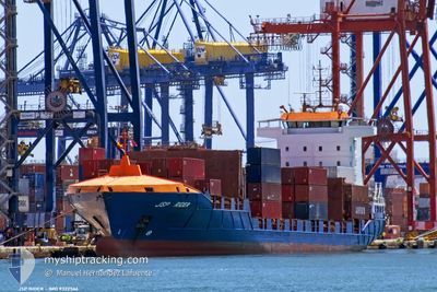
Container Ship

Current Trip
| Time Travelled | 1 day |
|---|---|
| Remaining Time | 1 day |
| Distance Travelled | 412.75 nm |
| Remaining Distance | 375.55 nm |
| AVG Speed | 14.5 Knots |
| MAX Speed | 18.5 Knots |
| AVG Wind | 15.3 knots |
| MAX Wind | 30 knots |
| MIN Temp | 0.9°C / 33.62°F |
| MAX Temp | 12.6°C / 54.68°F |
| Draught | 6.3 m |
| Position Received | 3 h, 56 m ago |
Current Position
| Longitude | --- |
|---|---|
| Latitude | --- |
| Status | Under way using engine |
| Speed | 11.8 Knots |
| Course | 240.9° |
| Area | English Channel |
| Station | T-AIS |
| Position Received | 3 h, 56 m ago |
Information
The current position of JSP RIDER is in English Channel with coordinates 49.54197° / -4.00189° as reported on 2025-02-20 09:47 by AIS to our vessel tracker app. The vessel's current speed is 11.8 Knots and is heading at the port of SANTANDER. The estimated time of arrival as calculated by MyShipTracking vessel tracking app is 2025-02-21 20:48 LT
The vessel JSP RIDER (IMO: 9322566, MMSI: 304922000) is a Container Ship that was built in 2006 ( 19 years old ). It's sailing under the flag of [AG] Antigua Barbuda.
In this page you can find informations about the vessels current position, last detected port calls, and current voyage information. If the vessels is not in coverage by AIS you will find the latest position.
The current position of JSP RIDER is detected by our AIS receivers and we are not responsible for the reliability of the data. The last position was recorded while the vessel was in Coverage by the Ais receivers of our vessel tracking app.
The current draught of JSP RIDER as reported by AIS is 6.3 meters
Weather
| Temperature | 12.5°C / 54.5°F |
|---|---|
| Wind Speed | 27 knots |
| Direction | 207° SSW |
| Pressure | 1012.4 hPa |
| Humidity | 94.8 % |
| Cloud Coverage | 100 % |


Featured Company
Last Port Calls
| Port | Arrival | Departure | Time In Port |
|---|---|---|---|
| 2025-02-19 06:32 | 2025-02-19 09:21 | 2 h | |
| 2025-02-19 06:29 | |||
| 2025-02-18 15:36 | |||
| 2025-02-17 14:44 | 2025-02-18 04:19 | 13 h | |
| 2025-02-14 17:18 | 2025-02-15 07:07 | 13 h | |
| 2025-02-11 15:40 | 2025-02-12 05:20 | 13 h | |
| 2025-02-10 12:08 | 2025-02-11 03:53 | 15 h | |
| 2025-02-07 17:13 | 2025-02-08 06:59 | 13 h | |
| 2025-02-04 15:43 | 2025-02-05 01:40 | 9 h | |
| 2025-02-03 13:50 | 2025-02-04 02:20 | 12 h |
Most Visited Ports (Last year)
| Port | Arrivals | |
|---|---|---|
| 70 | ||
| 24 | ||
| 18 | ||
| 18 | ||
| 9 | ||
| 8 |
Last Trips
| Origin | Departure | Destination | Arrival | Distance | |
|---|---|---|---|---|---|
| 2025-02-18 04:19 | 2025-02-19 07:32 | 172.25 nm | |||
| 2025-02-18 04:19 | 2025-02-19 07:29 | 172.20 nm | |||
| 2025-02-18 04:19 | 2025-02-18 16:36 | 168.87 nm | |||
| 2025-02-15 08:07 | 2025-02-17 14:44 | 722.91 nm | |||
| 2025-02-12 06:20 | 2025-02-14 18:18 | 790.48 nm | |||
| 2025-02-11 03:53 | 2025-02-11 16:40 | 167.90 nm | |||
| 2025-02-08 07:59 | 2025-02-10 12:08 | 721.53 nm | |||
| 2025-02-05 02:40 | 2025-02-07 18:13 | 791.21 nm | |||
| 2025-02-04 02:20 | 2025-02-04 16:43 | 175.04 nm | |||
| 2025-02-01 07:07 | 2025-02-03 13:50 | 722.36 nm |
Events
| Time | Event | Details | Position / Dest | Info |
|---|---|---|---|---|
| 2025-02-20 09:55 | Status Changed | Default Under way using engine |
49.52792 / -4.03875
ESSDR
|
Speed: 11.8 kn Course: 240.9° |
| 2025-02-20 09:47 | OUT of Coverage |
49.54197 / -4.00189
English Channel
ESSDR
|
Speed: 11.8 kn Course: 240.9° |
|
| 2025-02-20 08:53 | Status Changed | Under way using engine Default |
49.63574 / -3.74530
ESSDR
|
Speed: 12.7 kn Course: 239° |
| 2025-02-20 08:51 | Status Changed | Default Under way using engine |
49.63831 / -3.73862
ESSDR
|
Speed: 12.7 kn Course: 238.9° |
| 2025-02-20 08:51 | Status Changed | Under way using engine Default |
49.63922 / -3.73641
ESSDR
|
Speed: 13 kn Course: 239° |
| 2025-02-20 08:35 | Status Changed | Default Under way using engine |
49.66891 / -3.66179
ESSDR
|
Speed: 13.2 kn Course: 240.8° |
| 2025-02-20 08:15 | Status Changed | Under way using engine Default |
49.70663 / -3.56003
ESSDR
|
Speed: 13.9 kn Course: 241° |
| 2025-02-20 08:12 | Status Changed | Default Under way using engine |
49.71308 / -3.54191
ESSDR
|
Speed: 14 kn Course: 240.8° |
| 2025-02-20 07:30 | Status Changed | Under way using engine Default |
49.79266 / -3.32436
ESSDR
|
Speed: 14.3 kn Course: 241° |
| 2025-02-20 07:28 | Status Changed | Default Under way using engine |
49.79762 / -3.31125
ESSDR
|
Speed: 14.6 kn Course: 239.1° |