
JSP RIDER
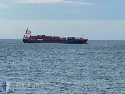
Container Ship
Current Trip
| Time Travelled | 2 days |
|---|---|
| Remaining Time | 10 h, 34 mins |
| Distance Travelled | 597.10 nm |
| Remaining Distance | 191.83 nm |
| AVG Speed | 13.5 Noeuds |
| MAX Speed | 17.5 Noeuds |
| AVG Wind | 5.1 knots |
| MAX Wind | 9 knots |
| MIN Temp | 6.5°C / 43.7°F |
| MAX Temp | 12.7°C / 54.86°F |
| Tirant d eau | 6.1 m |
| Position reçue | 4 h, 42 m depuis |
Current Position
| Longitude | --- |
|---|---|
| Latitude | --- |
| Etat | Under way using engine |
| Vitesse | 11.8 Noeuds |
| Parcours | 162.8° |
| Zone | Bay of Biscay |
| Station | T-AIS |
| Position reçue | 4 h, 42 m depuis |
Information
The current position of JSP RIDER is in Bay of Biscay with coordinates 46.52013° / -5.02308° as reported on 2025-03-27 23:55 by AIS to our vessel tracker app. The vessel's current speed is 11.8 Noeuds and is heading at the port of SANTANDER. The estimated time of arrival as calculated by MyShipTracking vessel tracking app is 2025-03-28 15:11 LT
The vessel JSP RIDER (IMO: 9322566, MMSI: 304922000) is a Container Ship that was built in 2006 ( 19 Age ). It's sailing under the flag of [AG] Antigua Barbuda.
In this page you can find informations about the vessels current position, last detected port calls, and current voyage information. If the vessels is not in coverage by AIS you will find the latest position.
The current position of JSP RIDER is detected by our AIS receivers and we are not responsible for the reliability of the data. The last position was recorded while the vessel was in Coverage by the Ais receivers of our vessel tracking app.
The current draught of JSP RIDER as reported by AIS is 6.1 meters
Weather
| Temperature | 12.2°C / 53.96°F |
|---|---|
| Wind Speed | 9 knots |
| Direction | 310° NW |
| Pressure | 1019.2 hPa |
| Humidity | 79 % |
| Cloud Coverage | 1 % |
Featured Company
Last Port Calls
| Port | Arrival | Departure | Time In Port |
|---|---|---|---|
| 2025-03-25 17:16 | 2025-03-26 03:18 | 10 h | |
| 2025-03-24 15:33 | 2025-03-25 05:52 | 14 h | |
| 2025-03-21 22:17 | 2025-03-22 14:57 | 16 h | |
| 2025-03-18 15:35 | 2025-03-19 05:40 | 14 h | |
| 2025-03-17 11:53 | 2025-03-18 03:51 | 15 h | |
| 2025-03-14 17:13 | 2025-03-15 09:32 | 16 h | |
| 2025-03-11 15:35 | 2025-03-12 07:50 | 16 h | |
| 2025-03-10 09:45 | 2025-03-11 03:54 | 18 h | |
| 2025-03-07 17:28 | 2025-03-08 09:04 | 15 h | |
| 2025-03-04 15:35 | 2025-03-05 06:16 | 14 h |
Most Visited Ports (Last year)
| Port | Arrivals | |
|---|---|---|
| 69 | ||
| 28 | ||
| 23 | ||
| 17 | ||
| 8 | ||
| 6 |
Last Trips
| Origin | Departure | Destination | Arrival | Distance | |
|---|---|---|---|---|---|
| 2025-03-25 05:52 | 2025-03-25 18:16 | 166.56 nm | |||
| 2025-03-22 15:57 | 2025-03-24 15:33 | 722.90 nm | |||
| 2025-03-19 06:40 | 2025-03-21 23:17 | 800.34 nm | |||
| 2025-03-18 03:51 | 2025-03-18 16:35 | 167.61 nm | |||
| 2025-03-15 10:32 | 2025-03-17 11:53 | 722.66 nm | |||
| 2025-03-12 08:50 | 2025-03-14 18:13 | 791.92 nm | |||
| 2025-03-11 03:54 | 2025-03-11 16:35 | 167.74 nm | |||
| 2025-03-08 10:04 | 2025-03-10 09:45 | 722.71 nm | |||
| 2025-03-05 07:16 | 2025-03-07 18:28 | 790.96 nm | |||
| 2025-03-04 04:26 | 2025-03-04 16:35 | 165.50 nm |
Events
| Heure | Evenement | Détails | Position/ Destination | Info |
|---|---|---|---|---|
| 2025-03-28 00:07 | Etat Changé | Default Under way using engine |
46.48329 / -5.00759
ESSDR
|
Vitesse: 11.8 kn Parcours: 162.8° |
| 2025-03-27 23:55 | Hors de la zone couverte |
46.52013 / -5.02308
Bay of Biscay
ESSDR
|
Vitesse: 11.8 kn Parcours: 162.8° |
|
| 2025-03-27 23:54 | Etat Changé | Under way using engine Default |
46.52384 / -5.02462
ESSDR
|
Vitesse: 12.1 kn Parcours: 164° |
| 2025-03-27 23:20 | Etat Changé | Default Under way using engine |
46.63336 / -5.06963
ESSDR
|
Vitesse: 11.8 kn Parcours: 162.9° |
| 2025-03-27 23:08 | Etat Changé | Under way using engine Default |
46.67090 / -5.08610
ESSDR
|
Vitesse: 11.8 kn Parcours: 163° |
| 2025-03-27 23:03 | Etat Changé | Default Under way using engine |
46.68709 / -5.09331
ESSDR
|
Vitesse: 11.8 kn Parcours: 163.2° |
| 2025-03-27 22:58 | Detecté en mer | French part of the Bay of Biscay |
46.70408 / -5.10061
Bay of Biscay
ESSDR
|
Vitesse: 11.7 kn Parcours: 163.2° |
| 2025-03-27 22:56 | Dans la zone couverte |
46.70408 / -5.10061
Bay of Biscay
ESSDR
|
Vitesse: 11.7 kn Parcours: 163.2° |
|
| 2025-03-27 21:12 | Etat Changé | Default Under way using engine |
47.03500 / -5.24167
ESSDR
|
Vitesse: 11.8 kn Parcours: 158.2° |
| 2025-03-27 20:18 | Hors de la zone couverte |
47.20736 / -5.32027
Celtic Sea
ESSDR
|
Vitesse: 11.8 kn Parcours: 158.2° |