

JONATHAN P
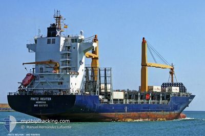
Container Ship
Current Trip
| Trip Time | 5 days |
|---|---|
| Trip Distance | 1747.64 nm |
| AVG Speed | 10.5 Knots |
| MAX Speed | 17.1 Knots |
| Draught | 9.3 m |
| AVG Wind | 11.3 knots |
| MAX Wind | 25.5 knots |
| MIN Temp | 6.1°C / 42.98°F |
| MAX Temp | 17.9°C / 64.22°F |
| Position Received | Now |
Current Position
| Longitude | --- |
|---|---|
| Latitude | --- |
| Status | Moored |
| Speed | |
| Course | 345° |
| Area | North Sea |
| Station | T-AIS |
| Position Received | Now |
Information
The current position of JONATHAN P is in North Sea with coordinates 51.46001° / 0.33290° as reported on 2025-02-04 11:35 by AIS to our vessel tracker app. The vessel's current speed is 0 Knots and is currently inside the port of TILBURY.
The vessel JONATHAN P (IMO: 9357872, MMSI: 636020153) is a Container Ship that was built in 2006 ( 19 years old ). It's sailing under the flag of [LR] Liberia.
In this page you can find informations about the vessels current position, last detected port calls, and current voyage information. If the vessels is not in coverage by AIS you will find the latest position.
The current position of JONATHAN P is detected by our AIS receivers and we are not responsible for the reliability of the data. The last position was recorded while the vessel was in Coverage by the Ais receivers of our vessel tracking app.
The current draught of JONATHAN P as reported by AIS is 9.3 meters
Weather
| Temperature | 8.2°C / 46.76°F |
|---|---|
| Wind Speed | 12 knots |
| Direction | 209° SSW |
| Pressure | 1022.8 hPa |
| Humidity | 81.8 % |
| Cloud Coverage | 81 % |
Featured Company
Last Port Calls
| Port | Arrival | Departure | Time In Port |
|---|---|---|---|
| 2025-02-03 16:50 | |||
| 2025-01-27 08:54 | 2025-01-29 00:23 | 1 d | |
| 2025-01-25 14:10 | 2025-01-26 14:10 | 1 d | |
| 2025-01-24 08:23 | 2025-01-25 00:47 | 16 h | |
| 2025-01-20 16:26 | 2025-01-21 00:51 | 8 h | |
| 2025-01-17 18:04 | 2025-01-18 13:34 | 19 h | |
| 2025-01-15 09:10 | 2025-01-16 14:49 | 1 d | |
| 2025-01-14 08:12 | 2025-01-15 08:53 | 1 d | |
| 2025-01-13 17:53 | 2025-01-14 07:56 | 14 h | |
| 2025-01-10 19:29 | 2025-01-12 09:00 | 1 d |
Most Visited Ports (Last year)
| Port | Arrivals | |
|---|---|---|
| 6 | ||
| 5 | ||
| 5 | ||
| 5 | ||
| 4 | ||
| 4 |
Last Trips
| Origin | Departure | Destination | Arrival | Distance | |
|---|---|---|---|---|---|
| 2025-01-29 01:23 | 2025-02-03 16:50 | 1747.64 nm | |||
| 2025-01-26 15:10 | 2025-01-27 09:54 | 288.95 nm | |||
| 2025-01-25 01:47 | 2025-01-25 15:10 | 197.76 nm | |||
| 2025-01-21 01:51 | 2025-01-24 09:23 | 644.54 nm | |||
| 2025-01-18 14:34 | 2025-01-20 17:26 | 748.61 nm | |||
| 2025-01-16 15:49 | 2025-01-17 19:04 | 302.97 nm | |||
| 2025-01-15 09:53 | 2025-01-15 10:10 | 2.01 nm | |||
| 2025-01-14 08:56 | 2025-01-14 09:12 | 1.71 nm | |||
| 2025-01-12 10:00 | 2025-01-13 18:53 | 125.74 nm | |||
| 2025-01-09 06:47 | 2025-01-10 20:29 | 412.60 nm |
Events
| Time | Event | Details | Position / Dest | Info |
|---|---|---|---|---|
| 2025-02-03 17:09 | Status Changed | Moored Under way using engine |
51.45996 / .33294
[GB] TILBURY
|
Speed: Course: 345° |
| 2025-02-03 17:01 | STOP Moving |
51.45983 / .33277
[GB] TILBURY
|
Speed: 0.2 kn Course: 345° |
|
| 2025-02-03 16:50 | PORT ARRIVAL |
|
51.45841 / .33109
[GB] TILBURY
|
Speed: 0.7 kn Course: 358° |
| 2025-02-03 09:58 | Change Sea Area | United Kingdom part of the North Sea French part of the North Sea |
51.37563 / 2.05212
North Sea
GBTIL
|
Speed: 8.6 kn Course: 328.1° |
| 2025-02-03 07:37 | Change Sea Area | French part of the North Sea United Kingdom part of the North Sea |
51.15060 / 1.81105
North Sea
GBTIL
|
Speed: 9 kn Course: 66° |
| 2025-02-03 06:40 | Change Sea Area | United Kingdom part of the North Sea French part of the North Sea |
51.06356 / 1.61644
North Sea
GBTIL
|
Speed: 10 kn Course: 46° |
| 2025-02-03 06:25 | Change Sea Area | French part of the North Sea French part of the English Channel |
51.03237 / 1.57263
North Sea
GBTIL
|
Speed: 10.1 kn Course: 35.6° |
| 2025-02-03 05:55 | Draught Changed | 9.3 9.8 |
50.96142 / 1.49807
GBTIL
|
Speed: 9.1 kn Course: 357.3° |
| 2025-02-03 05:55 | Destination Changed | GBTIL MAAGA |
50.96142 / 1.49807
GBTIL
|
Speed: 9.1 kn Course: 357.3° |
| 2025-02-03 05:55 | ETA Changed | 2025/02/03 13:00 2025/01/27 11:00 |
50.96142 / 1.49807
GBTIL
|
Speed: 9.1 kn Course: 357.3° |