
JJ NAGOYA
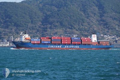
Container Ship
Current Trip
| Time Travelled | 1 day |
|---|---|
| Remaining Time | --- |
| Distance Travelled | 565.96 nm |
| Remaining Distance | --- |
| AVG Speed | 14.6 Knots |
| MAX Speed | 16.2 Knots |
| AVG Wind | 7.9 knots |
| MAX Wind | 12.6 knots |
| MIN Temp | 16.7°C / 62.06°F |
| MAX Temp | 28.7°C / 83.66°F |
| Draught | 5.4 m |
| Position Received | 1 d ago |
Current Position
| Longitude | 120.03210° |
|---|---|
| Latitude | 22.88542° |
| Status | Under way using engine |
| Speed | 14.7 Knots |
| Course | 332.3° |
| Area | South China Sea |
| Station | T-AIS |
| Position Received | 1 d ago |
Info
Information
The current position of JJ NAGOYA is in South China Sea with coordinates 22.88542° / 120.03210° as reported on 2024-05-05 11:50 by AIS to our vessel tracker app. The vessel's current speed is 14.7 Knots and is heading at the port of JIANGYIN. The estimated time of arrival as calculated by MyShipTracking vessel tracking app is 2024-05-07 12:00 LT
The vessel JJ NAGOYA (IMO: 9113161, MMSI: 477800200) is a Container Ship that was built in 1995 ( 29 years old ). It's sailing under the flag of [HK] Hong Kong.
In this page you can find informations about the vessels current position, last detected port calls, and current voyage information. If the vessels is not in coverage by AIS you will find the latest position.
The current position of JJ NAGOYA is detected by our AIS receivers and we are not responsible for the reliability of the data. The last position was recorded while the vessel was in Coverage by the Ais receivers of our vessel tracking app.
The current draught of JJ NAGOYA as reported by AIS is 5.4 meters
Weather
| Temperature | 17.3°C / 63.14°F |
|---|---|
| Wind Speed | 5 knots |
| Direction | 53° NE |
| Pressure | 1016.5 hPa |
| Humidity | 88 % |
| Cloud Coverage | 100 % |
Featured Company
Last Port Calls
| Port | Arrival | Departure | Time In Port |
|---|---|---|---|
| 2024-05-05 03:23 | 2024-05-05 09:59 | 6 h | |
| 2024-05-04 12:48 | 2024-05-04 16:12 | 3 h | |
| 2024-05-03 11:24 | 2024-05-04 04:28 | 17 h | |
| 2024-05-01 08:56 | 2024-05-02 00:48 | 15 h | |
| 2024-04-28 18:12 | 2024-04-29 00:27 | 6 h | |
| 2024-04-28 00:04 | 2024-04-28 07:28 | 7 h | |
| 2024-04-26 22:36 | 2024-04-27 08:30 | 9 h | |
| 2024-04-24 08:27 | 2024-04-25 00:36 | 16 h | |
| 2024-04-21 11:00 | 2024-04-21 17:06 | 6 h | |
| 2024-04-20 18:00 | 2024-04-21 00:24 | 6 h |
Last Trips
| Origin | Departure | Destination | Arrival | Distance | |
|---|---|---|---|---|---|
| 2024-05-05 00:12 | 2024-05-05 11:23 | 140.00 nm | |||
| 2024-05-04 12:28 | 2024-05-04 20:48 | 113.85 nm | |||
| 2024-05-02 08:48 | 2024-05-03 19:24 | 463.42 nm | |||
| 2024-04-29 08:27 | 2024-05-01 16:56 | 706.04 nm | |||
| 2024-04-28 15:28 | 2024-04-29 02:12 | 135.11 nm | |||
| 2024-04-27 16:30 | 2024-04-28 08:04 | 132.49 nm | |||
| 2024-04-25 08:36 | 2024-04-27 06:36 | 483.72 nm | |||
| 2024-04-22 01:06 | 2024-04-24 16:27 | 665.30 nm | |||
| 2024-04-21 08:24 | 2024-04-21 19:00 | 135.82 nm | |||
| 2024-04-20 16:52 | 2024-04-21 02:00 | 116.88 nm |
Events
| Time | Event | Details | Position / Dest | Info |
|---|---|---|---|---|
| 2024-05-07 00:34 | STOP Moving |
31.01500 / 122.72414
CN CJK
|
Speed: 0.3 kn Course: 136° |
|
| 2024-05-05 11:56 | Status Changed | Default Under way using engine |
22.90720 / 120.01975
CN CJK
|
Speed: 14.7 kn Course: 332.3° |
| 2024-05-05 11:50 | Status Changed | Under way using engine Default |
22.88542 / 120.03210
CN CJK
|
Speed: 14.6 kn Course: 332° |
| 2024-05-05 11:50 | OUT of Coverage |
22.88542 / 120.03210
South China Sea
CN CJK
|
Speed: 14.7 kn Course: 332.3° |
|
| 2024-05-05 11:23 | Status Changed | Default Under way using engine |
22.78614 / 120.08204
CN CJK
|
Speed: 14.8 kn Course: 342.1° |
| 2024-05-05 09:59 | PORT DEPARTURE |
|
22.54761 / 120.27926
CN CJK
|
Speed: 12.3 kn Course: 261° |
| 2024-05-05 09:42 | START Moving |
22.55484 / 120.32107
[TW] KAOHSIUNG
|
Speed: 3.1 kn Course: 233° |
|
| 2024-05-05 09:18 | Status Changed | Under way using engine Moored |
22.55823 / 120.32059
[TW] KAOHSIUNG
|
Speed: Course: 319° |
| 2024-05-05 09:17 | ETA Changed | 2024/05/07 12:00 2024/05/07 09:45 |
22.55821 / 120.32063
[TW] KAOHSIUNG
|
Speed: Course: 319° |
| 2024-05-05 08:50 | Draught Changed | 5.4 5.6 |
22.55825 / 120.32064
[TW] KAOHSIUNG
|
Speed: Course: 320° |