

JETOUR
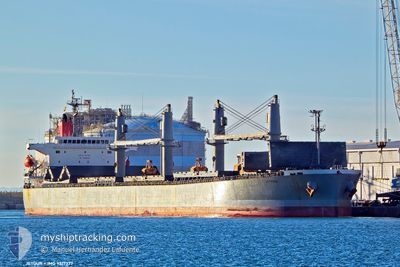
Bulk Carrier

Current Trip
| Time Travelled | 36 days |
|---|---|
| Remaining Time | 12 days |
| Distance Travelled | 5970.44 nm |
| Remaining Distance | 3688.30 nm |
| AVG Speed | 11.8 Knots |
| MAX Speed | 15.3 Knots |
| AVG Wind | 13 knots |
| MAX Wind | 28 knots |
| MIN Temp | -10.5°C / 13.1°F |
| MAX Temp | 26.1°C / 78.98°F |
| Draught | 10.3 m |
| Position Received | 1 d ago |
Current Position
| Longitude | --- |
|---|---|
| Latitude | --- |
| Status | Under way using engine |
| Speed | 12.2 Knots |
| Course | 150.3° |
| Area | Red Sea |
| Station | T-AIS |
| Position Received | 1 d ago |
Information
The current position of JETOUR is in Red Sea with coordinates 21.03002° / 38.41168° as reported on 2025-02-28 19:45 by AIS to our vessel tracker app. The vessel's current speed is 12.2 Knots and is heading at the port of PORT KLANG. The estimated time of arrival as calculated by MyShipTracking vessel tracking app is 2025-03-15 06:53 LT
The vessel JETOUR (IMO: 9317377, MMSI: 355557000) is a Bulk Carrier that was built in 2006 ( 19 years old ). It's sailing under the flag of [PA] Panama.
In this page you can find informations about the vessels current position, last detected port calls, and current voyage information. If the vessels is not in coverage by AIS you will find the latest position.
The current position of JETOUR is detected by our AIS receivers and we are not responsible for the reliability of the data. The last position was recorded while the vessel was in Coverage by the Ais receivers of our vessel tracking app.
The current draught of JETOUR as reported by AIS is 10.3 meters
Weather
| Temperature | 25.2°C / 77.36°F |
|---|---|
| Wind Speed | 3 knots |
| Direction | 101° E |
| Pressure | 1011.6 hPa |
| Humidity | 78.1 % |
| Cloud Coverage | 86 % |


Featured Company
Last Port Calls
| Port | Arrival | Departure | Time In Port |
|---|---|---|---|
| 2025-02-26 08:05 | 2025-02-26 17:10 | 9 h | |
| 2025-01-10 02:55 | 2025-01-24 16:26 | 14 d | |
| 2025-01-10 01:15 | 2025-01-10 02:07 | 52 m | |
| 2025-01-03 01:44 | 2025-01-08 16:39 | 5 d |
Last Trips
Events
| Time | Event | Details | Position / Dest | Info |
|---|---|---|---|---|
| 2025-02-28 19:46 | Status Changed | Default Under way using engine |
21.02658 / 38.41380
PORT KLANG
|
Speed: 12.2 kn Course: 150.3° |
| 2025-02-28 19:45 | OUT of Coverage |
21.03002 / 38.41168
Red Sea
PORT KLANG
|
Speed: 12.2 kn Course: 150.3° |
|
| 2025-02-28 18:56 | Status Changed | Under way using engine Default |
21.17297 / 38.32420
PORT KLANG
|
Speed: 12.3 kn Course: 149° |
| 2025-02-28 18:42 | Status Changed | Default Under way using engine |
21.21487 / 38.29774
PORT KLANG
|
Speed: 12.2 kn Course: 149.3° |
| 2025-02-28 18:25 | Change Sea Area | Saudi Arabian part of the Red Sea Sudanese part of the Red Sea |
21.26580 / 38.26564
Red Sea
PORT KLANG
|
Speed: 12.3 kn Course: 150° |
| 2025-02-28 18:24 | Status Changed | Under way using engine Default |
21.26729 / 38.26473
PORT KLANG
|
Speed: 12.4 kn Course: 150° |
| 2025-02-28 18:00 | Status Changed | Default Under way using engine |
21.33886 / 38.21924
PORT KLANG
|
Speed: 12.5 kn Course: 147.9° |
| 2025-02-28 15:15 | Status Changed | Under way using engine Default |
21.84593 / 37.90833
PORT KLANG
|
Speed: 12.7 kn Course: 150° |
| 2025-02-28 15:07 | Status Changed | Default Under way using engine |
21.86949 / 37.89375
PORT KLANG
|
Speed: 12.5 kn Course: 146.9° |
| 2025-02-28 14:58 | Change Sea Area | Sudanese part of the Red Sea Disputed Sudan-Egypt part of the Red Sea |
21.89612 / 37.87437
Red Sea
PORT KLANG
|
Speed: 12.5 kn Course: 146.8° |