
JEJU ISLAND
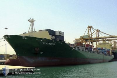
Container Ship
Current Trip
| Time Travelled | 4 days |
|---|---|
| Remaining Time | --- |
| Distance Travelled | 1216.93 nm |
| Remaining Distance | --- |
| AVG Speed | 12.4 Knots |
| MAX Speed | 13.8 Knots |
| AVG Wind | 7.4 knots |
| MAX Wind | 17.2 knots |
| MIN Temp | 22.3°C / 72.14°F |
| MAX Temp | 27.5°C / 81.5°F |
| Draught | 11 m |
| Position Received | 4 d ago |
Current Position
| Longitude | --- |
|---|---|
| Latitude | --- |
| Status | Under way using engine |
| Speed | 12.7 Knots |
| Course | 227.8° |
| Area | South China Sea |
| Station | T-AIS |
| Position Received | 4 d ago |
Information
The current position of JEJU ISLAND is in South China Sea with coordinates 14.52273° / 120.80572° as reported on 2025-03-23 18:19 by AIS to our vessel tracker app. The vessel's current speed is 12.7 Knots and is heading at the port of SUBIC. The estimated time of arrival as calculated by MyShipTracking vessel tracking app is 2025-03-21 04:00 LT
The vessel JEJU ISLAND (IMO: 9308417, MMSI: 538005592) is a Container Ship that was built in 2006 ( 19 years old ). It's sailing under the flag of [MH] Marshall Is.
In this page you can find informations about the vessels current position, last detected port calls, and current voyage information. If the vessels is not in coverage by AIS you will find the latest position.
The current position of JEJU ISLAND is detected by our AIS receivers and we are not responsible for the reliability of the data. The last position was recorded while the vessel was in Coverage by the Ais receivers of our vessel tracking app.
The current draught of JEJU ISLAND as reported by AIS is 11 meters
Weather
| Temperature | 27°C / 80.6°F |
|---|---|
| Wind Speed | 5 knots |
| Direction | 15° NNE |
| Pressure | 1006.8 hPa |
| Humidity | 82.4 % |
| Cloud Coverage | 40 % |
Featured Company
Last Port Calls
| Port | Arrival | Departure | Time In Port |
|---|---|---|---|
| 2025-03-22 02:51 | 2025-03-23 17:30 | 1 d | |
| 2025-03-16 04:39 | 2025-03-17 11:54 | 1 d | |
| 2025-03-10 05:20 | 2025-03-12 02:53 | 1 d | |
| 2025-03-02 16:18 | 2025-03-04 01:51 | 1 d | |
| 2025-02-25 05:25 | 2025-02-26 20:33 | 1 d | |
| 2025-02-18 09:36 | 2025-02-19 15:55 | 1 d | |
| 2025-02-10 19:36 | 2025-02-12 22:25 | 2 d | |
| 2025-02-03 04:13 | 2025-02-04 09:42 | 1 d | |
| 2025-01-27 16:04 | 2025-01-29 18:21 | 2 d | |
| 2025-01-20 20:50 | 2025-01-21 14:19 | 17 h |
Last Trips
| Origin | Departure | Destination | Arrival | Distance | |
|---|---|---|---|---|---|
| 2025-03-17 19:54 | 2025-03-22 10:51 | 1403.09 nm | |||
| 2025-03-12 10:53 | 2025-03-16 12:39 | 1353.29 nm | |||
| 2025-03-04 09:51 | 2025-03-10 13:20 | 1439.01 nm | |||
| 2025-02-27 04:33 | 2025-03-03 00:18 | 1352.12 nm | |||
| 2025-02-19 23:55 | 2025-02-25 13:25 | 1451.63 nm | |||
| 2025-02-13 06:25 | 2025-02-18 17:36 | 1361.18 nm | |||
| 2025-02-04 17:42 | 2025-02-11 03:36 | 1498.92 nm | |||
| 2025-01-30 02:21 | 2025-02-03 12:13 | 1369.14 nm | |||
| 2025-01-21 22:19 | 2025-01-28 00:04 | 1417.95 nm | |||
| 2025-01-21 03:06 | 2025-01-21 04:50 | 10.98 nm |
Events
| Time | Event | Details | Position / Dest | Info |
|---|---|---|---|---|
| 2025-03-23 18:26 | Status Changed | Default Under way using engine |
14.50790 / 120.78610
PHSFS
|
Speed: 12.7 kn Course: 227.8° |
| 2025-03-23 18:19 | Status Changed | Under way using engine Default |
14.52273 / 120.80572
PHSFS
|
Speed: 12.7 kn Course: 225° |
| 2025-03-23 18:19 | OUT of Coverage |
14.52273 / 120.80572
South China Sea
|
Speed: 12.7 kn Course: 227.8° |
|
| 2025-03-23 17:46 | Status Changed | Default Under way using engine |
14.60086 / 120.88821
PHSFS
|
Speed: 6.4 kn Course: 260° |
| 2025-03-23 17:41 | Change Sea Area | Philippines part of the South China Sea Indonesian part of the Singapore Strait |
14.60438 / 120.89680
South China Sea
|
Speed: 6.4 kn Course: 260° |
| 2025-03-23 17:41 | Status Changed | Under way using engine Default |
14.60438 / 120.89680
PHSFS
|
Speed: 7.9 kn Course: 268° |
| 2025-03-23 17:34 | IN Coverage |
14.60438 / 120.89680
South China Sea
|
Speed: 6.4 kn Course: 260° |
|
| 2025-03-23 17:30 | PORT DEPARTURE |
|
14.60484 / 120.92292
PHSFS
|
Speed: 9.2 kn Course: 270° |
| 2025-03-23 17:22 | START Moving |
14.60365 / 120.94292
[PH] MANILA
|
Speed: 5.1 kn Course: 280° |
|
| 2025-03-22 03:30 | STOP Moving |
14.60001 / 120.94899
[PH] MANILA
|
Speed: Course: 76° |