
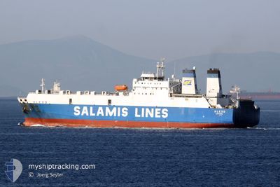
JABAL ALI 9
Ro-Ro Cargo
Current Trip
| Time Travelled | 3 days |
|---|---|
| Remaining Time | 2 days |
| Distance Travelled | 962.91 nm |
| Remaining Distance | 661.00 nm |
| AVG Speed | 10.1 Knots |
| MAX Speed | 12.4 Knots |
| AVG Wind | 9.1 knots |
| MAX Wind | 20 knots |
| MIN Temp | 15°C / 59°F |
| MAX Temp | 24.7°C / 76.46°F |
| Draught | 6.2 m |
| Position Received | 1 d ago |
Current Position
| Longitude | --- |
|---|---|
| Latitude | --- |
| Status | Under way using engine |
| Speed | 10.1 Knots |
| Course | 122.8° |
| Area | Gulf of Oman |
| Station | T-AIS |
| Position Received | 1 d ago |
Info
Information
The current position of JABAL ALI 9 is in Gulf of Oman with coordinates 25.09076° / 57.34354° as reported on 2025-02-17 13:17 by AIS to our vessel tracker app. The vessel's current speed is 10.1 Knots and is heading at the port of MUMBAI. The estimated time of arrival as calculated by MyShipTracking vessel tracking app is 2025-02-21 16:22 LT
The vessel JABAL ALI 9 (IMO: 8020604, MMSI: 341475000) is a Ro-Ro Cargo that was built in 1983 ( 42 years old ). It's sailing under the flag of [KN] St Kitts Nevis.
In this page you can find informations about the vessels current position, last detected port calls, and current voyage information. If the vessels is not in coverage by AIS you will find the latest position.
The current position of JABAL ALI 9 is detected by our AIS receivers and we are not responsible for the reliability of the data. The last position was recorded while the vessel was in Coverage by the Ais receivers of our vessel tracking app.
The current draught of JABAL ALI 9 as reported by AIS is 6.2 meters
Weather
| Temperature | 24.2°C / 75.56°F |
|---|---|
| Wind Speed | 9 knots |
| Direction | 200° SSW |
| Pressure | 1015.5 hPa |
| Humidity | 70.4 % |
| Cloud Coverage | 46 % |
Featured Company
Last Port Calls
| Port | Arrival | Departure | Time In Port |
|---|---|---|---|
| 2025-02-14 10:29 | 2025-02-14 20:53 | 10 h | |
| 2025-02-10 02:58 | 2025-02-12 11:16 | 2 d | |
| 2025-02-07 06:56 | 2025-02-07 19:54 | 12 h | |
| 2025-01-31 20:59 | 2025-02-02 15:38 | 1 d | |
| 2025-01-25 00:51 | 2025-01-26 02:21 | 1 d | |
| 2025-01-01 16:02 | 2025-01-10 05:44 | 8 d | |
| 2024-12-31 18:07 | 2025-01-01 10:47 | 16 h | |
| 2024-12-28 06:46 | 2024-12-29 13:21 | 1 d | |
| 2024-12-20 09:17 | 2024-12-21 10:20 | 1 d | |
| 2024-12-12 00:28 | 2024-12-13 10:08 | 1 d |
Last Trips
| Origin | Departure | Destination | Arrival | Distance | |
|---|---|---|---|---|---|
| 2025-02-12 15:16 | 2025-02-14 13:29 | 497.17 nm | |||
| 2025-02-07 22:54 | 2025-02-10 06:58 | 520.48 nm | |||
| 2025-02-02 19:38 | 2025-02-07 09:56 | 508.42 nm | |||
| 2025-01-26 07:51 | 2025-02-01 00:59 | 1249.51 nm | |||
| 2025-01-10 09:44 | 2025-01-25 06:21 | 1363.67 nm | |||
| 2025-01-01 14:47 | 2025-01-01 20:02 | 49.66 nm | |||
| 2024-12-29 16:21 | 2024-12-31 22:07 | 328.36 nm | |||
| 2024-12-21 15:50 | 2024-12-28 09:46 | 1453.78 nm | |||
| 2024-12-13 14:08 | 2024-12-20 14:47 | 1231.98 nm | |||
| 2024-12-04 18:23 | 2024-12-12 04:28 | 1249.80 nm |
Events
| Time | Event | Details | Position / Dest | Info |
|---|---|---|---|---|
| 2025-02-17 13:20 | Status Changed | Default Under way using engine |
25.08650 / 57.35102
MUMBAI PORT
|
Speed: 10.1 kn Course: 122.8° |
| 2025-02-17 13:17 | OUT of Coverage |
25.09076 / 57.34354
Gulf of Oman
MUMBAI PORT
|
Speed: 10.1 kn Course: 122.8° |
|
| 2025-02-17 12:59 | Status Changed | Under way using engine Default |
25.11980 / 57.29222
MUMBAI PORT
|
Speed: 11 kn Course: 122° |
| 2025-02-17 12:50 | Status Changed | Default Under way using engine |
25.13339 / 57.26814
MUMBAI PORT
|
Speed: 11 kn Course: 121.4° |
| 2025-02-17 12:38 | Status Changed | Under way using engine Default |
25.15299 / 57.23105
MUMBAI PORT
|
Speed: 10.7 kn Course: 117° |
| 2025-02-17 12:01 | Status Changed | Default Under way using engine |
25.20729 / 57.12181
MUMBAI PORT
|
Speed: 10.6 kn Course: 117.3° |
| 2025-02-17 11:37 | Change Sea Area | Iranian part of the Gulf of Oman United Arab Emirates part of the Gulf of Oman |
25.23964 / 57.05488
Gulf of Oman
MUMBAI PORT
|
Speed: 10.7 kn Course: 119° |
| 2025-02-17 11:35 | Status Changed | Under way using engine Default |
25.24182 / 57.05063
MUMBAI PORT
|
Speed: 10.6 kn Course: 119° |
| 2025-02-17 10:50 | Status Changed | Default Under way using engine |
25.31115 / 56.92445
MUMBAI PORT
|
Speed: 10.6 kn Course: 121° |
| 2025-02-17 08:49 | Change Sea Area | United Arab Emirates part of the Gulf of Oman Omani part of the Gulf of Oman |
25.65499 / 56.83412
Gulf of Oman
MUMBAI PORT
|
Speed: 10.5 kn Course: 166.8° |