

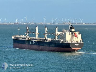
IVS WINDSOR
Cargo

Current Trip
| Time Travelled | 18 days |
|---|---|
| Remaining Time | --- |
| Distance Travelled | 5198.43 nm |
| Remaining Distance | --- |
| AVG Speed | 11.1 Knots |
| MAX Speed | 22.7 Knots |
| AVG Wind | 8 knots |
| MAX Wind | 26 knots |
| MIN Temp | 19°C / 66.2°F |
| MAX Temp | 29.3°C / 84.74°F |
| Draught | 11.5 m |
| Position Received | 1 d ago |
Current Position
| Longitude | --- |
|---|---|
| Latitude | --- |
| Status | Under way using engine |
| Speed | 13.5 Knots |
| Course | 215.6° |
| Area | Indian Ocean |
| Station | T-AIS |
| Position Received | 1 d ago |
Information
The current position of IVS WINDSOR is in Indian Ocean with coordinates -29.95876° / 31.58621° as reported on 2025-03-26 03:25 by AIS to our vessel tracker app. The vessel's current speed is 13.5 Knots and is heading at the port of FUJAIRAH. The estimated time of arrival as calculated by MyShipTracking vessel tracking app is 2025-04-25 09:00 LT
The vessel IVS WINDSOR (IMO: 9774458, MMSI: 563181300) is a Cargo It's sailing under the flag of [SG] Singapore.
In this page you can find informations about the vessels current position, last detected port calls, and current voyage information. If the vessels is not in coverage by AIS you will find the latest position.
The current position of IVS WINDSOR is detected by our AIS receivers and we are not responsible for the reliability of the data. The last position was recorded while the vessel was in Coverage by the Ais receivers of our vessel tracking app.
The current draught of IVS WINDSOR as reported by AIS is 11.5 meters
Weather
| Temperature | 19.7°C / 67.46°F |
|---|---|
| Wind Speed | 26 knots |
| Direction | 90° E |
| Pressure | 1017.2 hPa |
| Humidity | 82.5 % |
| Cloud Coverage | 77 % |


Featured Company
Events
| Time | Event | Details | Position / Dest | Info |
|---|---|---|---|---|
| 2025-03-26 03:32 | Status Changed | Default Under way using engine |
-29.98201 / 31.56772
AE FJR
|
Speed: 13.5 kn Course: 215.6° |
| 2025-03-26 03:25 | OUT of Coverage |
-29.95876 / 31.58621
Indian Ocean
|
Speed: 13.5 kn Course: 215.6° |
|
| 2025-03-26 03:23 | Status Changed | Under way using engine Default |
-29.95522 / 31.58905
AE FJR
|
Speed: 13.5 kn Course: 214° |
| 2025-03-26 03:14 | Status Changed | Default Under way using engine |
-29.92491 / 31.61345
AE FJR
|
Speed: 13.3 kn Course: 216.9° |
| 2025-03-26 03:09 | Status Changed | Under way using engine Default |
-29.91140 / 31.62470
AE FJR
|
Speed: 13.3 kn Course: 218° |
| 2025-03-26 02:58 | Status Changed | Default Under way using engine |
-29.87762 / 31.65430
AE FJR
|
Speed: 13.4 kn Course: 216.1° |
| 2025-03-26 02:55 | Change Sea Area | South African part of the Indian Ocean High seas of the Arabian Sea |
-29.86882 / 31.66202
Indian Ocean
|
Speed: 13.4 kn Course: 216.1° |
| 2025-03-26 02:53 | Status Changed | Under way using engine Default |
-29.86280 / 31.66716
AE FJR
|
Speed: 13.4 kn Course: 217° |
| 2025-03-26 02:45 | IN Coverage |
-29.86882 / 31.66202
Indian Ocean
|
Speed: 13.4 kn Course: 216.1° |