
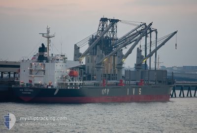
IVS KESTREL
Cargo
Current Trip
| Time Travelled | 7 days |
|---|---|
| Remaining Time | --- |
| Distance Travelled | 812.78 nm |
| Remaining Distance | --- |
| AVG Speed | 7.6 Knots |
| MAX Speed | 13.1 Knots |
| AVG Wind | 17.9 knots |
| MAX Wind | 40 knots |
| MIN Temp | 12.5°C / 54.5°F |
| MAX Temp | 17.9°C / 64.22°F |
| Draught | 6.5 m |
| Position Received | 3 m ago |
Current Position
| Longitude | --- |
|---|---|
| Latitude | --- |
| Status | Under way sailing |
| Speed | 0.5 Knots |
| Course | 204° |
| Area | North Atlantic Ocean |
| Station | T-AIS |
| Position Received | 3 m ago |
Info
Information
The current position of IVS KESTREL is in North Atlantic Ocean with coordinates 38.26306° / -8.98502° as reported on 2026-01-04 17:46 by AIS to our vessel tracker app. The vessel's current speed is 0.5 Knots
The vessel IVS KESTREL (IMO: 9700926, MMSI: 538010647) is a Cargo It's sailing under the flag of [MH] Marshall Is.
In this page you can find informations about the vessels current position, last detected port calls, and current voyage information. If the vessels is not in coverage by AIS you will find the latest position.
The current position of IVS KESTREL is detected by our AIS receivers and we are not responsible for the reliability of the data. The last position was recorded while the vessel was in Coverage by the Ais receivers of our vessel tracking app.
The current draught of IVS KESTREL as reported by AIS is 6.5 meters
Weather
| Temperature | 15.7°C / 60.26°F |
|---|---|
| Wind Speed | 10 knots |
| Direction | 357° N |
| Pressure | 1003.3 hPa |
| Humidity | 76.2 % |
| Cloud Coverage | 62 % |
Featured Company
Events
| Time | Event | Details | Position / Dest | Info |
|---|---|---|---|---|
| 2026-01-04 16:49 | Status Changed | Under way sailing Default |
38.26858 / -8.98973
PT SET
|
Speed: 0.4 kn Course: 241° |
| 2026-01-04 16:35 | Status Changed | Default Under way sailing |
38.27025 / -8.99127
PT SET
|
Speed: 0.4 kn Course: 242° |
| 2026-01-04 16:34 | Status Changed | Under way sailing Default |
38.27038 / -8.99138
PT SET
|
Speed: 0.6 kn Course: 240° |
| 2026-01-04 16:31 | Status Changed | Default Under way sailing |
38.27072 / -8.99173
PT SET
|
Speed: 0.3 kn Course: 231° |
| 2026-01-04 16:16 | Status Changed | Under way sailing Default |
38.27241 / -8.99342
PT SET
|
Speed: 0.2 kn Course: 233° |
| 2026-01-04 16:15 | Status Changed | Default Under way sailing |
38.27251 / -8.99351
PT SET
|
Speed: 0.3 kn Course: 245° |
| 2026-01-04 16:08 | Status Changed | Under way sailing Default |
38.27313 / -8.99385
PT SET
|
Speed: 0.2 kn Course: 250° |
| 2026-01-04 16:07 | Status Changed | Default Under way sailing |
38.27324 / -8.99389
PT SET
|
Speed: 0.2 kn Course: 262° |
| 2026-01-04 15:56 | STOP Moving | 15.27 nm, South West of SETUBAL |
38.27427 / -8.99382
PT SET
|
Speed: 0.3 kn Course: 282° |
| 2026-01-04 15:44 | ETA Changed | 2026/01/04 22:00 2026/01/02 00:01 |
38.27533 / -8.99289
PT SET
|
Speed: 0.8 kn Course: 284° |