
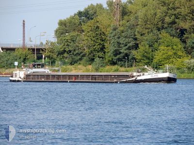
ISLAND
Wing in ground
Current Trip
| Time Travelled | 4 days |
|---|---|
| Remaining Time | 10 h, 11 mins |
| Distance Travelled | 185.39 nm |
| Remaining Distance | 60.04 nm |
| AVG Speed | 4.7 Knots |
| MAX Speed | 5.7 Knots |
| AVG Wind | 6.4 knots |
| MAX Wind | 12 knots |
| MIN Temp | 4.8°C / 40.64°F |
| MAX Temp | 11.4°C / 52.52°F |
| Draught | 1.7 m |
| Position Received | 1 h, 11 m ago |
Current Position
| Longitude | --- |
|---|---|
| Latitude | --- |
| Status | Under way using engine |
| Speed | 4.9 Knots |
| Course | 264° |
| Area | North Sea |
| Station | T-AIS |
| Position Received | 1 h, 11 m ago |
Info
Information
The current position of ISLAND is in North Sea with coordinates 52.31085° / 10.44773° as reported on 2025-12-11 11:49 by AIS to our vessel tracker app. The vessel's current speed is 4.9 Knots and is heading at the port of MINDEN. The estimated time of arrival as calculated by MyShipTracking vessel tracking app is 2025-12-12 00:11 LT
The vessel ISLAND (MMSI: 261184980) is a Wing in ground It's sailing under the flag of [PL] Poland.
In this page you can find informations about the vessels current position, last detected port calls, and current voyage information. If the vessels is not in coverage by AIS you will find the latest position.
The current position of ISLAND is detected by our AIS receivers and we are not responsible for the reliability of the data. The last position was recorded while the vessel was in Coverage by the Ais receivers of our vessel tracking app.
The current draught of ISLAND as reported by AIS is 1.7 meters
Weather
| Temperature | 9.8°C / 49.64°F |
|---|---|
| Wind Speed | 12 knots |
| Direction | 243° WSW |
| Pressure | 1023.1 hPa |
| Humidity | 74.9 % |
| Cloud Coverage | 96 % |
Featured Company
Last Port Calls
| Port | Arrival | Departure | Time In Port |
|---|---|---|---|
| 2025-12-06 07:43 | 2025-12-07 08:07 | 1 d | |
| 2025-11-26 14:52 | 2025-11-29 05:37 | 2 d | |
| 2025-11-16 11:00 | 2025-11-19 08:32 | 2 d | |
| 2025-11-08 16:14 | 2025-11-09 14:28 | 22 h | |
| 2025-11-06 18:01 | 2025-11-08 10:28 | 1 d | |
| 2025-11-05 15:22 | 2025-11-06 09:41 | 18 h | |
| 2025-11-05 13:00 | 2025-11-05 13:47 | 46 m | |
| 2025-11-04 15:52 | 2025-11-05 07:45 | 15 h | |
| 2025-11-03 15:21 | 2025-11-04 08:16 | 16 h | |
| 2025-10-29 17:49 | 2025-11-03 07:49 | 4 d |
Last Trips
| Origin | Departure | Destination | Arrival | Distance | |
|---|---|---|---|---|---|
| 2025-11-29 05:37 | 2025-12-06 07:43 | 292.52 nm | |||
| 2025-11-19 08:32 | 2025-11-26 14:52 | 259.54 nm | |||
| 2025-11-09 14:28 | 2025-11-16 11:00 | 193.93 nm | |||
| 2025-11-08 10:28 | 2025-11-08 16:14 | 52.26 nm | |||
| 2025-11-06 09:41 | 2025-11-06 18:01 | 2.06 nm | |||
| 2025-11-05 13:47 | 2025-11-05 15:22 | 2.46 nm | |||
| 2025-11-05 07:45 | 2025-11-05 13:00 | 3.20 nm | |||
| 2025-11-04 08:16 | 2025-11-04 15:52 | 2.65 nm | |||
| 2025-11-03 07:49 | 2025-11-03 15:21 | 2.89 nm | |||
| 2025-10-29 11:43 | 2025-10-29 17:49 | 1.33 nm |
Events
| Time | Event | Details | Position / Dest | Info |
|---|---|---|---|---|
| 2025-12-11 11:49 | OUT of Coverage |
52.31085 / 10.44773
North Sea
|
Speed: 4.9 kn Course: 264.5° |
|
| 2025-12-11 11:02 | IN Coverage |
52.34228 / 10.53006
North Sea
|
Speed: 4.8 kn Course: 228.4° |
|
| 2025-12-09 12:04 | OUT of Coverage |
52.45278 / 12.94673
North Sea
|
Speed: 5.5 kn Course: 280.9° |
|
| 2025-12-09 09:12 | START Moving | 7.27 nm, West of BERLIN |
52.53876 / 13.20948
MINDEN
|
Speed: 3.5 kn Course: 189° |
| 2025-12-09 09:10 | Status Changed | Under way using engine Moored |
52.54019 / 13.20927
MINDEN
|
Speed: 0.1 kn Course: 175° |
| 2025-12-09 08:58 | STOP Moving | 7.3 nm, West of BERLIN |
52.54082 / 13.20905
MINDEN
|
Speed: 0.3 kn Course: 172° |
| 2025-12-09 08:57 | Status Changed | Moored Under way using engine |
52.54094 / 13.20902
MINDEN
|
Speed: 1 kn Course: 171° |
| 2025-12-09 05:32 | IN Coverage |
52.75923 / 13.27380
North Sea
|
Speed: 4.8 kn Course: 216.5° |
|
| 2025-12-08 21:53 | Destination Changed | MINDEN SZCZECIN |
52.84679 / 13.44422
MINDEN
|
Speed: 3.6 kn Course: 256° |
| 2025-12-08 13:05 | OUT of Coverage |
52.84679 / 13.44422
North Sea
|
Speed: 3.6 kn Course: 257.8° |