
INDIGO
Other Type
Current Trip
DESTB03903CITYX23180
| Time Travelled | 9 h, 46 mins |
|---|---|
| Remaining Time | --- |
| Distance Travelled | 4.35 nm |
| Remaining Distance | --- |
| AVG Speed | 7.4 Knots |
| MAX Speed | 8.4 Knots |
| AVG Wind | 9.2 knots |
| MAX Wind | 10 knots |
| MIN Temp | 9.3°C / 48.74°F |
| MAX Temp | 10.2°C / 50.36°F |
| Draught | 0.1 m |
| Position Received | 9 h, 7 m ago |
Current Position
| Longitude | --- |
|---|---|
| Latitude | --- |
| Status | Under way using engine |
| Speed | 8.4 Knots |
| Course | 69° |
| Area | North Sea |
| Station | T-AIS |
| Position Received | 9 h, 7 m ago |
Information
The current position of INDIGO is in North Sea with coordinates 53.32810° / 7.08924° as reported on 2025-04-24 05:40 by AIS to our vessel tracker app. The vessel's current speed is 8.4 Knots
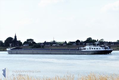
The vessel INDIGO (MMSI: 244650333) is a Other Type It's sailing under the flag of [NL] Netherlands.
In this page you can find informations about the vessels current position, last detected port calls, and current voyage information. If the vessels is not in coverage by AIS you will find the latest position.
The current position of INDIGO is detected by our AIS receivers and we are not responsible for the reliability of the data. The last position was recorded while the vessel was in Coverage by the Ais receivers of our vessel tracking app.
The current draught of INDIGO as reported by AIS is 0.1 meters
Weather
| Temperature | 10.1°C / 50.18°F |
|---|---|
| Wind Speed | 9 knots |
| Direction | 45° NE |
| Pressure | 1016 hPa |
| Humidity | 97.9 % |
| Cloud Coverage | 100 % |
Featured Company
Last Port Calls
| Port | Arrival | Departure | Time In Port |
|---|---|---|---|
| 2025-04-23 16:13 | 2025-04-24 05:02 | 12 h | |
| 2025-04-21 16:53 | 2025-04-22 23:39 | 1 d | |
| 2025-04-19 12:49 | 2025-04-21 03:56 | 1 d | |
| 2025-04-08 13:52 | 2025-04-09 09:18 | 19 h | |
| 2025-04-05 18:03 | 2025-04-06 04:35 | 10 h | |
| 2025-04-05 05:00 | 2025-04-05 05:22 | 21 m | |
| 2025-04-03 08:24 | 2025-04-05 00:46 | 1 d | |
| 2025-04-03 07:31 | 2025-04-03 07:44 | 13 m | |
| 2025-04-02 17:59 | 2025-04-03 03:46 | 9 h | |
| 2025-03-28 20:38 | 2025-04-02 06:40 | 4 d |
Last Trips
| Origin | Departure | Destination | Arrival | Distance | |
|---|---|---|---|---|---|
| 2025-04-23 01:39 | 2025-04-23 18:13 | 93.52 nm | |||
| 2025-04-21 05:56 | 2025-04-21 18:53 | 75.47 nm | |||
| 2025-04-06 06:35 | 2025-04-08 15:52 | 175.77 nm | |||
| 2025-04-05 07:22 | 2025-04-05 20:03 | 67.51 nm | |||
| 2025-04-05 02:46 | 2025-04-05 07:00 | 31.05 nm | |||
| 2025-04-03 09:44 | 2025-04-03 10:24 | 3.65 nm | |||
| 2025-04-03 05:46 | 2025-04-03 09:31 | 25.16 nm | |||
| 2025-04-02 08:40 | 2025-04-02 19:59 | 59.52 nm | |||
| 2025-03-28 09:22 | 2025-03-28 21:38 | 69.49 nm | |||
| 2025-03-28 05:51 | 2025-03-28 09:06 | 23.65 nm |
Events
| Time | Event | Details | Position / Dest | Info |
|---|---|---|---|---|
| 2025-04-24 05:40 | OUT of Coverage |
53.32810 / 7.08924
North Sea
|
Speed: 8.4 kn Course: 69° |
|
| 2025-04-24 05:25 | Change Sea Area | German part of the North Sea Dutch part of the North Sea |
53.32073 / 7.03315
North Sea
|
Speed: 8.2 kn Course: 76° |
| 2025-04-24 05:02 | PORT DEPARTURE |
|
53.32101 / 6.96174
DESTB03903CITYX23180
|
Speed: 6.8 kn Course: 98° |
| 2025-04-24 04:52 | START Moving |
53.32952 / 6.93405
[NL] DELFZIJL
|
Speed: 5 kn Course: 132° |
|
| 2025-04-24 04:50 | Status Changed | Under way using engine Moored |
53.32893 / 6.93168
[NL] DELFZIJL
|
Speed: Course: 19° |
| 2025-04-23 16:59 | Status Changed | Moored Under way using engine |
53.32881 / 6.93126
[NL] DELFZIJL
|
Speed: 0.1 kn Course: 19° |
| 2025-04-23 16:57 | STOP Moving |
53.32878 / 6.93128
[NL] DELFZIJL
|
Speed: 0.2 kn Course: 21° |
|
| 2025-04-23 16:48 | START Moving |
53.32116 / 6.94122
[NL] DELFZIJL
|
Speed: 5.2 kn Course: 31° |
|
| 2025-04-23 16:47 | Status Changed | Under way using engine Moored |
53.31981 / 6.93987
[NL] DELFZIJL
|
Speed: Course: 30° |
| 2025-04-23 16:39 | Status Changed | Moored Under way using engine |
53.31946 / 6.93952
[NL] DELFZIJL
|
Speed: 0.2 kn Course: 31° |