

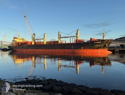
ID PIONEER
Bulk Carrier

Current Trip
| Time Travelled | 4 days |
|---|---|
| Remaining Time | --- |
| Distance Travelled | 1205.07 nm |
| Remaining Distance | --- |
| AVG Speed | 10.2 Knots |
| MAX Speed | 13.8 Knots |
| AVG Wind | 21.3 knots |
| MAX Wind | 36.8 knots |
| MIN Temp | 10.3°C / 50.54°F |
| MAX Temp | 20°C / 68°F |
| Draught | 8.1 m |
| Position Received | 9 h, 40 m ago |
Current Position
| Longitude | --- |
|---|---|
| Latitude | --- |
| Status | Under way using engine |
| Speed | 10.7 Knots |
| Course | 2° |
| Area | Tyrrhenian Sea |
| Station | T-AIS |
| Position Received | 9 h, 40 m ago |
Information
The current position of ID PIONEER is in Tyrrhenian Sea with coordinates 40.60000° / 14.71967° as reported on 2025-03-22 01:22 by AIS to our vessel tracker app. The vessel's current speed is 10.7 Knots
The vessel ID PIONEER (IMO: 9665700, MMSI: 229969000) is a Bulk Carrier that was built in 2012 ( 13 years old ). It's sailing under the flag of [MT] Malta.
In this page you can find informations about the vessels current position, last detected port calls, and current voyage information. If the vessels is not in coverage by AIS you will find the latest position.
The current position of ID PIONEER is detected by our AIS receivers and we are not responsible for the reliability of the data. The last position was recorded while the vessel was in Coverage by the Ais receivers of our vessel tracking app.
The current draught of ID PIONEER as reported by AIS is 8.1 meters
Weather
| Temperature | 16.9°C / 62.42°F |
|---|---|
| Wind Speed | 4 knots |
| Direction | 200° SSW |
| Pressure | 1017 hPa |
| Humidity | 39.6 % |
| Cloud Coverage | 100 % |


Featured Company
Last Port Calls
| Port | Arrival | Departure | Time In Port |
|---|---|---|---|
| 2025-03-13 08:18 | 2025-03-17 15:53 | 4 d | |
| 2025-03-01 13:06 | 2025-03-04 15:02 | 3 d | |
| 2025-02-24 06:45 | 2025-02-28 08:42 | 4 d | |
| 2025-02-01 20:44 | 2025-02-03 17:51 | 1 d | |
| 2025-01-23 12:48 | 2025-01-25 23:04 | 2 d | |
| 2025-01-14 08:01 | 2025-01-18 04:26 | 3 d |
Most Visited Ports (Last year)
| Port | Arrivals | |
|---|---|---|
| 2 | ||
| 2 | ||
| 2 | ||
| 2 | ||
| 1 | ||
| 1 |
Last Trips
| Origin | Departure | Destination | Arrival | Distance | |
|---|---|---|---|---|---|
| 2025-03-04 17:02 | 2025-03-13 11:18 | 986.47 nm | |||
| 2025-02-28 10:42 | 2025-03-01 15:06 | 326.21 nm | |||
| 2025-02-03 18:51 | 2025-02-24 08:45 | 2074.17 nm | |||
| 2025-01-25 23:04 | 2025-02-01 21:44 | 951.45 nm | |||
| 2025-01-18 05:26 | 2025-01-23 12:48 | 381.59 nm | |||
| 2024-12-27 10:57 | 2025-01-14 09:01 | 2258.63 nm |
Events
| Time | Event | Details | Position / Dest | Info |
|---|---|---|---|---|
| 2025-03-22 02:21 | STOP Moving | 1.56 nm, South of SALERNO |
40.64133 / 14.74683
ITSAL
|
Speed: 0.1 kn Course: 88° |
| 2025-03-22 01:29 | Status Changed | Default Under way using engine |
40.62067 / 14.72150
ITSAL
|
Speed: 10.7 kn Course: 2° |
| 2025-03-22 01:22 | Status Changed | Under way using engine Default |
40.60000 / 14.71967
ITSAL
|
Speed: 10.9 kn Course: 1° |
| 2025-03-22 01:22 | OUT of Coverage |
40.60000 / 14.71967
Tyrrhenian Sea
ITSAL
|
Speed: 10.7 kn Course: 2° |
|
| 2025-03-22 01:18 | Status Changed | Default Under way using engine |
40.58750 / 14.71917
ITSAL
|
Speed: 10.8 kn Course: 2° |
| 2025-03-22 00:15 | Status Changed | Under way using engine Default |
40.37833 / 14.72250
ITSAL
|
Speed: 12.8 kn Course: 358° |
| 2025-03-22 00:15 | IN Coverage |
40.37833 / 14.72250
Tyrrhenian Sea
ITSAL
|
Speed: 12.5 kn Course: 0° |
|
| 2025-03-21 19:35 | Status Changed | Default Under way using engine |
39.41900 / 15.14900
ITSAL
|
Speed: 13.4 kn Course: 337° |
| 2025-03-21 18:40 | OUT of Coverage |
39.23167 / 15.25433
Tyrrhenian Sea
ITSAL
|
Speed: 13.4 kn Course: 337° |
|
| 2025-03-21 13:51 | Change Sea Area | Italian part of the Tyrrhenian Sea Italian part of the Ionian Sea |
38.25300 / 15.66883
Tyrrhenian Sea
ITSAL
|
Speed: 10.8 kn Course: 58° |