
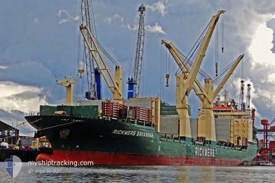
HYUNDAI ULSAN
General Cargo
Current Trip
| Time Travelled | 15 days |
|---|---|
| Remaining Time | 4 days |
| Distance Travelled | 4635.62 nm |
| Remaining Distance | 1528.44 nm |
| AVG Speed | 12.9 Knots |
| MAX Speed | 18.3 Knots |
| AVG Wind | 9.7 knots |
| MAX Wind | 23.8 knots |
| MIN Temp | 23.7°C / 74.66°F |
| MAX Temp | 29.3°C / 84.74°F |
| Draught | 8.2 m |
| Position Received | 3 d ago |
Current Position
| Longitude | --- |
|---|---|
| Latitude | --- |
| Status | Under way using engine |
| Speed | 16.5 Knots |
| Course | 82° |
| Area | Singapore Strait |
| Station | T-AIS |
| Position Received | 3 d ago |
Info
Information
The current position of HYUNDAI ULSAN is in Singapore Strait with coordinates 1.26078° / 104.15255° as reported on 2025-12-07 09:04 by AIS to our vessel tracker app. The vessel's current speed is 16.5 Knots and is heading at the port of MASAN. The estimated time of arrival as calculated by MyShipTracking vessel tracking app is 2025-12-14 20:22 LT
The vessel HYUNDAI ULSAN (IMO: 9469895, MMSI: 538004217) is a General Cargo that was built in 2011 ( 14 years old ). It's sailing under the flag of [MH] Marshall Is.
In this page you can find informations about the vessels current position, last detected port calls, and current voyage information. If the vessels is not in coverage by AIS you will find the latest position.
The current position of HYUNDAI ULSAN is detected by our AIS receivers and we are not responsible for the reliability of the data. The last position was recorded while the vessel was in Coverage by the Ais receivers of our vessel tracking app.
The current draught of HYUNDAI ULSAN as reported by AIS is 8.2 meters
Weather
| Temperature | 27.1°C / 80.78°F |
|---|---|
| Wind Speed | 13 knots |
| Direction | 42° NE |
| Pressure | 1010.2 hPa |
| Humidity | 85.5 % |
| Cloud Coverage | 100 % |
Featured Company
Last Port Calls
| Port | Arrival | Departure | Time In Port |
|---|---|---|---|
| 2025-11-21 15:13 | 2025-11-25 10:11 | 3 d | |
| 2025-11-08 15:39 | 2025-11-13 07:18 | 4 d | |
| 2025-11-03 22:01 | 2025-11-08 06:09 | 4 d | |
| 2025-11-01 22:44 | 2025-11-02 22:34 | 23 h | |
| 2025-10-12 02:52 | 2025-10-15 18:13 | 3 d | |
| 2025-10-08 11:49 | 2025-10-11 00:18 | 2 d | |
| 2025-10-04 08:26 | 2025-10-06 18:32 | 2 d |
Last Trips
| Origin | Departure | Destination | Arrival | Distance | |
|---|---|---|---|---|---|
| 2025-11-13 07:18 | 2025-11-21 15:13 | 572.82 nm | |||
| 2025-11-08 06:09 | 2025-11-08 15:39 | 121.45 nm | |||
| 2025-11-02 22:34 | 2025-11-03 22:01 | 316.83 nm | |||
| 2025-10-15 18:13 | 2025-11-01 22:44 | 6181.86 nm | |||
| 2025-10-11 00:18 | 2025-10-12 02:52 | 366.43 nm | |||
| 2025-10-06 18:32 | 2025-10-08 11:49 | 526.80 nm | |||
| 2025-09-25 12:38 | 2025-10-04 08:26 | 580.40 nm |
Events
| Time | Event | Details | Position / Dest | Info |
|---|---|---|---|---|
| 2025-12-07 09:12 | Status Changed | Default Under way using engine |
1.26534 / 104.18544
KRMAS
|
Speed: 16.5 kn Course: 82° |
| 2025-12-07 09:04 | Detected in Sea | Malaysian part of the Singapore Strait |
1.26078 / 104.15255
Singapore Strait
KRMAS
|
Speed: 16.5 kn Course: 82° |
| 2025-12-07 09:04 | OUT of Coverage |
1.26078 / 104.15255
Singapore Strait
KRMAS
|
Speed: 16.5 kn Course: 82° |
|
| 2025-12-07 08:57 | Status Changed | Under way using engine Default |
1.25610 / 104.11929
KRMAS
|
Speed: 16.4 kn Course: 82° |
| 2025-12-07 08:49 | Status Changed | Default Under way using engine |
1.25090 / 104.08293
KRMAS
|
Speed: 16.4 kn Course: 81.9° |
| 2025-12-07 08:12 | Change Sea Area | Indonesian part of the Singapore Strait Singaporean part of the Singapore Strait |
1.21913 / 103.92297
Singapore Strait
KRMAS
|
Speed: 14.4 kn Course: 74.7° |
| 2025-12-07 07:12 | START Moving | 2.34 nm, East of SINGAPORE |
1.27130 / 103.89109
KRMAS
|
Speed: 3.1 kn Course: 250° |
| 2025-12-07 07:01 | Status Changed | Under way using engine At anchor |
1.27144 / 103.89400
KRMAS
|
Speed: 0.3 kn Course: 228° |
| 2025-12-07 06:58 | ETA Changed | 2025/12/15 11:00 2025/12/15 07:00 |
1.27195 / 103.89395
KRMAS
|
Speed: 0.2 kn Course: 242° |
| 2025-12-07 06:07 | Draught Changed | 8.2 7.8 |
1.27118 / 103.89467
KRMAS
|
Speed: 0.1 kn Course: 245° |