
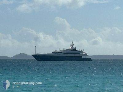
HOLDIN' MY OWN
Pleasure Craft
Current Trip
| Trip Time | 5 h, 38 mins |
|---|---|
| Trip Distance | 71.26 nm |
| AVG Speed | 12.7 Knots |
| MAX Speed | 13.3 Knots |
| Draught | 0 m |
| AVG Wind | 8 knots |
| MAX Wind | 10 knots |
| MIN Temp | 26°C / 78.8°F |
| MAX Temp | 27°C / 80.6°F |
| Position Received | 3 m ago |
Current Position
| Longitude | --- |
|---|---|
| Latitude | --- |
| Status | Moored |
| Speed | |
| Course | 208° |
| Area | North Atlantic Ocean |
| Station | T-AIS |
| Position Received | 3 m ago |
Info
Information
The current position of HOLDIN' MY OWN is in North Atlantic Ocean with coordinates 18.46414° / -66.10431° as reported on 2025-03-15 13:19 by AIS to our vessel tracker app. The vessel's current speed is 0 Knots and is currently inside the port of SAN JUAN.
The vessel HOLDIN' MY OWN (IMO: 1011173000, MMSI: 319133200) is a Pleasure Craft It's sailing under the flag of [KY] Cayman Is.
In this page you can find informations about the vessels current position, last detected port calls, and current voyage information. If the vessels is not in coverage by AIS you will find the latest position.
The current position of HOLDIN' MY OWN is detected by our AIS receivers and we are not responsible for the reliability of the data. The last position was recorded while the vessel was in Coverage by the Ais receivers of our vessel tracking app.
Weather
| Temperature | 23.7°C / 74.66°F |
|---|---|
| Wind Speed | 2 knots |
| Direction | 258° WSW |
| Pressure | 1015.5 hPa |
| Humidity | 80.1 % |
| Cloud Coverage | 6 % |
Featured Company
Most Visited Ports (Last year)
| Port | Arrivals | |
|---|---|---|
| 3 | ||
| 2 | ||
| 2 | ||
| 2 | ||
| 1 | ||
| 1 |
Last Trips
| Origin | Departure | Destination | Arrival | Distance | |
|---|---|---|---|---|---|
| 2025-03-08 10:50 | 2025-03-08 16:28 | 71.26 nm | |||
| 2025-03-06 07:16 | 2025-03-08 09:25 | 41.04 nm | |||
| 2025-03-04 08:38 | 2025-03-04 17:43 | 108.59 nm | |||
| 2025-01-09 08:10 | 2025-01-09 17:16 | 107.83 nm | |||
| 2024-12-27 16:09 | 2025-01-04 13:42 | 286.26 nm |
Events
| Time | Event | Details | Position / Dest | Info |
|---|---|---|---|---|
| 2025-03-14 13:01 | IN Coverage |
18.46415 / -66.10430
North Atlantic Ocean
[PR] SAN JUAN
|
Speed: Course: 310.3° |
|
| 2025-03-14 10:57 | OUT of Coverage |
18.46413 / -66.10433
North Atlantic Ocean
[PR] SAN JUAN
|
Speed: Course: 310.3° |
|
| 2025-03-14 08:04 | IN Coverage |
18.46414 / -66.10434
North Atlantic Ocean
[PR] SAN JUAN
|
Speed: Course: 310.3° |
|
| 2025-03-14 02:22 | OUT of Coverage |
18.46422 / -66.10438
North Atlantic Ocean
[PR] SAN JUAN
|
Speed: Course: 310.3° |
|
| 2025-03-13 07:09 | IN Coverage |
18.46416 / -66.10434
North Atlantic Ocean
[PR] SAN JUAN
|
Speed: Course: 308.4° |
|
| 2025-03-13 06:06 | OUT of Coverage |
18.46414 / -66.10434
North Atlantic Ocean
[PR] SAN JUAN
|
Speed: Course: 308.4° |
|
| 2025-03-10 16:45 | IN Coverage |
18.46416 / -66.10431
North Atlantic Ocean
[PR] SAN JUAN
|
Speed: Course: 301.3° |
|
| 2025-03-08 21:45 | OUT of Coverage |
18.46417 / -66.10434
North Atlantic Ocean
[PR] SAN JUAN
|
Speed: Course: 40° |
|
| 2025-03-08 21:45 | STOP Moving |
18.46417 / -66.10434
[PR] SAN JUAN
|
Speed: Course: 208° |
|
| 2025-03-08 21:04 | Detected in Sea | Puerto Rican part of the North Atlantic Ocean |
18.46823 / -66.12776
North Atlantic Ocean
PRSJU
|
Speed: 7 kn Course: 166° |