
HOHEPLATE
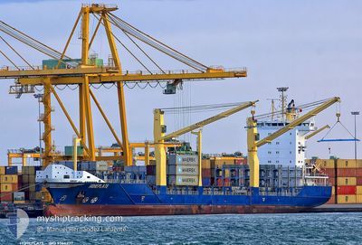
Container Ship
Current Trip
DOHAI
| Time Travelled | 1 day |
|---|---|
| Remaining Time | --- |
| Distance Travelled | 424.69 nm |
| Remaining Distance | --- |
| AVG Speed | 12.5 Knots |
| MAX Speed | 13.6 Knots |
| AVG Wind | 15.7 knots |
| MAX Wind | 20 knots |
| MIN Temp | 26.7°C / 80.06°F |
| MAX Temp | 28.9°C / 84.02°F |
| Draught | 9 m |
| Position Received | 1 d ago |
Current Position
| Longitude | --- |
|---|---|
| Latitude | --- |
| Status | Moored |
| Speed | 13.6 Knots |
| Course | 165.1° |
| Area | Caribbean Sea |
| Station | T-AIS |
| Position Received | 1 d ago |
Info
Information
The current position of HOHEPLATE is in Caribbean Sea with coordinates 18.27071° / -69.96701° as reported on 2024-11-27 18:21 by AIS to our vessel tracker app. The vessel's current speed is 13.6 Knots
The vessel HOHEPLATE (IMO: 9366237, MMSI: 305236000) is a Container Ship that was built in 2007 ( 17 years old ). It's sailing under the flag of [AG] Antigua Barbuda.
In this page you can find informations about the vessels current position, last detected port calls, and current voyage information. If the vessels is not in coverage by AIS you will find the latest position.
The current position of HOHEPLATE is detected by our AIS receivers and we are not responsible for the reliability of the data. The last position was recorded while the vessel was in Coverage by the Ais receivers of our vessel tracking app.
The current draught of HOHEPLATE as reported by AIS is 9 meters
Weather
| Temperature | 28.9°C / 84.02°F |
|---|---|
| Wind Speed | 19 knots |
| Direction | 94° E |
| Pressure | 1010.1 hPa |
| Humidity | 84.4 % |
| Cloud Coverage | 100 % |
Featured Company
Last Port Calls
| Port | Arrival | Departure | Time In Port |
|---|---|---|---|
| 2024-11-26 18:54 | 2024-11-27 13:52 | 18 h | |
| 2024-11-23 17:13 | 2024-11-23 17:23 | 9 m | |
| 2024-11-22 01:14 | |||
| 2024-11-22 01:01 | 2024-11-22 01:09 | 7 m | |
| 2024-11-17 10:49 | 2024-11-18 09:47 | 22 h | |
| 2024-11-16 11:37 | 2024-11-16 23:37 | 11 h | |
| 2024-11-14 11:11 | 2024-11-15 01:04 | 13 h | |
| 2024-11-10 17:42 | 2024-11-11 02:27 | 8 h | |
| 2024-11-09 22:37 | |||
| 2024-11-09 22:17 | 2024-11-09 22:25 | 7 m |
Most Visited Ports (Last year)
| Port | Arrivals | |
|---|---|---|
| 46 | ||
| 33 | ||
| 17 | ||
| 8 | ||
| 7 | ||
| 7 |
Last Trips
| Origin | Departure | Destination | Arrival | Distance | |
|---|---|---|---|---|---|
| 2024-11-23 17:23 | 2024-11-26 18:54 | 934.23 nm | |||
| 2024-11-22 01:09 | 2024-11-23 17:13 | 2.14 nm | |||
| 2024-11-22 01:09 | 2024-11-22 01:14 | 0.65 nm | |||
| 2024-11-18 09:47 | 2024-11-22 01:01 | 1260.27 nm | |||
| 2024-11-16 23:37 | 2024-11-17 10:49 | 95.38 nm | |||
| 2024-11-15 01:04 | 2024-11-16 11:37 | 499.37 nm | |||
| 2024-11-11 02:27 | 2024-11-14 11:11 | 952.83 nm | |||
| 2024-11-09 22:25 | 2024-11-10 17:42 | 1.79 nm | |||
| 2024-11-09 22:25 | 2024-11-09 22:37 | 0.73 nm | |||
| 2024-11-09 02:25 | 2024-11-09 22:17 | 22.05 nm |
Events
| Time | Event | Details | Position / Dest | Info |
|---|---|---|---|---|
| 2024-11-27 18:25 | Status Changed | Default Moored |
18.25538 / -69.96259
DOHAI
|
Speed: 13.6 kn Course: 165.1° |
| 2024-11-27 18:21 | OUT of Coverage |
18.27071 / -69.96701
Caribbean Sea
|
Speed: 13.6 kn Course: 165.1° |
|
| 2024-11-27 18:17 | Status Changed | Moored Default |
18.28531 / -69.97140
DOHAI
|
Speed: 13.6 kn Course: 162° |
| 2024-11-27 18:14 | Status Changed | Default Moored |
18.29723 / -69.97534
DOHAI
|
Speed: 13.7 kn Course: 162.2° |
| 2024-11-27 18:04 | Status Changed | Moored Default |
18.33170 / -69.98636
DOHAI
|
Speed: 13.4 kn Course: 163° |
| 2024-11-27 18:01 | Status Changed | Default Moored |
18.34137 / -69.98939
DOHAI
|
Speed: 13.6 kn Course: 162.7° |
| 2024-11-27 17:53 | Status Changed | Moored Default |
18.37375 / -69.99954
DOHAI
|
Speed: 7.3 kn Course: -1° |
| 2024-11-27 17:52 | PORT DEPARTURE |
|
18.37375 / -69.99954
DOHAI
|
Speed: 7.3 kn Course: -1° |
| 2024-11-27 17:40 | START Moving |
18.41089 / -70.01756
[DO] RIO HAINA
|
Speed: 7.3 kn Course: -1° |
|
| 2024-11-27 17:40 | IN Coverage |
18.37086 / -69.99860
Caribbean Sea
|
Speed: 13.5 kn Course: 163.7° |