

HOHEPLATE
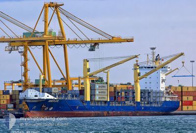
Container Ship

Current Trip
| Time Travelled | 1 day |
|---|---|
| Remaining Time | 1 day |
| Distance Travelled | 554.10 nm |
| Remaining Distance | 872.51 nm |
| AVG Speed | 12.6 Knop |
| MAX Speed | 14.8 Knop |
| AVG Wind | 10.8 knots |
| MAX Wind | 23.7 knots |
| MIN Temp | 23°C / 73.4°F |
| MAX Temp | 26.5°C / 79.7°F |
| Djupgående | 8.5 m |
| Position mottagen | 1 d sen |
Current Position
| Longitud | --- |
|---|---|
| Latitude | --- |
| Status | Under way using engine |
| Fart | 12.2 Knop |
| Kurs | 167.8° |
| Område | North Atlantic Ocean |
| Station | T-AIS |
| Position mottagen | 1 d sen |
Information
The current position of HOHEPLATE is in North Atlantic Ocean with coordinates 25.40481° / -79.58026° as reported on 2025-03-26 13:28 by AIS to our vessel tracker app. The vessel's current speed is 12.2 Knop and is heading at the port of RIO HAINA. The estimated time of arrival as calculated by MyShipTracking vessel tracking app is 2025-03-29 15:06 LT
The vessel HOHEPLATE (IMO: 9366237, MMSI: 305236000) is a Container Ship that was built in 2007 ( 18 År gammal ). It's sailing under the flag of [AG] Antigua Barbuda.
In this page you can find informations about the vessels current position, last detected port calls, and current voyage information. If the vessels is not in coverage by AIS you will find the latest position.
The current position of HOHEPLATE is detected by our AIS receivers and we are not responsible for the reliability of the data. The last position was recorded while the vessel was in Coverage by the Ais receivers of our vessel tracking app.
The current draught of HOHEPLATE as reported by AIS is 8.5 meters
Weather
| Temperature | 26.5°C / 79.7°F |
|---|---|
| Wind Speed | 22 knots |
| Direction | 40° NE |
| Pressure | 1016.4 hPa |
| Humidity | 76.5 % |
| Cloud Coverage | 54 % |


Featured Company
Last Port Calls
| Port | Arrival | Departure | Time In Port |
|---|---|---|---|
| 2025-03-24 20:06 | 2025-03-26 04:44 | 1 d | |
| 2025-03-24 09:23 | 2025-03-24 20:03 | 10 h | |
| 2025-03-19 14:06 | 2025-03-20 14:58 | 1 d | |
| 2025-03-18 12:45 | 2025-03-19 04:07 | 15 h | |
| 2025-03-15 21:35 | 2025-03-16 13:08 | 15 h | |
| 2025-03-13 14:53 | 2025-03-14 05:57 | 15 h | |
| 2025-03-09 17:28 | 2025-03-10 03:53 | 10 h | |
| 2025-03-08 17:55 | 2025-03-09 04:01 | 9 h | |
| 2025-03-08 03:20 | 2025-03-08 17:43 | 14 h | |
| 2025-03-07 18:03 |
Most Visited Ports (Last year)
| Port | Arrivals | |
|---|---|---|
| 40 | ||
| 38 | ||
| 22 | ||
| 12 | ||
| 12 | ||
| 6 |
Last Trips
| Origin | Departure | Destination | Arrival | Distance | |
|---|---|---|---|---|---|
| 2025-03-24 20:03 | 2025-03-24 20:06 | 0.41 nm | |||
| 2025-03-20 14:58 | 2025-03-24 09:23 | 1098.84 nm | |||
| 2025-03-19 04:07 | 2025-03-19 14:06 | 96.17 nm | |||
| 2025-03-16 13:08 | 2025-03-18 12:45 | 593.49 nm | |||
| 2025-03-14 05:57 | 2025-03-15 21:35 | 502.01 nm | |||
| 2025-03-10 03:53 | 2025-03-13 14:53 | 957.75 nm | |||
| 2025-03-09 04:01 | 2025-03-09 17:28 | 9.98 nm | |||
| 2025-03-08 17:43 | 2025-03-08 17:55 | 0.65 nm | |||
| 2025-03-04 02:00 | 2025-03-08 03:20 | 1080.99 nm | |||
| 2025-03-04 02:00 | 2025-03-07 18:03 | 1079.77 nm |
Events
| Tid | Event | Detaljer | Position / Dest | Information |
|---|---|---|---|---|
| 2025-03-26 13:33 | Status ändrad | Default Under way using engine |
25.38665 / -79.57564
DOHAI
|
Fart: 12.2 kn Kurs: 167.8° |
| 2025-03-26 13:28 | UTANFÖR täckningsområde |
25.40481 / -79.58026
North Atlantic Ocean
DOHAI
|
Fart: 12.2 kn Kurs: 167.8° |
|
| 2025-03-26 13:04 | Status ändrad | Under way using engine Default |
25.48207 / -79.60002
DOHAI
|
Fart: 11.8 kn Kurs: 165° |
| 2025-03-26 12:58 | Status ändrad | Default Under way using engine |
25.50178 / -79.60526
DOHAI
|
Fart: 11.8 kn Kurs: 166° |
| 2025-03-26 11:34 | Status ändrad | Under way using engine Default |
25.76028 / -79.67615
DOHAI
|
Fart: 11 kn Kurs: 169° |
| 2025-03-26 11:25 | Status ändrad | Default Under way using engine |
25.78727 / -79.68214
DOHAI
|
Fart: 11 kn Kurs: 167.5° |
| 2025-03-26 11:08 | Byter havsområde | Bahamas part of the North Atlantic Ocean United States part of the North Atlantic Ocean |
25.83857 / -79.69593
North Atlantic Ocean
DOHAI
|
Fart: 10 kn Kurs: 160.2° |
| 2025-03-26 08:44 | AVGÅTT HAMN |
|
26.09357 / -80.10822
DOHAI
|
Fart: 7.9 kn Kurs: 89.7° |
| 2025-03-26 08:38 | STARTAR förflyttning |
26.08846 / -80.11831
[US] PORT EVERGLADES
|
Fart: 3.2 kn Kurs: 40° |
|
| 2025-03-26 08:35 | Djupgående ändrat | 8.5 7.5 |
26.08830 / -80.11955
[US] PORT EVERGLADES
|
Fart: 1.6 kn Kurs: 511° |