

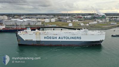
HOEGH NEW YORK
Vehicles Carrier

Current Trip
| Time Travelled | 7 days |
|---|---|
| Remaining Time | --- |
| Distance Travelled | 1470.91 nm |
| Remaining Distance | 21.68 nm |
| AVG Speed | 11.2 Knots |
| MAX Speed | 18.4 Knots |
| AVG Wind | 8.9 knots |
| MAX Wind | 20 knots |
| MIN Temp | 19.4°C / 66.92°F |
| MAX Temp | 26.9°C / 80.42°F |
| Draught | 7.6 m |
| Position Received | 5 d ago |
Current Position
| Longitude | --- |
|---|---|
| Latitude | --- |
| Status | Under way using engine |
| Speed | 9.5 Knots |
| Course | 113° |
| Area | Gulf of Oman |
| Station | T-AIS |
| Position Received | 5 d ago |
Information
The current position of HOEGH NEW YORK is in Gulf of Oman with coordinates 24.79532° / 57.19830° as reported on 2025-02-24 21:09 by AIS to our vessel tracker app. The vessel's current speed is 9.5 Knots and is heading at the port of MUMBAI. The estimated time of arrival as calculated by MyShipTracking vessel tracking app is 2025-03-01 06:00 LT
The vessel HOEGH NEW YORK (IMO: 9295830, MMSI: 257560000) is a Vehicles Carrier that was built in 2005 ( 20 years old ). It's sailing under the flag of [NO] Norway.
In this page you can find informations about the vessels current position, last detected port calls, and current voyage information. If the vessels is not in coverage by AIS you will find the latest position.
The current position of HOEGH NEW YORK is detected by our AIS receivers and we are not responsible for the reliability of the data. The last position was recorded while the vessel was in Coverage by the Ais receivers of our vessel tracking app.
The current draught of HOEGH NEW YORK as reported by AIS is 7.6 meters
Weather
| Temperature | 26.7°C / 80.06°F |
|---|---|
| Wind Speed | 13 knots |
| Direction | 346° NNW |
| Pressure | 1011.2 hPa |
| Humidity | 69.2 % |
| Cloud Coverage | 32 % |


Featured Company
Last Port Calls
| Port | Arrival | Departure | Time In Port |
|---|---|---|---|
| 2025-02-21 12:38 | 2025-02-23 01:46 | 1 d | |
| 2025-02-18 09:54 | 2025-02-19 03:47 | 17 h | |
| 2025-02-17 09:31 | 2025-02-18 07:14 | 21 h | |
| 2025-01-17 01:23 | 2025-01-17 22:51 | 21 h | |
| 2025-01-11 01:28 | 2025-01-12 00:20 | 22 h | |
| 2025-01-03 07:43 | 2025-01-03 19:59 | 12 h |
Last Trips
| Origin | Departure | Destination | Arrival | Distance | |
|---|---|---|---|---|---|
| 2025-02-19 03:47 | 2025-02-21 12:38 | 377.59 nm | |||
| 2025-02-18 07:14 | 2025-02-18 09:54 | 34.18 nm | |||
| 2025-01-17 22:51 | 2025-02-17 09:31 | 11272.77 nm | |||
| 2025-01-12 00:20 | 2025-01-17 01:23 | 1501.41 nm | |||
| 2025-01-03 19:59 | 2025-01-11 01:28 | 2094.24 nm | |||
| 2024-12-29 20:47 | 2025-01-03 07:43 | 1288.00 nm |
Events
| Time | Event | Details | Position / Dest | Info |
|---|---|---|---|---|
| 2025-03-01 01:38 | STOP Moving | 21.09 nm, West of MUMBAI |
19.09500 / 72.51923
INBOM
|
Speed: 0.2 kn Course: 347° |
| 2025-02-24 21:10 | Status Changed | Default Under way using engine |
24.79443 / 57.20045
INBOM
|
Speed: 9.5 kn Course: 113° |
| 2025-02-24 21:09 | OUT of Coverage |
24.79532 / 57.19830
Gulf of Oman
INBOM
|
Speed: 9.5 kn Course: 113° |
|
| 2025-02-24 21:04 | Status Changed | Under way using engine Default |
24.80060 / 57.18425
INBOM
|
Speed: 9.8 kn Course: 113° |
| 2025-02-24 20:54 | Status Changed | Default Under way using engine |
24.81092 / 57.15673
INBOM
|
Speed: 9.9 kn Course: 112° |
| 2025-02-24 20:45 | Status Changed | Under way using engine Default |
24.81970 / 57.13238
INBOM
|
Speed: 9.8 kn Course: 114° |
| 2025-02-24 19:48 | Status Changed | Default Under way using engine |
24.88727 / 56.97373
INBOM
|
Speed: 10.3 kn Course: 115° |
| 2025-02-24 19:45 | Status Changed | Under way using engine Default |
24.89070 / 56.96608
INBOM
|
Speed: 10.3 kn Course: 112° |
| 2025-02-24 19:38 | Status Changed | Default Under way using engine |
24.90055 / 56.94323
INBOM
|
Speed: 10.3 kn Course: 110° |
| 2025-02-24 19:32 | Status Changed | Under way using engine Default |
24.90642 / 56.92657
INBOM
|
Speed: 10.1 kn Course: 111° |