
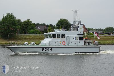
HMS TRUMPETER
Military ops
Current Trip
| Trip Time | 7 h, 30 mins |
|---|---|
| Trip Distance | 109.52 nm |
| AVG Speed | 17.9 Knots |
| MAX Speed | 20.9 Knots |
| Draught | --- |
| AVG Wind | 6.2 knots |
| MAX Wind | 9 knots |
| MIN Temp | 0.2°C / 32.36°F |
| MAX Temp | 3°C / 37.4°F |
| Position Received | 1 h, 36 m ago |
Current Position
| Longitude | --- |
|---|---|
| Latitude | --- |
| Status | Default |
| Speed | 6.5 Knots |
| Course | 259.8° |
| Area | Norwegian Sea |
| Station | T-AIS |
| Position Received | 1 h, 36 m ago |
Info
Information
The current position of HMS TRUMPETER is in Norwegian Sea with coordinates 68.80068° / 16.55636° as reported on 2025-02-27 16:34 by AIS to our vessel tracker app. The vessel's current speed is 6.5 Knots and is currently inside the port of HARSTAD.
The vessel HMS TRUMPETER (MMSI: 232002978) is a Military ops It's sailing under the flag of [GB] United Kingdom.
In this page you can find informations about the vessels current position, last detected port calls, and current voyage information. If the vessels is not in coverage by AIS you will find the latest position.
The current position of HMS TRUMPETER is detected by our AIS receivers and we are not responsible for the reliability of the data. The last position was recorded while the vessel was in Coverage by the Ais receivers of our vessel tracking app.
Weather
| Temperature | 0.8°C / 33.44°F |
|---|---|
| Wind Speed | 7 knots |
| Direction | 174° S |
| Pressure | 1007.9 hPa |
| Humidity | 93.7 % |
| Cloud Coverage | 100 % |
Featured Company
Last Port Calls
| Port | Arrival | Departure | Time In Port |
|---|---|---|---|
| 2025-02-27 16:34 | |||
| 2025-02-19 13:35 | 2025-02-27 09:04 | 7 d | |
| 2025-02-17 15:16 | 2025-02-18 06:12 | 14 h | |
| 2025-02-16 15:05 | 2025-02-17 06:58 | 15 h | |
| 2025-02-06 17:40 | |||
| 2025-02-03 16:50 | 2025-02-04 07:04 | 14 h | |
| 2025-01-29 15:25 | 2025-02-03 09:35 | 4 d | |
| 2025-01-21 18:21 | 2025-01-29 10:49 | 7 d | |
| 2025-01-21 10:46 | |||
| 2025-01-15 13:42 |
Most Visited Ports (Last year)
| Port | Arrivals | |
|---|---|---|
| 6 | ||
| 3 | ||
| 2 | ||
| 2 | ||
| 2 | ||
| 2 |
Last Trips
| Origin | Departure | Destination | Arrival | Distance | |
|---|---|---|---|---|---|
| 2025-02-27 10:04 | 2025-02-27 17:34 | 109.52 nm | |||
| 2025-02-18 07:12 | 2025-02-19 14:35 | 291.45 nm | |||
| 2025-02-17 07:58 | 2025-02-17 16:16 | 154.28 nm | |||
| 2025-02-04 07:04 | 2025-02-06 18:40 | 279.25 nm | |||
| 2025-02-03 09:35 | 2025-02-03 16:50 | 101.09 nm | |||
| 2025-01-29 10:49 | 2025-01-29 15:25 | 8.15 nm | |||
| 2025-01-21 10:46 | 2025-01-21 18:21 | 23.82 nm | |||
| 2024-12-12 12:30 | 2025-01-13 17:05 | 78.59 nm |
Events
| Time | Event | Details | Position / Dest | Info |
|---|---|---|---|---|
| 2025-02-27 16:34 | OUT of Coverage |
68.80068 / 16.55636
Norwegian Sea
[NO] HARSTAD
|
Speed: 6.5 kn Course: 259.8° |
|
| 2025-02-27 16:34 | PORT ARRIVAL |
|
68.80068 / 16.55636
[NO] HARSTAD
|
Speed: 19.8 kn Course: 332.8° |
| 2025-02-27 16:22 | IN Coverage |
68.75744 / 16.64586
Norwegian Sea
|
Speed: 19.7 kn Course: 350.6° |
|
| 2025-02-27 15:19 | OUT of Coverage |
68.61687 / 16.56617
Norwegian Sea
|
Speed: 20.9 kn Course: 31.3° |
|
| 2025-02-27 12:58 | IN Coverage |
68.16499 / 15.40048
Norwegian Sea
|
Speed: 20.2 kn Course: 48.2° |
|
| 2025-02-27 09:43 | OUT of Coverage |
67.44804 / 14.54109
Norwegian Sea
|
Speed: 19.7 kn Course: 26.8° |
|
| 2025-02-27 09:04 | PORT DEPARTURE |
|
67.28960 / 14.36756
|
Speed: 9.2 kn Course: 32.4° |
| 2025-02-27 09:00 | START Moving |
67.28520 / 14.36981
[NO] BODOE
|
Speed: 6.1 kn Course: 296° |
|
| 2025-02-27 07:47 | IN Coverage |
67.28410 / 14.37445
Norwegian Sea
[NO] BODOE
|
Speed: Course: 0° |
|
| 2025-02-26 20:53 | OUT of Coverage |
67.28409 / 14.37441
Norwegian Sea
[NO] BODOE
|
Speed: Course: 219.3° |