
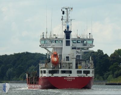
HJORDIS
General Cargo
Current Trip
| Time Travelled | 4 days |
|---|---|
| Remaining Time | 23 h, 54 mins |
| Distance Travelled | 1183.13 nm |
| Remaining Distance | 312.13 nm |
| AVG Speed | 12.4 Knots |
| MAX Speed | 17.5 Knots |
| AVG Wind | 8 knots |
| MAX Wind | 14.3 knots |
| MIN Temp | 0.9°C / 33.62°F |
| MAX Temp | 7.2°C / 44.96°F |
| Draught | 7.2 m |
| Position Received | 3 h, 19 m ago |
Current Position
| Longitude | --- |
|---|---|
| Latitude | --- |
| Status | Under way using engine |
| Speed | 12 Knots |
| Course | 13.3° |
| Area | Gulf of Bothnia |
| Station | T-AIS |
| Position Received | 3 h, 19 m ago |
Info
Information
The current position of HJORDIS is in Gulf of Bothnia with coordinates 60.92500° / 19.27038° as reported on 2025-03-01 03:33 by AIS to our vessel tracker app. The vessel's current speed is 12 Knots and is heading at the port of ROYTTA. The estimated time of arrival as calculated by MyShipTracking vessel tracking app is 2025-03-02 08:46 LT
The vessel HJORDIS (IMO: 9126235, MMSI: 230351000) is a General Cargo that was built in 1996 ( 29 years old ). It's sailing under the flag of [FI] Finland.
In this page you can find informations about the vessels current position, last detected port calls, and current voyage information. If the vessels is not in coverage by AIS you will find the latest position.
The current position of HJORDIS is detected by our AIS receivers and we are not responsible for the reliability of the data. The last position was recorded while the vessel was in Coverage by the Ais receivers of our vessel tracking app.
The current draught of HJORDIS as reported by AIS is 7.2 meters
Weather
| Temperature | 2°C / 35.6°F |
|---|---|
| Wind Speed | 8 knots |
| Direction | 311° NW |
| Pressure | 1020.3 hPa |
| Humidity | 82.3 % |
| Cloud Coverage | 98 % |
Featured Company
Last Port Calls
| Port | Arrival | Departure | Time In Port |
|---|---|---|---|
| 2025-02-25 02:09 | 2025-02-25 03:29 | 1 h | |
| 2025-02-23 20:40 | 2025-02-25 02:02 | 1 d | |
| 2025-02-23 20:02 | 2025-02-23 20:17 | 14 m | |
| 2025-02-16 22:49 | 2025-02-19 12:25 | 2 d | |
| 2025-02-11 23:55 | 2025-02-12 01:05 | 1 h | |
| 2025-02-09 20:46 | 2025-02-11 23:28 | 2 d | |
| 2025-02-09 20:11 | 2025-02-09 20:25 | 13 m | |
| 2025-02-08 10:01 | 2025-02-08 10:37 | 35 m | |
| 2025-01-27 04:21 | 2025-02-05 13:25 | 9 d | |
| 2025-01-19 22:25 | 2025-01-22 16:57 | 2 d |
Most Visited Ports (Last year)
| Port | Arrivals | |
|---|---|---|
| 35 | ||
| 22 | ||
| 20 | ||
| 8 | ||
| 5 | ||
| 3 |
Last Trips
| Origin | Departure | Destination | Arrival | Distance | |
|---|---|---|---|---|---|
| 2025-02-25 02:02 | 2025-02-25 02:09 | 0.05 nm | |||
| 2025-02-23 20:17 | 2025-02-23 20:40 | 2.11 nm | |||
| 2025-02-19 12:25 | 2025-02-23 20:02 | 1503.17 nm | |||
| 2025-02-12 01:05 | 2025-02-16 22:49 | 1527.80 nm | |||
| 2025-02-11 23:28 | 2025-02-11 23:55 | 1.86 nm | |||
| 2025-02-09 20:25 | 2025-02-09 20:46 | 1.48 nm | |||
| 2025-02-08 10:37 | 2025-02-09 20:11 | 376.02 nm | |||
| 2025-02-05 13:25 | 2025-02-08 10:01 | 975.01 nm | |||
| 2025-01-22 16:57 | 2025-01-27 04:21 | 1499.83 nm | |||
| 2025-01-19 22:16 | 2025-01-19 22:25 | 0.92 nm |
Events
| Time | Event | Details | Position / Dest | Info |
|---|---|---|---|---|
| 2025-03-01 03:37 | Status Changed | Default Under way using engine |
60.94013 / 19.27769
FITOR
|
Speed: 12 kn Course: 13.3° |
| 2025-03-01 03:33 | Change Sea Area | Finnish part of the Gulf of Bothnia Swedish part of the Gulf of Bothnia |
60.92500 / 19.27038
Gulf of Bothnia
|
Speed: 12 kn Course: 13.3° |
| 2025-03-01 03:33 | OUT of Coverage |
60.92500 / 19.27038
Gulf of Bothnia
|
Speed: 12 kn Course: 13.3° |
|
| 2025-03-01 03:31 | Status Changed | Under way using engine Default |
60.92062 / 19.26824
FITOR
|
Speed: 11.9 kn Course: 13° |
| 2025-03-01 03:25 | Status Changed | Default Under way using engine |
60.90112 / 19.25900
FITOR
|
Speed: 12 kn Course: 13.6° |
| 2025-03-01 03:20 | Status Changed | Under way using engine Default |
60.88435 / 19.25090
FITOR
|
Speed: 12 kn Course: 13° |
| 2025-03-01 03:14 | Status Changed | Default Under way using engine |
60.86251 / 19.24037
FITOR
|
Speed: 12 kn Course: 13.8° |
| 2025-03-01 00:04 | ETA Changed | 2026/02/02 09:00 2025/02/02 09:00 |
60.24115 / 19.04598
FITOR
|
Speed: 11.6 kn Course: 351.8° |
| 2025-02-28 23:52 | Detected in Sea | Swedish part of the Gulf of Bothnia |
60.21040 / 19.08993
Gulf of Bothnia
|
Speed: 11.8 kn Course: 321.5° |
| 2025-02-28 21:07 | Change Sea Area | Finnish part of the Gulf of Bothnia Finnish part of the Baltic Sea |
59.78341 / 19.79183
Gulf of Bothnia
|
Speed: 12.2 kn Course: 319.4° |