
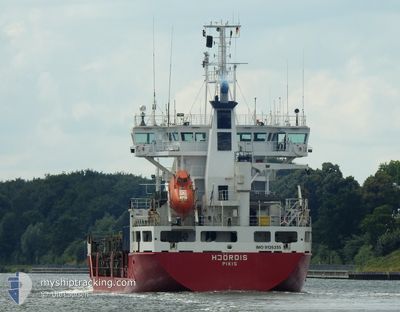
HJORDIS
General Cargo
Current Trip
| Trip Time | 5 days |
|---|---|
| Trip Distance | 1509.55 nm |
| AVG Speed | 12.8 Knopen |
| MAX Speed | 18.3 Knopen |
| Diepgang | 7.1 M |
| AVG Wind | 11.2 knots |
| MAX Wind | 25 knots |
| MIN Temp | -11.1°C / 12.02°F |
| MAX Temp | 8.9°C / 48.02°F |
| Positie ontvangen | 2 d geleden |
Current Position
| Lengtegraad | 21.34315° |
|---|---|
| Breedtegraat | 63.63013° |
| Status | Under way using engine |
| Snelheid | 14.2 Knopen |
| Koers | 64.3° |
| Gebied | Gulf of Bothnia |
| Station | T-AIS |
| Positie ontvangen | 2 d geleden |
Info
Information
The current position of HJORDIS is in Gulf of Bothnia with coordinates 63.63013° / 21.34315° as reported on 2024-04-21 14:13 by AIS to our vessel tracker app. The vessel's current speed is 14.2 Knopen and is currently inside the port of ROYTTA.
The vessel HJORDIS (IMO: 9126235, MMSI: 230351000) is a General Cargo that was built in 1996 ( 28 Jaar oud ). It's sailing under the flag of [FI] Finland.
In this page you can find informations about the vessels current position, last detected port calls, and current voyage information. If the vessels is not in coverage by AIS you will find the latest position.
The current position of HJORDIS is detected by our AIS receivers and we are not responsible for the reliability of the data. The last position was recorded while the vessel was in Coverage by the Ais receivers of our vessel tracking app.
The current draught of HJORDIS as reported by AIS is 7.1 meters
Weather
| Temperature | -0.2°C / 31.64°F |
|---|---|
| Wind Speed | 7 knots |
| Direction | 142° SE |
| Pressure | 1011.9 hPa |
| Humidity | 96 % |
| Cloud Coverage | 96 % |
Featured Company
Last Port Calls
| Port | Arrival | Departure | Time In Port |
|---|---|---|---|
| 2024-04-22 02:24 | |||
| 2024-04-14 04:00 | 2024-04-16 21:09 | 2 d | |
| 2024-04-14 03:21 | 2024-04-14 03:35 | 14 m | |
| 2024-03-14 13:23 | 2024-04-09 08:25 | 25 d | |
| 2024-03-08 04:25 | 2024-03-09 12:10 | 1 d | |
| 2024-03-07 20:08 | 2024-03-07 21:21 | 1 h | |
| 2024-03-07 04:39 | 2024-03-07 19:36 | 14 h | |
| 2024-03-07 04:10 | 2024-03-07 04:31 | 20 m | |
| 2024-03-05 23:55 | 2024-03-06 01:23 | 1 h | |
| 2024-03-05 14:41 | 2024-03-05 15:50 | 1 h |
Last Trips
| Origin | Departure | Destination | Arrival | Distance | |
|---|---|---|---|---|---|
| 2024-04-16 23:09 | 2024-04-22 05:24 | 1509.55 nm | |||
| 2024-04-14 05:35 | 2024-04-14 06:00 | 1.42 nm | |||
| 2024-04-09 11:25 | 2024-04-14 05:21 | 1506.45 nm | |||
| 2024-03-09 13:10 | 2024-03-14 15:23 | 1509.40 nm | |||
| 2024-03-07 22:21 | 2024-03-08 05:25 | 99.07 nm | |||
| 2024-03-07 20:36 | 2024-03-07 21:08 | 2.21 nm | |||
| 2024-03-07 05:31 | 2024-03-07 05:39 | 1.10 nm | |||
| 2024-03-06 02:23 | 2024-03-07 05:10 | 322.96 nm | |||
| 2024-03-05 16:50 | 2024-03-06 00:55 | 49.30 nm | |||
| 2024-03-02 22:20 | 2024-03-05 15:41 | 969.82 nm |
Events
| Tijd | Evenement | Details | Positie / Bestemming | Info |
|---|---|---|---|---|
| 2024-04-22 02:32 | Stop beweging |
65.75513 / 24.15531
[FI] ROYTTA
|
Snelheid: 0.3 kn Koers: 72° |
|
| 2024-04-22 02:24 | Aankomsthaven |
|
65.75344 / 24.15243
[FI] ROYTTA
|
Snelheid: 2.6 kn Koers: 347° |
| 2024-04-21 14:20 | Status Changed | Default Under way using engine |
63.64092 / 21.39597
FITOR
|
Snelheid: 14.2 kn Koers: 64.3° |
| 2024-04-21 14:13 | Status Changed | Under way using engine Default |
63.63013 / 21.34315
FITOR
|
Snelheid: 14.2 kn Koers: 65° |
| 2024-04-21 14:13 | Buitenbereik |
63.63013 / 21.34315
Gulf of Bothnia
FITOR
|
Snelheid: 14.2 kn Koers: 64.3° |
|
| 2024-04-21 13:56 | Status Changed | Default Under way using engine |
63.60247 / 21.20822
FITOR
|
Snelheid: 14 kn Koers: 73.5° |
| 2024-04-21 12:34 | Wijzig zee gebeid | Swedish part of the Gulf of Bothnia Finnish part of the Gulf of Bothnia |
63.45781 / 20.63856
Gulf of Bothnia
FITOR
|
Snelheid: 13.5 kn Koers: 29.5° |
| 2024-04-21 10:44 | Status Changed | Under way using engine Default |
63.07501 / 20.31569
FITOR
|
Snelheid: 13.4 kn Koers: 12° |
| 2024-04-21 10:40 | Status Changed | Default Under way using engine |
63.06189 / 20.30958
FITOR
|
Snelheid: 13.6 kn Koers: 13.1° |
| 2024-04-21 10:30 | Status Changed | Under way using engine Default |
63.02536 / 20.29252
FITOR
|
Snelheid: 13.5 kn Koers: 13° |