
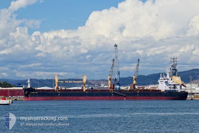
HG LEIXOES
Cargo
Current Trip
| Time Travelled | 14 days |
|---|---|
| Remaining Time | --- |
| Distance Travelled | 937.69 nm |
| Remaining Distance | --- |
| AVG Speed | 10.3 Knots |
| MAX Speed | 14.3 Knots |
| AVG Wind | 9.7 knots |
| MAX Wind | 23 knots |
| MIN Temp | 8.4°C / 47.12°F |
| MAX Temp | 26.1°C / 78.98°F |
| Draught | 10.2 m |
| Position Received | 2 d ago |
Current Position
| Longitude | -48.58654° |
|---|---|
| Latitude | -28.23859° |
| Status | At anchor |
| Speed | 0.2 Knots |
| Course | 28° |
| Area | South Atlantic Ocean |
| Station | T-AIS |
| Position Received | 2 d ago |
Info
Information
The current position of HG LEIXOES is in South Atlantic Ocean with coordinates -28.23859° / -48.58654° as reported on 2024-05-06 17:33 by AIS to our vessel tracker app. The vessel's current speed is 0.2 Knots
The vessel HG LEIXOES (IMO: 9737709, MMSI: 636017493) is a Cargo It's sailing under the flag of [LR] Liberia.
In this page you can find informations about the vessels current position, last detected port calls, and current voyage information. If the vessels is not in coverage by AIS you will find the latest position.
The current position of HG LEIXOES is detected by our AIS receivers and we are not responsible for the reliability of the data. The last position was recorded while the vessel was in Coverage by the Ais receivers of our vessel tracking app.
The current draught of HG LEIXOES as reported by AIS is 10.2 meters
Weather
| Temperature | 23.2°C / 73.76°F |
|---|---|
| Wind Speed | 10 knots |
| Direction | 183° S |
| Pressure | 1011.7 hPa |
| Humidity | 90.2 % |
| Cloud Coverage | 100 % |
Featured Company
Last Port Calls
| Port | Arrival | Departure | Time In Port |
|---|---|---|---|
| 2024-04-21 05:41 | 2024-04-24 09:41 | 3 d | |
| 2024-04-04 23:50 | 2024-04-13 20:55 | 8 d | |
| 2024-03-07 09:13 | 2024-03-17 14:01 | 10 d |
Most Visited Ports (Last year)
| Port | Arrivals | |
|---|---|---|
| 2 | ||
| 2 | ||
| 1 | ||
| 1 | ||
| 1 | ||
| 1 |
Last Trips
| Origin | Departure | Destination | Arrival | Distance | |
|---|---|---|---|---|---|
| 2024-04-13 17:55 | 2024-04-21 02:41 | 1100.40 nm | |||
| 2024-03-17 16:01 | 2024-04-04 20:50 | 4227.46 nm | |||
| 2024-01-23 18:35 | 2024-03-07 11:13 | 7192.86 nm |
Events
| Time | Event | Details | Position / Dest | Info |
|---|---|---|---|---|
| 2024-05-06 17:39 | Status Changed | Default At anchor |
-28.23863 / -48.58635
IMBITUBA
|
Speed: 0.2 kn Course: 28° |
| 2024-05-06 17:33 | Detected in Sea | Brazilian part of the South Atlantic Ocean |
-28.23859 / -48.58654
South Atlantic Ocean
|
Speed: 0.2 kn Course: 113.5° |
| 2024-05-06 17:33 | Status Changed | At anchor Default |
-28.23859 / -48.58654
IMBITUBA
|
Speed: Course: 22° |
| 2024-05-06 17:33 | IN Coverage |
-28.23859 / -48.58654
South Atlantic Ocean
|
Speed: 0.2 kn Course: 113.5° |
|
| 2024-05-06 17:33 | OUT of Coverage |
-28.23859 / -48.58654
South Atlantic Ocean
|
Speed: 0.2 kn Course: 113.5° |
|
| 2024-05-02 08:57 | STOP Moving | 3.82 nm, East of IMBITUBA |
-28.23778 / -48.58505
IMBITUBA
|
Speed: 0.2 kn Course: 333° |
| 2024-04-30 06:24 | Status Changed | Default Under way using engine |
-35.08915 / -54.65248
IMBITUBA
|
Speed: 10.3 kn Course: 89.8° |
| 2024-04-30 06:17 | OUT of Coverage |
-35.08949 / -54.67589
South Atlantic Ocean
IMBITUBA
|
Speed: 10.3 kn Course: 89.8° |
|
| 2024-04-30 04:14 | Change Sea Area | Uruguayan part of the South Atlantic Ocean Uruguayan part of the Rio de La Plata |
-35.06627 / -55.09447
South Atlantic Ocean
IMBITUBA
|
Speed: 10.1 kn Course: 92.3° |
| 2024-04-30 03:53 | Draught Changed | 10.2 10.3 |
-35.06423 / -55.16896
IMBITUBA
|
Speed: 10.4 kn Course: 91.5° |