

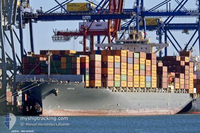
HERTA
Container Ship

Current Trip
| Time Travelled | 9 h, 11 mins |
|---|---|
| Remaining Time | --- |
| Distance Travelled | 100.54 nm |
| Remaining Distance | 761.89 nm |
| AVG Speed | 11.4 Knots |
| MAX Speed | 16.1 Knots |
| AVG Wind | 15.6 knots |
| MAX Wind | 27.7 knots |
| MIN Temp | 18.4°C / 65.12°F |
| MAX Temp | 21.5°C / 70.7°F |
| Draught | 10.4 m |
| Position Received | 11 d ago |
Current Position
| Longitude | --- |
|---|---|
| Latitude | --- |
| Status | Under way using engine |
| Speed | 13.3 Knots |
| Course | 82.7° |
| Area | Singapore Strait |
| Station | T-AIS |
| Position Received | 11 d ago |
Information
The current position of HERTA is in Singapore Strait with coordinates 1.26989° / 104.24756° as reported on 2025-03-04 13:39 by AIS to our vessel tracker app. The vessel's current speed is 13.3 Knots and is heading at the port of SHANGHAI. The estimated time of arrival as calculated by MyShipTracking vessel tracking app is 2025-03-11 08:30 LT
The vessel HERTA (IMO: 9535151, MMSI: 255805590) is a Container Ship that was built in 2011 ( 14 years old ). It's sailing under the flag of [PT] Portugal.
In this page you can find informations about the vessels current position, last detected port calls, and current voyage information. If the vessels is not in coverage by AIS you will find the latest position.
The current position of HERTA is detected by our AIS receivers and we are not responsible for the reliability of the data. The last position was recorded while the vessel was in Coverage by the Ais receivers of our vessel tracking app.
The current draught of HERTA as reported by AIS is 10.4 meters
Weather
| Temperature | 18.7°C / 65.66°F |
|---|---|
| Wind Speed | 20 knots |
| Direction | 14° NNE |
| Pressure | 1016.5 hPa |
| Humidity | 79.6 % |
| Cloud Coverage | 100 % |


Featured Company
Last Port Calls
| Port | Arrival | Departure | Time In Port |
|---|---|---|---|
| 2025-03-14 17:17 | 2025-03-15 18:34 | 1 d | |
| 2025-03-03 09:37 | 2025-03-04 06:17 | 20 h | |
| 2025-02-18 20:03 | 2025-02-20 19:42 | 1 d | |
| 2025-02-14 12:19 | 2025-02-15 05:23 | 17 h | |
| 2025-02-05 18:05 | 2025-02-06 15:09 | 21 h | |
| 2025-01-26 20:01 | 2025-01-28 12:57 | 1 d | |
| 2025-01-20 06:29 | 2025-01-21 00:09 | 17 h | |
| 2025-01-07 09:08 | 2025-01-10 10:54 | 3 d |
Most Visited Ports (Last year)
| Port | Arrivals | |
|---|---|---|
| 11 | ||
| 10 | ||
| 7 | ||
| 6 | ||
| 4 | ||
| 2 |
Last Trips
| Origin | Departure | Destination | Arrival | Distance | |
|---|---|---|---|---|---|
| 2025-03-04 06:17 | 2025-03-14 17:17 | 3383.09 nm | |||
| 2025-02-20 19:42 | 2025-03-03 09:37 | 3407.39 nm | |||
| 2025-02-15 05:23 | 2025-02-18 20:03 | 1009.57 nm | |||
| 2025-02-06 15:09 | 2025-02-14 12:19 | 2630.32 nm | |||
| 2025-01-28 12:57 | 2025-02-05 18:05 | 1853.83 nm | |||
| 2025-01-21 00:09 | 2025-01-26 20:01 | 1690.51 nm | |||
| 2025-01-10 10:54 | 2025-01-20 06:29 | 3407.55 nm | |||
| 2024-12-31 01:10 | 2025-01-07 09:08 | 1009.42 nm |
Events
| Time | Event | Details | Position / Dest | Info |
|---|---|---|---|---|
| 2025-03-15 10:34 | PORT DEPARTURE |
|
22.56115 / 114.28178
SHANGHAI CHINA
|
Speed: 8 kn Course: 119° |
| 2025-03-15 10:26 | START Moving |
22.56929 / 114.26619
[CN] YANTIAN
|
Speed: 5.2 kn Course: 135° |
|
| 2025-03-14 09:17 | STOP Moving |
22.57286 / 114.26367
[CN] YANTIAN
|
Speed: 0.3 kn Course: 42° |
|
| 2025-03-14 09:17 | PORT ARRIVAL |
|
22.57286 / 114.26367
[CN] YANTIAN
|
Speed: 1.3 kn Course: 35° |
| 2025-03-12 04:58 | START Moving | 6.57 nm, West of YANGSHAN |
30.64809 / 122.01672
SHANGHAI CHINA
|
Speed: 6.3 kn Course: 132° |
| 2025-03-11 11:30 | STOP Moving | 6.55 nm, North West of YANGSHAN |
30.65316 / 122.01963
SHANGHAI CHINA
|
Speed: 0.1 kn Course: 102° |
| 2025-03-11 07:35 | START Moving | 15.92 nm, South of SHENGSI |
30.48935 / 122.52397
SHANGHAI CHINA
|
Speed: 6 kn Course: 2° |
| 2025-03-10 14:25 | STOP Moving | 15.68 nm, South of SHENGSI |
30.49188 / 122.51818
SHANGHAI CHINA
|
Speed: 0.1 kn Course: 171° |
| 2025-03-10 09:19 | START Moving |
30.52453 / 123.38136
SHANGHAI CHINA
|
Speed: 12.6 kn Course: 273° |
|
| 2025-03-10 08:21 | STOP Moving |
30.50667 / 123.41310
SHANGHAI CHINA
|
Speed: Course: 86° |