

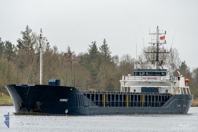
HENRIKE
General Cargo

Current Trip
| Time Travelled | 1 day |
|---|---|
| Remaining Time | 19 h, 54 mins |
| Distance Travelled | 221.74 nm |
| Remaining Distance | 156.04 nm |
| AVG Speed | 8.4 Knots |
| MAX Speed | 9 Knots |
| AVG Wind | 10.9 knots |
| MAX Wind | 24 knots |
| MIN Temp | -0.2°C / 31.64°F |
| MAX Temp | 2.5°C / 36.5°F |
| Draught | 4.7 m |
| Position Received | Now |
Current Position
| Longitude | --- |
|---|---|
| Latitude | --- |
| Status | Under way using engine |
| Speed | 7.7 Knots |
| Course | 302.8° |
| Area | Baltic Sea |
| Station | T-AIS |
| Position Received | Now |
Information
The current position of HENRIKE is in Baltic Sea with coordinates 55.14758° / 13.36004° as reported on 2025-02-21 01:08 by AIS to our vessel tracker app. The vessel's current speed is 7.7 Knots and is heading at the port of AARHUS. The estimated time of arrival as calculated by MyShipTracking vessel tracking app is 2025-02-21 21:03 LT
The vessel HENRIKE (IMO: 9218222, MMSI: 218858000) is a General Cargo that was built in 2000 ( 25 years old ). It's sailing under the flag of [DE] Germany.
In this page you can find informations about the vessels current position, last detected port calls, and current voyage information. If the vessels is not in coverage by AIS you will find the latest position.
The current position of HENRIKE is detected by our AIS receivers and we are not responsible for the reliability of the data. The last position was recorded while the vessel was in Coverage by the Ais receivers of our vessel tracking app.
The current draught of HENRIKE as reported by AIS is 4.7 meters
Weather
| Temperature | 1.8°C / 35.24°F |
|---|---|
| Wind Speed | 19 knots |
| Direction | 181° S |
| Pressure | 1024.1 hPa |
| Humidity | 75.3 % |
| Cloud Coverage | 100 % |


Featured Company
Last Port Calls
| Port | Arrival | Departure | Time In Port |
|---|---|---|---|
| 2025-02-17 13:58 | 2025-02-19 22:48 | 2 d | |
| 2025-02-13 04:43 | 2025-02-14 08:00 | 1 d | |
| 2025-02-08 10:01 | 2025-02-10 18:43 | 2 d | |
| 2025-02-07 18:45 | 2025-02-08 08:48 | 14 h | |
| 2025-02-03 10:02 | 2025-02-04 20:56 | 1 d | |
| 2025-01-31 13:04 | 2025-02-02 14:54 | 2 d | |
| 2025-01-29 05:07 | 2025-01-29 17:04 | 11 h | |
| 2025-01-24 07:21 | 2025-01-27 16:01 | 3 d | |
| 2025-01-22 05:35 | 2025-01-23 10:48 | 1 d | |
| 2025-01-19 10:04 | 2025-01-19 21:35 | 11 h |
Last Trips
| Origin | Departure | Destination | Arrival | Distance | |
|---|---|---|---|---|---|
| 2025-02-14 09:00 | 2025-02-17 14:58 | 431.47 nm | |||
| 2025-02-10 19:43 | 2025-02-13 05:43 | 307.81 nm | |||
| 2025-02-08 09:48 | 2025-02-08 11:01 | 10.37 nm | |||
| 2025-02-04 21:56 | 2025-02-07 19:45 | 322.16 nm | |||
| 2025-02-02 15:54 | 2025-02-03 11:02 | 113.12 nm | |||
| 2025-01-29 18:04 | 2025-01-31 14:04 | 302.92 nm | |||
| 2025-01-27 18:01 | 2025-01-29 06:07 | 298.48 nm | |||
| 2025-01-23 11:48 | 2025-01-24 09:21 | 151.35 nm | |||
| 2025-01-19 22:35 | 2025-01-22 06:35 | 440.12 nm | |||
| 2025-01-18 06:32 | 2025-01-19 11:04 | 113.27 nm |
Events
| Time | Event | Details | Position / Dest | Info |
|---|---|---|---|---|
| 2025-02-21 00:44 | Status Changed | Under way using engine Default |
55.12345 / 13.44011
DKAAR
|
Speed: 7.9 kn Course: 295° |
| 2025-02-21 00:05 | Status Changed | Default Under way using engine |
55.09183 / 13.57226
DKAAR
|
Speed: 7.7 kn Course: 293.9° |
| 2025-02-20 23:57 | Status Changed | Under way using engine Default |
55.08464 / 13.60157
DKAAR
|
Speed: 7.5 kn Course: 292° |
| 2025-02-20 23:49 | Status Changed | Default Under way using engine |
55.07858 / 13.62608
DKAAR
|
Speed: 7.5 kn Course: 293.6° |
| 2025-02-20 23:44 | Status Changed | Under way using engine Default |
55.07446 / 13.64296
DKAAR
|
Speed: 7.3 kn Course: 291° |
| 2025-02-20 23:41 | Status Changed | Default Under way using engine |
55.07220 / 13.65244
DKAAR
|
Speed: 7.4 kn Course: 290.1° |
| 2025-02-20 21:58 | Change Sea Area | Swedish part of the Baltic Sea Danish part of the Kattegat |
54.98192 / 14.00435
Baltic Sea
DKAAR
|
Speed: 8.2 kn Course: 293.4° |
| 2025-02-20 16:01 | Change Sea Area | Danish part of the Kattegat Polish part of the Baltic Sea |
54.85710 / 15.36360
Kattegat
DKAAR
|
Speed: 8.4 kn Course: 277.6° |
| 2025-02-20 13:12 | IN Coverage |
54.83300 / 16.05347
Baltic Sea
DKAAR
|
Speed: 8.8 kn Course: 272° |
|
| 2025-02-20 05:51 | OUT of Coverage |
54.94532 / 17.89940
Baltic Sea
DKAAR
|
Speed: 8.9 kn Course: 276.1° |