
HELENA JANNY
Cargo
Current Trip
000
| Time Travelled | 3 days |
|---|---|
| Remaining Time | --- |
| Distance Travelled | 74.45 nm |
| Remaining Distance | --- |
| AVG Speed | 6.2 Knots |
| MAX Speed | 6.9 Knots |
| AVG Wind | 11.9 knots |
| MAX Wind | 14 knots |
| MIN Temp | -4.2°C / 24.44°F |
| MAX Temp | 1.7°C / 35.06°F |
| Draught | 0 m |
| Position Received | 22 h, 14 m ago |
Current Position
| Longitude | --- |
|---|---|
| Latitude | --- |
| Status | Under way using engine |
| Speed | 6.3 Knots |
| Course | 116.8° |
| Area | North Sea |
| Station | T-AIS |
| Position Received | 22 h, 14 m ago |
Info
Information
The current position of HELENA JANNY is in North Sea with coordinates 52.40795° / 9.73901° as reported on 2026-01-05 11:39 by AIS to our vessel tracker app. The vessel's current speed is 6.3 Knots
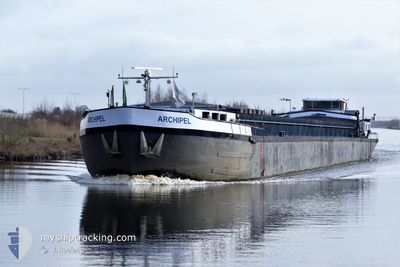
The vessel HELENA JANNY (MMSI: 244660465) is a Cargo It's sailing under the flag of [NL] Netherlands.
In this page you can find informations about the vessels current position, last detected port calls, and current voyage information. If the vessels is not in coverage by AIS you will find the latest position.
The current position of HELENA JANNY is detected by our AIS receivers and we are not responsible for the reliability of the data. The last position was recorded while the vessel was in Coverage by the Ais receivers of our vessel tracking app.
Weather
| Temperature | -0.8°C / 30.56°F |
|---|---|
| Wind Speed | 7 knots |
| Direction | 216° SW |
| Pressure | 1011.3 hPa |
| Humidity | 78.6 % |
| Cloud Coverage | 85 % |
Featured Company
Last Port Calls
| Port | Arrival | Departure | Time In Port |
|---|---|---|---|
| 2026-01-01 15:04 | 2026-01-02 17:41 | 1 d | |
| 2025-12-30 14:17 | 2025-12-31 11:55 | 21 h | |
| 2025-12-29 14:07 | 2025-12-30 11:01 | 20 h | |
| 2025-12-27 20:11 | 2025-12-29 11:27 | 1 d | |
| 2025-12-19 18:04 | 2025-12-19 18:27 | 22 m | |
| 2025-12-18 18:33 | 2025-12-19 13:40 | 19 h | |
| 2025-12-18 14:40 | 2025-12-18 15:15 | 34 m | |
| 2025-12-03 15:38 | 2025-12-18 11:37 | 14 d | |
| 2025-12-03 09:09 | 2025-12-03 09:16 | 7 m | |
| 2025-11-26 18:08 | 2025-11-27 09:09 | 15 h |
Most Visited Ports (Last year)
| Port | Arrivals | |
|---|---|---|
| 7 | ||
| 6 | ||
| 6 | ||
| 6 | ||
| 6 | ||
| 5 |
Last Trips
| Origin | Departure | Destination | Arrival | Distance | |
|---|---|---|---|---|---|
| 2025-12-31 11:55 | 2026-01-01 15:04 | 26.65 nm | |||
| 2025-12-30 11:01 | 2025-12-30 14:17 | 13.69 nm | |||
| 2025-12-29 11:27 | 2025-12-29 14:07 | 20.39 nm | |||
| 2025-12-19 18:27 | 2025-12-27 20:11 | 109.56 nm | |||
| 2025-12-19 13:40 | 2025-12-19 18:04 | 31.18 nm | |||
| 2025-12-18 15:15 | 2025-12-18 18:33 | 26.95 nm | |||
| 2025-12-18 11:37 | 2025-12-18 14:40 | 23.59 nm | |||
| 2025-12-03 09:16 | 2025-12-03 15:38 | 44.12 nm | |||
| 2025-11-27 09:09 | 2025-12-03 09:09 | 140.78 nm | |||
| 2025-11-26 15:57 | 2025-11-26 18:08 | 9.52 nm |
Events
| Time | Event | Details | Position / Dest | Info |
|---|---|---|---|---|
| 2026-01-05 11:39 | OUT of Coverage |
52.40795 / 9.73901
North Sea
|
Speed: 6.3 kn Course: 116.8° |
|
| 2026-01-05 11:33 | IN Coverage |
52.41256 / 9.72530
North Sea
|
Speed: 6.7 kn Course: 119.9° |
|
| 2026-01-05 10:09 | OUT of Coverage |
52.40767 / 9.49363
North Sea
|
Speed: 6.8 kn Course: 74.8° |
|
| 2026-01-05 07:56 | IN Coverage |
52.35659 / 9.12066
North Sea
|
Speed: 6.7 kn Course: 51.6° |
|
| 2026-01-02 18:04 | OUT of Coverage |
52.03710 / 7.67427
North Sea
|
Speed: 6.1 kn Course: 59.5° |
|
| 2026-01-02 16:41 | PORT DEPARTURE |
|
51.98055 / 7.66129
000
|
Speed: 3.8 kn Course: 346.1° |
| 2026-01-02 16:40 | START Moving |
51.97983 / 7.66157
[DE] MUNSTER
|
Speed: 3.2 kn Course: 348.1° |
|
| 2026-01-02 16:22 | Status Changed | Under way using engine Moored |
51.97561 / 7.66284
[DE] MUNSTER
|
Speed: Course: 511° |
| 2026-01-02 16:19 | Status Changed | Moored Under way using engine |
51.97537 / 7.66295
[DE] MUNSTER
|
Speed: Course: 511° |
| 2026-01-02 15:58 | STOP Moving |
51.97535 / 7.66296
[DE] MUNSTER
|
Speed: 0.3 kn Course: 511° |