
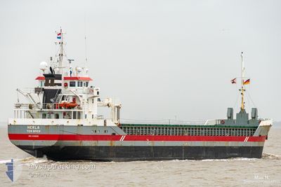
HEKLA
General Cargo
Current Trip
| Time Travelled | 2 days |
|---|---|
| Remaining Time | 1 day |
| Distance Travelled | 628.92 nm |
| Remaining Distance | 335.62 nm |
| AVG Speed | 8.7 Knots |
| MAX Speed | 11.7 Knots |
| AVG Wind | 18.6 knots |
| MAX Wind | 28.9 knots |
| MIN Temp | 11.4°C / 52.52°F |
| MAX Temp | 15.7°C / 60.26°F |
| Draught | 5.6 m |
| Position Received | Now |
Current Position
| Longitude | -4.16031° |
|---|---|
| Latitude | 49.29462° |
| Status | Under way using engine |
| Speed | 11.1 Knots |
| Course | 60° |
| Area | English Channel |
| Station | T-AIS |
| Position Received | Now |
Info
Information
The current position of HEKLA is in English Channel with coordinates 49.29462° / -4.16031° as reported on 2024-05-06 17:00 by AIS to our vessel tracker app. The vessel's current speed is 11.1 Knots and is heading at the port of VLISSINGEN. The estimated time of arrival as calculated by MyShipTracking vessel tracking app is 2024-05-07 22:26 LT
The vessel HEKLA (IMO: 9356505, MMSI: 245281000) is a General Cargo that was built in 2008 ( 16 years old ). It's sailing under the flag of [NL] Netherlands.
In this page you can find informations about the vessels current position, last detected port calls, and current voyage information. If the vessels is not in coverage by AIS you will find the latest position.
The current position of HEKLA is detected by our AIS receivers and we are not responsible for the reliability of the data. The last position was recorded while the vessel was in Coverage by the Ais receivers of our vessel tracking app.
The current draught of HEKLA as reported by AIS is 5.6 meters
Weather
| Temperature | 13.4°C / 56.12°F |
|---|---|
| Wind Speed | 15 knots |
| Direction | 308° NW |
| Pressure | 1010.9 hPa |
| Humidity | 84.9 % |
| Cloud Coverage | 13 % |
Featured Company
Last Port Calls
| Port | Arrival | Departure | Time In Port |
|---|---|---|---|
| 2024-05-02 07:00 | 2024-05-03 19:22 | 1 d | |
| 2024-04-25 00:14 | 2024-04-26 14:10 | 1 d | |
| 2024-04-19 02:35 | 2024-04-21 15:05 | 2 d | |
| 2024-04-15 20:57 | 2024-04-18 23:12 | 3 d | |
| 2024-04-10 06:59 | 2024-04-11 16:02 | 1 d | |
| 2024-04-06 23:20 | 2024-04-09 14:07 | 2 d | |
| 2024-04-03 06:50 | 2024-04-04 17:26 | 1 d | |
| 2024-03-27 06:52 | 2024-03-27 07:03 | 11 m | |
| 2024-03-23 23:26 | 2024-03-26 16:57 | 2 d | |
| 2024-03-20 19:24 | 2024-03-22 21:20 | 2 d |
Most Visited Ports (Last year)
| Port | Arrivals | |
|---|---|---|
| 8 | ||
| 3 | ||
| 3 | ||
| 3 | ||
| 3 | ||
| 3 |
Last Trips
| Origin | Departure | Destination | Arrival | Distance | |
|---|---|---|---|---|---|
| 2024-04-26 15:10 | 2024-05-02 08:00 | 1043.65 nm | |||
| 2024-04-21 17:05 | 2024-04-25 01:14 | 765.35 nm | |||
| 2024-04-19 01:12 | 2024-04-19 04:35 | 31.81 nm | |||
| 2024-04-11 17:02 | 2024-04-15 22:57 | 970.74 nm | |||
| 2024-04-09 16:07 | 2024-04-10 07:59 | 154.07 nm | |||
| 2024-04-04 19:26 | 2024-04-07 01:20 | 468.75 nm | |||
| 2024-03-27 08:03 | 2024-04-03 08:50 | 852.47 nm | |||
| 2024-03-26 17:57 | 2024-03-27 07:52 | 133.46 nm | |||
| 2024-03-22 21:20 | 2024-03-24 00:26 | 253.17 nm | |||
| 2024-03-15 06:08 | 2024-03-20 19:24 | 163.51 nm |
Events
| Time | Event | Details | Position / Dest | Info |
|---|---|---|---|---|
| 2024-05-06 16:30 | Status Changed | Under way using engine Default |
49.24607 / -4.28424
VLISSINGEN
|
Speed: 11 kn Course: 59° |
| 2024-05-06 15:40 | Status Changed | Default Under way using engine |
49.16500 / -4.49167
VLISSINGEN
|
Speed: 11.6 kn Course: 60.4° |
| 2024-05-06 14:59 | Status Changed | Under way using engine Default |
49.10044 / -4.67277
VLISSINGEN
|
Speed: 11 kn Course: 60° |
| 2024-05-06 14:46 | Status Changed | Default Under way using engine |
49.08055 / -4.72731
VLISSINGEN
|
Speed: 11.6 kn Course: 59.5° |
| 2024-05-06 14:41 | Change Sea Area | French part of the English Channel French part of the Celtic Sea |
49.07260 / -4.74884
English Channel
VLISSINGEN
|
Speed: 11.7 kn Course: 61.8° |
| 2024-05-06 14:41 | Status Changed | Under way using engine Default |
49.07260 / -4.74884
VLISSINGEN
|
Speed: 11 kn Course: 62° |
| 2024-05-06 13:53 | Status Changed | Default Under way using engine |
48.99587 / -4.95102
VLISSINGEN
|
Speed: 11.4 kn Course: 62.8° |
| 2024-05-06 13:36 | Draught Changed | 5.6 5.8 |
48.96953 / -5.02334
VLISSINGEN
|
Speed: 11.1 kn Course: 59.6° |
| 2024-05-06 13:36 | ETA Changed | 2024/05/08 01:00 2024/05/07 21:00 |
48.96953 / -5.02334
VLISSINGEN
|
Speed: 11.1 kn Course: 59.6° |
| 2024-05-06 13:19 | Status Changed | Under way using engine Default |
48.94321 / -5.09124
VLISSINGEN
|
Speed: 11 kn Course: 60° |