
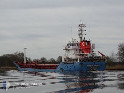
GUNDEM MAKBULE
General Cargo
Current Trip
| Time Travelled | 4 days |
|---|---|
| Remaining Time | --- |
| Distance Travelled | 970.85 nm |
| Remaining Distance | --- |
| AVG Speed | 9.5 Knots |
| MAX Speed | 12 Knots |
| AVG Wind | 11.7 knots |
| MAX Wind | 35.9 knots |
| MIN Temp | 9°C / 48.2°F |
| MAX Temp | 16.7°C / 62.06°F |
| Draught | 6.6 m |
| Position Received | 14 h, 4 m ago |
Current Position
| Longitude | 22.95205° |
|---|---|
| Latitude | 38.20829° |
| Status | Under way using engine |
| Speed | 5.6 Knots |
| Course | 286.9° |
| Area | Ionian Sea |
| Station | T-AIS |
| Position Received | 14 h, 4 m ago |
Info
Information
The current position of GUNDEM MAKBULE is in Ionian Sea with coordinates 38.20829° / 22.95205° as reported on 2024-04-27 04:34 by AIS to our vessel tracker app. The vessel's current speed is 5.6 Knots
The vessel GUNDEM MAKBULE (IMO: 9520388, MMSI: 374281000) is a General Cargo that was built in 2009 ( 15 years old ). It's sailing under the flag of [PA] Panama.
In this page you can find informations about the vessels current position, last detected port calls, and current voyage information. If the vessels is not in coverage by AIS you will find the latest position.
The current position of GUNDEM MAKBULE is detected by our AIS receivers and we are not responsible for the reliability of the data. The last position was recorded while the vessel was in Coverage by the Ais receivers of our vessel tracking app.
The current draught of GUNDEM MAKBULE as reported by AIS is 6.6 meters
Weather
| Temperature | 12.5°C / 54.5°F |
|---|---|
| Wind Speed | 3 knots |
| Direction | 9° N |
| Pressure | 1016.2 hPa |
| Humidity | 71.4 % |
| Cloud Coverage | 58 % |
Featured Company
Last Port Calls
| Port | Arrival | Departure | Time In Port |
|---|---|---|---|
| 2024-04-17 18:23 | 2024-04-22 20:40 | 5 d | |
| 2024-04-16 09:26 | 2024-04-17 10:30 | 1 d | |
| 2024-04-09 07:44 | 2024-04-10 14:46 | 1 d | |
| 2024-04-05 07:30 | 2024-04-05 18:56 | 11 h | |
| 2024-03-30 17:15 | 2024-04-01 11:35 | 1 d | |
| 2024-03-22 08:43 | 2024-03-27 14:33 | 5 d | |
| 2024-03-17 21:38 | 2024-03-20 19:35 | 2 d | |
| 2024-03-14 06:46 | |||
| 2024-03-03 01:12 | 2024-03-06 19:08 | 3 d | |
| 2024-02-21 12:47 | 2024-02-22 19:23 | 1 d |
Last Trips
| Origin | Departure | Destination | Arrival | Distance | |
|---|---|---|---|---|---|
| 2024-04-17 12:30 | 2024-04-17 20:23 | 77.89 nm | |||
| 2024-04-10 15:46 | 2024-04-16 11:26 | 1149.32 nm | |||
| 2024-04-05 19:56 | 2024-04-09 08:44 | 42.46 nm | |||
| 2024-04-01 13:35 | 2024-04-05 08:30 | 611.79 nm | |||
| 2024-03-27 15:33 | 2024-03-30 18:15 | 584.37 nm | |||
| 2024-03-20 20:35 | 2024-03-22 09:43 | 339.95 nm | |||
| 2024-03-14 07:46 | 2024-03-17 22:38 | 781.75 nm | |||
| 2024-02-22 22:23 | 2024-03-03 02:12 | 1680.16 nm | |||
| 2024-02-01 21:37 | 2024-02-14 18:32 | 2974.40 nm | |||
| 2024-01-30 23:57 | 2024-02-01 15:07 | 371.38 nm |
Events
| Time | Event | Details | Position / Dest | Info |
|---|---|---|---|---|
| 2024-04-27 04:34 | OUT of Coverage |
38.20829 / 22.95205
Ionian Sea
GR THI
|
Speed: 5.6 kn Course: 286.9° |
|
| 2024-04-27 01:22 | Status Changed | Under way using engine Default |
38.25217 / 22.47233
GR THI
|
Speed: 10.4 kn Course: 104° |
| 2024-04-27 01:05 | IN Coverage |
38.25217 / 22.47233
Ionian Sea
GR THI
|
Speed: 9.6 kn Course: 103° |
|
| 2024-04-26 23:51 | Status Changed | Default Under way using engine |
38.31081 / 22.15379
GR THI
|
Speed: 10.1 kn Course: 104.5° |
| 2024-04-26 23:44 | OUT of Coverage |
38.31516 / 22.13204
Ionian Sea
GR THI
|
Speed: 10.1 kn Course: 104.5° |
|
| 2024-04-26 09:08 | Detected in Sea | Greek part of the Ionian Sea |
37.92072 / 19.36280
Ionian Sea
GR THI
|
Speed: 9.6 kn Course: 87.3° |
| 2024-04-26 09:08 | IN Coverage |
37.92072 / 19.36280
Ionian Sea
GR THI
|
Speed: 9.6 kn Course: 87.3° |
|
| 2024-04-25 16:08 | Status Changed | Default Under way using engine |
37.85696 / 15.93371
GR THI
|
Speed: 9.7 kn Course: 91.1° |
| 2024-04-25 15:58 | OUT of Coverage |
37.85617 / 15.90072
Ionian Sea
GR THI
|
Speed: 9.7 kn Course: 91.1° |
|
| 2024-04-25 12:15 | Change Sea Area | Italian part of the Ionian Sea Italian part of the Tyrrhenian Sea |
38.25655 / 15.64670
Ionian Sea
GR THI
|
Speed: 9.7 kn Course: 247.9° |