
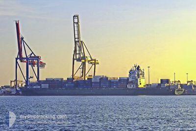
GSL SUSAN
Container Ship
Current Trip
| Time Travelled | 10 days |
|---|---|
| Remaining Time | --- |
| Distance Travelled | 2780.15 nm |
| Remaining Distance | --- |
| AVG Speed | 12.2 Knots |
| MAX Speed | 18.6 Knots |
| AVG Wind | 11.7 knots |
| MAX Wind | 24 knots |
| MIN Temp | 3.4°C / 38.12°F |
| MAX Temp | 18.7°C / 65.66°F |
| Draught | 12 m |
| Position Received | 1 m ago |
Current Position
| Longitude | 14.66070° |
|---|---|
| Latitude | 35.65989° |
| Status | Under way using engine |
| Speed | 0.7 Knots |
| Course | 86° |
| Area | Mediterranean Sea - Eastern Basin |
| Station | T-AIS |
| Position Received | 1 m ago |
Info
Information
The current position of GSL SUSAN is in Mediterranean Sea - Eastern Basin with coordinates 35.65989° / 14.66070° as reported on 2024-05-06 14:51 by AIS to our vessel tracker app. The vessel's current speed is 0.7 Knots
The vessel GSL SUSAN (IMO: 9349617, MMSI: 636019366) is a Container Ship that was built in 2008 ( 16 years old ). It's sailing under the flag of [LR] Liberia.
In this page you can find informations about the vessels current position, last detected port calls, and current voyage information. If the vessels is not in coverage by AIS you will find the latest position.
The current position of GSL SUSAN is detected by our AIS receivers and we are not responsible for the reliability of the data. The last position was recorded while the vessel was in Coverage by the Ais receivers of our vessel tracking app.
The current draught of GSL SUSAN as reported by AIS is 12 meters
Weather
| Temperature | 18.7°C / 65.66°F |
|---|---|
| Wind Speed | 9 knots |
| Direction | 170° S |
| Pressure | 1016.5 hPa |
| Humidity | 74.9 % |
| Cloud Coverage | 4 % |
Featured Company
Last Port Calls
| Port | Arrival | Departure | Time In Port |
|---|---|---|---|
| 2024-04-24 18:39 | 2024-04-26 01:30 | 1 d | |
| 2024-04-21 23:15 | 2024-04-23 00:13 | 1 d | |
| 2024-04-17 17:44 | 2024-04-18 23:21 | 1 d | |
| 2024-04-16 11:08 | 2024-04-17 04:17 | 17 h | |
| 2024-04-12 07:32 | 2024-04-12 22:48 | 15 h | |
| 2024-04-07 16:36 | 2024-04-07 23:57 | 7 h | |
| 2024-04-04 10:09 | 2024-04-05 16:53 | 1 d | |
| 2024-04-03 02:25 | 2024-04-03 13:59 | 11 h | |
| 2024-04-01 13:42 | 2024-04-02 20:26 | 1 d | |
| 2024-03-29 07:10 | 2024-04-01 09:22 | 3 d |
Most Visited Ports (Last year)
| Port | Arrivals | |
|---|---|---|
| 11 | ||
| 10 | ||
| 10 | ||
| 10 | ||
| 10 | ||
| 9 |
Last Trips
| Origin | Departure | Destination | Arrival | Distance | |
|---|---|---|---|---|---|
| 2024-04-23 02:13 | 2024-04-24 20:39 | 368.16 nm | |||
| 2024-04-19 01:21 | 2024-04-22 01:15 | 264.27 nm | |||
| 2024-04-17 05:17 | 2024-04-17 19:44 | 149.94 nm | |||
| 2024-04-12 22:48 | 2024-04-16 12:08 | 1357.79 nm | |||
| 2024-04-08 01:57 | 2024-04-12 07:32 | 1104.39 nm | |||
| 2024-04-05 19:53 | 2024-04-07 18:36 | 801.15 nm | |||
| 2024-04-03 16:59 | 2024-04-04 13:09 | 281.18 nm | |||
| 2024-04-02 23:26 | 2024-04-03 05:25 | 59.98 nm | |||
| 2024-04-01 12:22 | 2024-04-01 16:42 | 46.93 nm | |||
| 2024-03-27 04:09 | 2024-03-29 10:10 | 840.28 nm |
Events
| Time | Event | Details | Position / Dest | Info |
|---|---|---|---|---|
| 2024-05-06 14:49 | Status Changed | Under way using engine Default |
35.65974 / 14.66070
MTMAR
|
Speed: 0.6 kn Course: 83° |
| 2024-05-06 14:28 | Status Changed | Default Under way using engine |
35.65599 / 14.66159
MTMAR
|
Speed: 0.6 kn Course: 82° |
| 2024-05-06 13:00 | STOP Moving | 12.01 nm, South East of MARSAXLOKK |
35.64520 / 14.65879
MTMAR
|
Speed: 0.3 kn Course: 130° |
| 2024-05-06 12:23 | Status Changed | Under way using engine Default |
35.64725 / 14.64690
MTMAR
|
Speed: 2.4 kn Course: 148° |
| 2024-05-06 12:17 | Status Changed | Default Under way using engine |
35.64894 / 14.64375
MTMAR
|
Speed: 2.7 kn Course: 158° |
| 2024-05-06 12:14 | Status Changed | Under way using engine Default |
35.65105 / 14.64257
MTMAR
|
Speed: 5.2 kn Course: 235° |
| 2024-05-06 12:00 | IN Coverage |
35.64981 / 14.64306
Mediterranean Sea - Eastern Basin
|
Speed: 2.7 kn Course: 173° |
|
| 2024-05-06 11:17 | START Moving | 11.99 nm, South East of MARSAXLOKK |
35.74376 / 14.77197
MTMAR
|
Speed: 7 kn Course: 240° |
| 2024-05-06 11:02 | Status Changed | Default Under way using engine |
35.74844 / 14.78447
MTMAR
|
Speed: 0.6 kn Course: 269° |
| 2024-05-06 10:52 | OUT of Coverage |
35.74839 / 14.78229
Mediterranean Sea - Eastern Basin
|
Speed: 0.6 kn Course: 89° |