
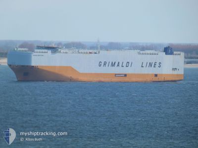
GRANDE NEW YORK
Cargo
Current Trip
| Time Travelled | 9 days |
|---|---|
| Remaining Time | --- |
| Distance Travelled | 4186.12 nm |
| Remaining Distance | --- |
| AVG Speed | 17.3 Knots |
| MAX Speed | 18.8 Knots |
| AVG Wind | 11.6 knots |
| MAX Wind | 23 knots |
| MIN Temp | 12.1°C / 53.78°F |
| MAX Temp | 27.3°C / 81.14°F |
| Draught | 8.9 m |
| Position Received | 1 d ago |
Current Position
| Longitude | --- |
|---|---|
| Latitude | --- |
| Status | Under way using engine |
| Speed | 17.5 Knots |
| Course | 192.2° |
| Area | North Atlantic Ocean |
| Station | T-AIS |
| Position Received | 1 d ago |
Info
Information
The current position of GRANDE NEW YORK is in North Atlantic Ocean with coordinates 15.93413° / -20.06107° as reported on 2025-01-29 01:16 by AIS to our vessel tracker app. The vessel's current speed is 17.5 Knots and is heading at the port of SINGAPORE. The estimated time of arrival as calculated by MyShipTracking vessel tracking app is 2025-02-20 14:00 LT
The vessel GRANDE NEW YORK (IMO: 9784049, MMSI: 247376300) is a Cargo It's sailing under the flag of [IT] Italy.
In this page you can find informations about the vessels current position, last detected port calls, and current voyage information. If the vessels is not in coverage by AIS you will find the latest position.
The current position of GRANDE NEW YORK is detected by our AIS receivers and we are not responsible for the reliability of the data. The last position was recorded while the vessel was in Coverage by the Ais receivers of our vessel tracking app.
The current draught of GRANDE NEW YORK as reported by AIS is 8.9 meters
Weather
| Temperature | 27.3°C / 81.14°F |
|---|---|
| Wind Speed | 7 knots |
| Direction | 53° NE |
| Pressure | 1010.4 hPa |
| Humidity | 78.9 % |
| Cloud Coverage | 38 % |
Featured Company
Last Port Calls
| Port | Arrival | Departure | Time In Port |
|---|---|---|---|
| 2025-01-17 03:51 | 2025-01-20 16:07 | 3 d | |
| 2025-01-05 14:05 | 2025-01-07 22:17 | 2 d | |
| 2024-12-30 23:14 | 2025-01-03 21:28 | 3 d | |
| 2024-12-29 10:04 | 2024-12-29 22:40 | 12 h | |
| 2024-12-20 18:49 | 2024-12-21 23:11 | 1 d | |
| 2024-12-14 19:01 | 2024-12-18 13:35 | 3 d | |
| 2024-12-09 08:03 | 2024-12-12 04:00 | 2 d | |
| 2024-12-03 01:50 | 2024-12-06 12:56 | 3 d | |
| 2024-11-21 14:24 | 2024-11-25 14:51 | 4 d |
Last Trips
| Origin | Departure | Destination | Arrival | Distance | |
|---|---|---|---|---|---|
| 2025-01-07 23:17 | 2025-01-17 05:51 | 3460.34 nm | |||
| 2025-01-03 22:28 | 2025-01-05 15:05 | 640.37 nm | |||
| 2024-12-29 23:40 | 2024-12-31 00:14 | 35.48 nm | |||
| 2024-12-22 02:11 | 2024-12-29 11:04 | 2837.39 nm | |||
| 2024-12-18 15:35 | 2024-12-20 21:49 | 880.42 nm | |||
| 2024-12-12 05:00 | 2024-12-14 21:01 | 1052.08 nm | |||
| 2024-12-06 14:56 | 2024-12-09 09:03 | 1056.59 nm | |||
| 2024-11-25 14:51 | 2024-12-03 03:50 | 2747.04 nm | |||
| 2024-10-21 02:21 | 2024-11-21 14:24 | 12460.42 nm |
Events
| Time | Event | Details | Position / Dest | Info |
|---|---|---|---|---|
| 2025-01-29 01:23 | Status Changed | Default Under way using engine |
15.89919 / -20.06870
ILASH-SGSIN
|
Speed: 17.5 kn Course: 192.2° |
| 2025-01-29 01:16 | Change Sea Area | Cape Verdean part of the North Atlantic Ocean Western Saharan part of the North Atlantic Ocean |
15.93413 / -20.06107
North Atlantic Ocean
ILASH-SGSIN
|
Speed: 17.5 kn Course: 192.2° |
| 2025-01-29 01:16 | Status Changed | Under way using engine Default |
15.93413 / -20.06107
ILASH-SGSIN
|
Speed: 17.5 kn Course: 192° |
| 2025-01-29 01:16 | OUT of Coverage |
15.93413 / -20.06107
North Atlantic Ocean
ILASH-SGSIN
|
Speed: 17.5 kn Course: 192.2° |
|
| 2025-01-29 01:15 | IN Coverage |
15.93413 / -20.06107
North Atlantic Ocean
ILASH-SGSIN
|
Speed: 17.5 kn Course: 192.2° |
|
| 2025-01-28 09:35 | Status Changed | Default Under way using engine |
20.43374 / -19.14265
ILASH-SGSIN
|
Speed: 17 kn Course: 191° |
| 2025-01-28 09:23 | Status Changed | Under way using engine Default |
20.50438 / -19.12813
ILASH-SGSIN
|
Speed: 17.3 kn Course: 190° |
| 2025-01-28 09:23 | OUT of Coverage |
20.50438 / -19.12813
North Atlantic Ocean
ILASH-SGSIN
|
Speed: 17 kn Course: 191° |
|
| 2025-01-28 09:07 | IN Coverage |
20.50438 / -19.12813
North Atlantic Ocean
ILASH-SGSIN
|
Speed: 17 kn Course: 191° |
|
| 2025-01-27 23:36 | OUT of Coverage |
23.00165 / -17.72392
North Atlantic Ocean
ILASH-SGSIN
|
Speed: 18.1 kn Course: 215.9° |