

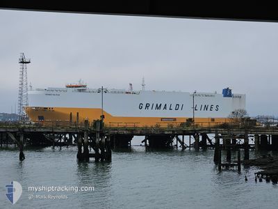
GRANDE HALIFAX
Cargo

Current Trip
| Time Travelled | 1 day |
|---|---|
| Remaining Time | --- |
| Distance Travelled | 310.42 nm |
| Remaining Distance | --- |
| AVG Speed | 14.7 Knots |
| MAX Speed | 18.6 Knots |
| AVG Wind | 11.8 knots |
| MAX Wind | 32 knots |
| MIN Temp | 14.7°C / 58.46°F |
| MAX Temp | 28.1°C / 82.58°F |
| Draught | 9 m |
| Position Received | 3 m ago |
Current Position
| Longitude | --- |
|---|---|
| Latitude | --- |
| Status | Under way using engine |
| Speed | 2.9 Knots |
| Course | 193° |
| Area | Bass Strait |
| Station | T-AIS |
| Position Received | 3 m ago |
Information
The current position of GRANDE HALIFAX is in Bass Strait with coordinates -40.47762° / 146.38518° as reported on 2025-03-29 19:07 by AIS to our vessel tracker app. The vessel's current speed is 2.9 Knots and is heading at the port of TAICANG. The estimated time of arrival as calculated by MyShipTracking vessel tracking app is 2025-04-11 16:00 LT
The vessel GRANDE HALIFAX (IMO: 9784051, MMSI: 247376400) is a Cargo It's sailing under the flag of [IT] Italy.
In this page you can find informations about the vessels current position, last detected port calls, and current voyage information. If the vessels is not in coverage by AIS you will find the latest position.
The current position of GRANDE HALIFAX is detected by our AIS receivers and we are not responsible for the reliability of the data. The last position was recorded while the vessel was in Coverage by the Ais receivers of our vessel tracking app.
The current draught of GRANDE HALIFAX as reported by AIS is 9 meters
Weather
| Temperature | 14.7°C / 58.46°F |
|---|---|
| Wind Speed | 18 knots |
| Direction | 122° ESE |
| Pressure | 1024.2 hPa |
| Humidity | 63.5 % |
| Cloud Coverage | 100 % |


Featured Company
Last Port Calls
| Port | Arrival | Departure | Time In Port |
|---|---|---|---|
| 2025-03-28 07:52 | 2025-03-28 18:04 | 10 h | |
| 2025-03-23 03:11 | 2025-03-23 23:18 | 20 h | |
| 2025-03-10 05:18 | 2025-03-10 17:44 | 12 h | |
| 2025-02-20 14:54 | 2025-02-21 21:41 | 1 d | |
| 2025-02-17 10:20 | 2025-02-18 19:42 | 1 d | |
| 2025-02-14 14:33 | 2025-02-15 01:09 | 10 h | |
| 2025-02-14 14:21 | 2025-02-14 14:28 | 7 m | |
| 2025-02-12 23:09 | 2025-02-13 16:18 | 17 h | |
| 2025-02-06 06:41 | 2025-02-12 04:08 | 5 d | |
| 2025-02-04 05:25 | 2025-02-05 16:36 | 1 d |
Most Visited Ports (Last year)
| Port | Arrivals | |
|---|---|---|
| 7 | ||
| 5 | ||
| 5 | ||
| 5 | ||
| 5 | ||
| 4 |
Last Trips
| Origin | Departure | Destination | Arrival | Distance | |
|---|---|---|---|---|---|
| 2025-03-23 23:18 | 2025-03-28 07:52 | 1717.11 nm | |||
| 2025-03-10 17:44 | 2025-03-23 03:11 | 3877.55 nm | |||
| 2025-02-21 21:41 | 2025-03-10 05:18 | 6662.80 nm | |||
| 2025-02-18 19:42 | 2025-02-20 14:54 | 725.81 nm | |||
| 2025-02-15 01:09 | 2025-02-17 10:20 | 901.72 nm | |||
| 2025-02-14 14:28 | 2025-02-14 14:33 | 0.99 nm | |||
| 2025-02-13 16:18 | 2025-02-14 14:21 | 395.32 nm | |||
| 2025-02-12 04:08 | 2025-02-12 23:09 | 272.15 nm | |||
| 2025-02-05 16:36 | 2025-02-06 06:41 | 46.90 nm | |||
| 2025-02-03 11:50 | 2025-02-04 05:25 | 227.59 nm |
Events
| Time | Event | Details | Position / Dest | Info |
|---|---|---|---|---|
| 2025-03-29 17:29 | Status Changed | Under way using engine Default |
-40.42568 / 146.46545
AUMEL>CNTAC
|
Speed: 2.7 kn Course: 190° |
| 2025-03-29 17:25 | Status Changed | Default Under way using engine |
-40.42377 / 146.46883
AUMEL>CNTAC
|
Speed: 2.9 kn Course: 187° |
| 2025-03-29 14:47 | Status Changed | Under way using engine Default |
-40.33462 / 146.58631
AUMEL>CNTAC
|
Speed: 2.9 kn Course: 189° |
| 2025-03-29 14:45 | Status Changed | Default Under way using engine |
-40.33363 / 146.58780
AUMEL>CNTAC
|
Speed: 3 kn Course: 189° |
| 2025-03-29 14:29 | Status Changed | Under way using engine Default |
-40.32544 / 146.60134
AUMEL>CNTAC
|
Speed: 2.9 kn Course: 185° |
| 2025-03-29 14:29 | Status Changed | Default Under way using engine |
-40.32544 / 146.60133
AUMEL>CNTAC
|
Speed: 3.1 kn Course: 183° |
| 2025-03-29 14:22 | Status Changed | Under way using engine Default |
-40.32133 / 146.60754
AUMEL>CNTAC
|
Speed: 3.3 kn Course: 187° |
| 2025-03-29 14:17 | Status Changed | Default Under way using engine |
-40.31829 / 146.61237
AUMEL>CNTAC
|
Speed: 3.1 kn Course: 185° |
| 2025-03-29 13:58 | Status Changed | Under way using engine Default |
-40.30875 / 146.62838
AUMEL>CNTAC
|
Speed: 3 kn Course: 184° |
| 2025-03-29 13:57 | Status Changed | Default Under way using engine |
-40.30780 / 146.62993
AUMEL>CNTAC
|
Speed: 2.9 kn Course: 185° |