
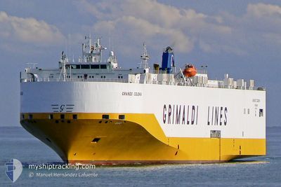
GRANDE COLONIA
Vehicles Carrier
Current Trip
| Trip Time | 1 day |
|---|---|
| Trip Distance | 663.15 nm |
| AVG Speed | 18.1 Knots |
| MAX Speed | 19.8 Knots |
| Draught | 8.7 m |
| AVG Wind | 11.5 knots |
| MAX Wind | 24 knots |
| MIN Temp | 9.4°C / 48.92°F |
| MAX Temp | 15.4°C / 59.72°F |
| Position Received | 3 d ago |
Current Position
| Longitude | --- |
|---|---|
| Latitude | --- |
| Status | Under way using engine |
| Speed | 9.4 Knots |
| Course | 34.4° |
| Area | Tyrrhenian Sea |
| Station | T-AIS |
| Position Received | 3 d ago |
Info
Information
The current position of GRANDE COLONIA is in Tyrrhenian Sea with coordinates 42.09690° / 11.72636° as reported on 2025-12-31 07:43 by AIS to our vessel tracker app. The vessel's current speed is 9.4 Knots and is currently inside the port of CIVITAVECCHIA.
The vessel GRANDE COLONIA (IMO: 9318527, MMSI: 247217500) is a Vehicles Carrier that was built in 2007 ( 19 years old ). It's sailing under the flag of [IT] Italy.
In this page you can find informations about the vessels current position, last detected port calls, and current voyage information. If the vessels is not in coverage by AIS you will find the latest position.
The current position of GRANDE COLONIA is detected by our AIS receivers and we are not responsible for the reliability of the data. The last position was recorded while the vessel was in Coverage by the Ais receivers of our vessel tracking app.
The current draught of GRANDE COLONIA as reported by AIS is 8.7 meters
Weather
| Temperature | 15°C / 59°F |
|---|---|
| Wind Speed | 17 knots |
| Direction | 227° SW |
| Pressure | 1005.6 hPa |
| Humidity | 78.4 % |
| Cloud Coverage | 100 % |
Featured Company
Last Port Calls
| Port | Arrival | Departure | Time In Port |
|---|---|---|---|
| 2025-12-31 08:05 | |||
| 2025-12-29 19:52 | |||
| 2025-12-24 15:02 | 2025-12-25 12:43 | 21 h | |
| 2025-12-20 06:28 | 2025-12-20 17:28 | 11 h | |
| 2025-12-16 02:12 | 2025-12-17 10:25 | 1 d | |
| 2025-12-08 16:49 | 2025-12-13 04:37 | 4 d | |
| 2025-12-04 17:20 | 2025-12-07 07:28 | 2 d | |
| 2025-12-04 16:31 | 2025-12-04 16:40 | 8 m | |
| 2025-12-02 17:30 | 2025-12-04 03:29 | 1 d | |
| 2025-11-26 10:52 | 2025-11-27 18:31 | 1 d |
Last Trips
| Origin | Departure | Destination | Arrival | Distance | |
|---|---|---|---|---|---|
| 2025-12-29 20:52 | 2025-12-31 09:05 | 663.15 nm | |||
| 2025-12-20 18:28 | 2025-12-24 17:02 | 1288.90 nm | |||
| 2025-12-17 10:25 | 2025-12-20 07:28 | 1146.55 nm | |||
| 2025-12-13 05:37 | 2025-12-16 02:12 | 1167.10 nm | |||
| 2025-12-07 07:28 | 2025-12-08 17:49 | 585.20 nm | |||
| 2025-12-04 16:40 | 2025-12-04 17:20 | 3.35 nm | |||
| 2025-12-04 03:29 | 2025-12-04 16:31 | 216.27 nm | |||
| 2025-11-27 19:31 | 2025-12-02 17:30 | 1296.73 nm | |||
| 2025-11-25 12:05 | 2025-11-26 11:52 | 417.77 nm | |||
| 2025-11-20 19:35 | 2025-11-22 06:47 | 574.03 nm |
Events
| Time | Event | Details | Position / Dest | Info |
|---|---|---|---|---|
| 2025-12-31 08:28 | STOP Moving |
42.11036 / 11.76705
[IT] CIVITAVECCHIA
|
Speed: 0.1 kn Course: 236° |
|
| 2025-12-31 08:05 | PORT ARRIVAL |
|
42.10852 / 11.76323
[IT] CIVITAVECCHIA
|
Speed: 6.2 kn Course: 122° |
| 2025-12-31 07:49 | Status Changed | Default Under way using engine |
42.10594 / 11.73451
MEBAR |
Speed: 9.4 kn Course: 34.4° |
| 2025-12-31 07:43 | OUT of Coverage |
42.09690 / 11.72636
Tyrrhenian Sea
[IT] CIVITAVECCHIA
|
Speed: 9.4 kn Course: 34.4° |
|
| 2025-12-31 07:42 | Status Changed | Under way using engine Default |
42.09604 / 11.72556
MEBAR |
Speed: 13.6 kn Course: 34° |
| 2025-12-31 07:41 | Status Changed | Default Under way using engine |
42.09213 / 11.72197
MEBAR |
Speed: 14.7 kn Course: 1.8° |
| 2025-12-31 07:34 | Status Changed | Under way using engine Default |
42.06752 / 11.71125
MEBAR |
Speed: 14.9 kn Course: 349° |
| 2025-12-31 07:33 | Status Changed | Default Under way using engine |
42.06143 / 11.71280
MEBAR |
Speed: 14.5 kn Course: 340.9° |
| 2025-12-31 05:52 | ETA Changed | 2025/12/31 07:45 2025/12/31 08:30 |
41.59783 / 12.02373
MEBAR |
Speed: 19.5 kn Course: 303.7° |
| 2025-12-31 05:39 | Status Changed | Under way using engine Default |
41.56028 / 12.09846
MEBAR |
Speed: 19.5 kn Course: 304° |