

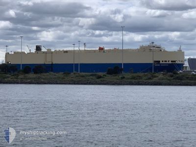
GRAND CHAMPION
Vehicles Carrier

Current Trip
| Time Travelled | 1 day |
|---|---|
| Remaining Time | 23 h, 52 mins |
| Distance Travelled | 620.25 nm |
| Remaining Distance | 435.81 nm |
| AVG Speed | 18 Knots |
| MAX Speed | 19.2 Knots |
| AVG Wind | 11 knots |
| MAX Wind | 16.8 knots |
| MIN Temp | 24°C / 75.2°F |
| MAX Temp | 27.6°C / 81.68°F |
| Draught | 9.1 m |
| Position Received | 18 h, 15 m ago |
Current Position
| Longitude | --- |
|---|---|
| Latitude | --- |
| Status | Under way using engine |
| Speed | 19.2 Knots |
| Course | 201.2° |
| Area | South Atlantic Ocean |
| Station | T-AIS |
| Position Received | 18 h, 15 m ago |
Information
The current position of GRAND CHAMPION is in South Atlantic Ocean with coordinates -28.50046° / -48.31752° as reported on 2025-02-22 10:53 by AIS to our vessel tracker app. The vessel's current speed is 19.2 Knots and is heading at the port of ZARATE. The estimated time of arrival as calculated by MyShipTracking vessel tracking app is 2025-02-24 02:00 LT
The vessel GRAND CHAMPION (IMO: 9340570, MMSI: 372613000) is a Vehicles Carrier that was built in 2008 ( 17 years old ). It's sailing under the flag of [PA] Panama.
In this page you can find informations about the vessels current position, last detected port calls, and current voyage information. If the vessels is not in coverage by AIS you will find the latest position.
The current position of GRAND CHAMPION is detected by our AIS receivers and we are not responsible for the reliability of the data. The last position was recorded while the vessel was in Coverage by the Ais receivers of our vessel tracking app.
The current draught of GRAND CHAMPION as reported by AIS is 9.1 meters
Weather
| Temperature | 24.2°C / 75.56°F |
|---|---|
| Wind Speed | 17 knots |
| Direction | 32° NNE |
| Pressure | 1016.9 hPa |
| Humidity | 78.7 % |
| Cloud Coverage | 1 % |


Featured Company
Last Port Calls
| Port | Arrival | Departure | Time In Port |
|---|---|---|---|
| 2025-02-20 21:05 | 2025-02-21 15:22 | 18 h | |
| 2025-02-15 13:14 | 2025-02-16 00:19 | 11 h | |
| 2025-02-01 04:11 | 2025-02-01 13:12 | 9 h | |
| 2025-01-30 20:43 | 2025-01-31 15:07 | 18 h | |
| 2025-01-27 16:26 | 2025-01-29 02:15 | 1 d | |
| 2025-01-26 06:18 | 2025-01-26 19:34 | 13 h | |
| 2025-01-24 05:56 | 2025-01-24 12:57 | 7 h | |
| 2025-01-19 16:17 | 2025-01-20 15:35 | 23 h | |
| 2024-12-22 08:35 | 2024-12-23 16:08 | 1 d | |
| 2024-12-21 07:19 | 2024-12-22 07:30 | 1 d |
Last Trips
| Origin | Departure | Destination | Arrival | Distance | |
|---|---|---|---|---|---|
| 2025-02-16 00:19 | 2025-02-20 21:05 | 484.40 nm | |||
| 2025-02-01 13:12 | 2025-02-15 13:14 | 5312.50 nm | |||
| 2025-01-31 15:07 | 2025-02-01 04:11 | 164.93 nm | |||
| 2025-01-29 02:15 | 2025-01-30 20:43 | 626.15 nm | |||
| 2025-01-26 19:34 | 2025-01-27 16:26 | 256.65 nm | |||
| 2025-01-24 12:57 | 2025-01-26 06:18 | 603.92 nm | |||
| 2025-01-20 15:35 | 2025-01-24 05:56 | 1230.28 nm | |||
| 2024-12-23 16:08 | 2025-01-19 16:17 | 9660.67 nm | |||
| 2024-12-22 07:30 | 2024-12-22 08:35 | 8.50 nm | |||
| 2024-12-19 18:41 | 2024-12-21 07:19 | 544.01 nm |
Events
| Time | Event | Details | Position / Dest | Info |
|---|---|---|---|---|
| 2025-02-22 10:55 | Status Changed | Default Under way using engine |
-28.50980 / -48.32156
AR ZAE
|
Speed: 19.2 kn Course: 201.2° |
| 2025-02-22 10:53 | OUT of Coverage |
-28.50046 / -48.31752
South Atlantic Ocean
AR ZAE
|
Speed: 19.2 kn Course: 201.2° |
|
| 2025-02-22 05:19 | Status Changed | Under way using engine Default |
-26.90128 / -47.59038
AR ZAE
|
Speed: 17.3 kn Course: 204° |
| 2025-02-22 05:00 | IN Coverage |
-26.90128 / -47.59038
South Atlantic Ocean
AR ZAE
|
Speed: 17.5 kn Course: 204.5° |
|
| 2025-02-21 18:22 | PORT DEPARTURE |
|
-24.00320 / -46.33804
AR ZAE
|
Speed: 6 kn Course: 222° |
| 2025-02-21 18:06 | Status Changed | Default Under way using engine |
-23.99304 / -46.30263
[BR] SANTOS
|
Speed: 8.9 kn Course: 210° |
| 2025-02-21 18:00 | OUT of Coverage |
-23.98626 / -46.29069
South Atlantic Ocean
AR ZAE
|
Speed: 8.9 kn Course: 208.9° |
|
| 2025-02-21 17:47 | START Moving |
-23.96122 / -46.30053
[BR] SANTOS
|
Speed: 3.4 kn Course: 150° |
|
| 2025-02-21 17:30 | Status Changed | Under way using engine Moored |
-23.95754 / -46.30023
[BR] SANTOS
|
Speed: Course: 317° |
| 2025-02-21 17:20 | Status Changed | Moored Default |
-23.95754 / -46.30024
[BR] SANTOS
|
Speed: Course: 317° |