
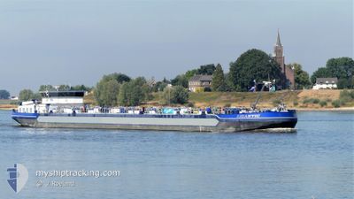
GIGANTIC
Other Type
Current Trip
| Trip Time | 1 day |
|---|---|
| Trip Distance | 158.61 nm |
| AVG Speed | 5.4 Knots |
| MAX Speed | 8.3 Knots |
| Draught | 0 m |
| AVG Wind | 7.6 knots |
| MAX Wind | 14 knots |
| MIN Temp | 11.2°C / 52.16°F |
| MAX Temp | 21.7°C / 71.06°F |
| Position Received | 5 m ago |
Current Position
| Longitude | --- |
|---|---|
| Latitude | --- |
| Status | Moored |
| Speed | |
| Course | --- |
| Area | North Sea |
| Station | T-AIS |
| Position Received | 5 m ago |
Information
The current position of GIGANTIC is in North Sea with coordinates 49.07115° / 8.33683° as reported on 2025-04-14 01:00 by AIS to our vessel tracker app. The vessel's current speed is 0 Knots and is currently inside the port of KARLSRUHE.
The vessel GIGANTIC (MMSI: 211511460) is a Other Type It's sailing under the flag of [DE] Germany.
In this page you can find informations about the vessels current position, last detected port calls, and current voyage information. If the vessels is not in coverage by AIS you will find the latest position.
The current position of GIGANTIC is detected by our AIS receivers and we are not responsible for the reliability of the data. The last position was recorded while the vessel was in Coverage by the Ais receivers of our vessel tracking app.
Weather
| Temperature | 11.1°C / 51.98°F |
|---|---|
| Wind Speed | 4 knots |
| Direction | 219° SW |
| Pressure | 1010.4 hPa |
| Humidity | 80.7 % |
| Cloud Coverage | 100 % |
Featured Company
Last Port Calls
| Port | Arrival | Departure | Time In Port |
|---|---|---|---|
| 2025-04-14 01:58 | |||
| 2025-04-12 17:27 | 2025-04-12 18:28 | 1 h | |
| 2025-04-12 01:32 | 2025-04-12 02:28 | 55 m | |
| 2025-04-11 06:45 | 2025-04-11 15:20 | 8 h | |
| 2025-04-09 12:16 | 2025-04-11 06:15 | 1 d | |
| 2025-04-08 17:29 | 2025-04-08 18:03 | 34 m | |
| 2025-04-07 09:07 | 2025-04-07 10:12 | 1 h | |
| 2025-04-05 20:36 | 2025-04-06 06:00 | 9 h | |
| 2025-04-05 17:20 | 2025-04-05 20:19 | 2 h | |
| 2025-04-05 08:58 | 2025-04-05 09:45 | 47 m |
Most Visited Ports (Last year)
| Port | Arrivals | |
|---|---|---|
| 40 | ||
| 31 | ||
| 27 | ||
| 24 | ||
| 22 | ||
| 22 |
Last Trips
| Origin | Departure | Destination | Arrival | Distance | |
|---|---|---|---|---|---|
| 2025-04-12 18:28 | 2025-04-14 01:58 | 158.61 nm | |||
| 2025-04-12 02:28 | 2025-04-12 17:27 | 89.37 nm | |||
| 2025-04-11 15:20 | 2025-04-12 01:32 | 80.94 nm | |||
| 2025-04-11 06:15 | 2025-04-11 06:45 | 3.04 nm | |||
| 2025-04-08 18:03 | 2025-04-09 12:16 | 169.29 nm | |||
| 2025-04-07 10:12 | 2025-04-08 17:29 | 65.24 nm | |||
| 2025-04-06 06:00 | 2025-04-07 09:07 | 162.89 nm | |||
| 2025-04-05 20:19 | 2025-04-05 20:36 | 2.65 nm | |||
| 2025-04-05 09:45 | 2025-04-05 17:20 | 74.59 nm | |||
| 2025-04-04 23:38 | 2025-04-05 08:58 | 88.22 nm |
Events
| Time | Event | Details | Position / Dest | Info |
|---|---|---|---|---|
| 2025-04-14 00:09 | STOP Moving |
49.07119 / 8.33693
[DE] KARLSRUHE
|
Speed: 0.2 kn Course: 511° |
|
| 2025-04-14 00:09 | Status Changed | Moored Under way using engine |
49.07120 / 8.33700
[DE] KARLSRUHE
|
Speed: 0.8 kn Course: 511° |
| 2025-04-13 23:58 | PORT ARRIVAL |
|
49.07836 / 8.34046
[DE] KARLSRUHE
|
Speed: 4.8 kn Course: 186.4° |
| 2025-04-13 17:23 | Status Changed | Under way using engine Default |
49.46741 / 8.46435
NO ORDER
|
Speed: 5 kn Course: 155° |
| 2025-04-13 17:05 | Status Changed | Default Under way using engine |
49.49221 / 8.44364
NO ORDER
|
Speed: 7.3 kn Course: 162.1° |
| 2025-04-13 07:18 | IN Coverage |
49.97724 / 7.87077
North Sea
|
Speed: 4.5 kn Course: 128.4° |
|
| 2025-04-13 06:11 | OUT of Coverage |
50.04604 / 7.78993
North Sea
|
Speed: 4.7 kn Course: 130.9° |
|
| 2025-04-13 06:08 | IN Coverage |
50.04845 / 7.78564
North Sea
|
Speed: 4.3 kn Course: 134.5° |
|
| 2025-04-12 22:30 | OUT of Coverage |
50.48011 / 7.34042
North Sea
|
Speed: 5.3 kn Course: 143.3° |
|
| 2025-04-12 16:28 | PORT DEPARTURE |
|
50.89367 / 7.01112
NO ORDER
|
Speed: 5.3 kn Course: 86.5° |