
GERARD ALBERT
Other Type
Current Trip
Unknown
| Time Travelled | 2 days |
|---|---|
| Remaining Time | --- |
| Distance Travelled | 307.08 nm |
| Remaining Distance | --- |
| AVG Speed | 6.8 Knots |
| MAX Speed | 10.7 Knots |
| AVG Wind | 7.1 knots |
| MAX Wind | 17 knots |
| MIN Temp | -0.1°C / 31.82°F |
| MAX Temp | 10.5°C / 50.9°F |
| Draught | 0 m |
| Position Received | 6 m ago |
Current Position
| Longitude | --- |
|---|---|
| Latitude | --- |
| Status | Under way using engine |
| Speed | 5.6 Knots |
| Course | 133.8° |
| Area | North Sea |
| Station | T-AIS |
| Position Received | 6 m ago |
Info
Information
The current position of GERARD ALBERT is in North Sea with coordinates 49.48736° / 8.44861° as reported on 2025-03-17 08:30 by AIS to our vessel tracker app. The vessel's current speed is 5.6 Knots
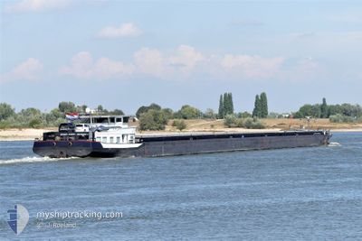
The vessel GERARD ALBERT (MMSI: 244620889) is a Other Type It's sailing under the flag of [NL] Netherlands.
In this page you can find informations about the vessels current position, last detected port calls, and current voyage information. If the vessels is not in coverage by AIS you will find the latest position.
The current position of GERARD ALBERT is detected by our AIS receivers and we are not responsible for the reliability of the data. The last position was recorded while the vessel was in Coverage by the Ais receivers of our vessel tracking app.
Weather
| Temperature | 4.7°C / 40.46°F |
|---|---|
| Wind Speed | 4 knots |
| Direction | 28° NNE |
| Pressure | 1025.7 hPa |
| Humidity | 58.1 % |
| Cloud Coverage | 65 % |
Featured Company
Last Port Calls
| Port | Arrival | Departure | Time In Port |
|---|---|---|---|
| 2025-03-15 05:59 | 2025-03-15 09:11 | 3 h | |
| 2025-03-13 11:28 | 2025-03-15 05:54 | 1 d | |
| 2025-03-13 09:05 | 2025-03-13 10:04 | 58 m | |
| 2025-03-11 10:49 | 2025-03-13 01:54 | 1 d | |
| 2025-03-10 16:04 | 2025-03-10 17:11 | 1 h | |
| 2025-03-06 01:03 | 2025-03-08 11:29 | 2 d | |
| 2025-03-02 02:20 | 2025-03-02 06:30 | 4 h | |
| 2025-02-27 23:29 | 2025-03-02 02:15 | 2 d | |
| 2025-02-27 15:36 | 2025-02-27 23:26 | 7 h | |
| 2025-02-27 14:49 | 2025-02-27 15:30 | 40 m |
Most Visited Ports (Last year)
| Port | Arrivals | |
|---|---|---|
| 89 | ||
| 32 | ||
| 25 | ||
| 19 | ||
| 13 | ||
| 13 |
Last Trips
| Origin | Departure | Destination | Arrival | Distance | |
|---|---|---|---|---|---|
| 2025-03-15 05:54 | 2025-03-15 05:59 | 0.48 nm | |||
| 2025-03-13 10:04 | 2025-03-13 11:28 | 14.33 nm | |||
| 2025-03-13 01:54 | 2025-03-13 09:05 | 54.79 nm | |||
| 2025-03-10 17:11 | 2025-03-11 10:49 | 44.12 nm | |||
| 2025-03-08 11:29 | 2025-03-10 16:04 | 404.36 nm | |||
| 2025-03-02 06:30 | 2025-03-06 01:03 | 441.05 nm | |||
| 2025-03-02 02:15 | 2025-03-02 02:20 | 0.88 nm | |||
| 2025-02-27 23:26 | 2025-02-27 23:29 | 0.60 nm | |||
| 2025-02-27 15:30 | 2025-02-27 15:36 | 1.31 nm | |||
| 2025-02-27 13:03 | 2025-02-27 14:49 | 15.97 nm |
Events
| Time | Event | Details | Position / Dest | Info |
|---|---|---|---|---|
| 2025-03-16 23:09 | IN Coverage |
49.98024 / 7.86685
North Sea
|
Speed: 4.4 kn Course: 147.1° |
|
| 2025-03-16 15:44 | OUT of Coverage |
50.45018 / 7.38110
North Sea
|
Speed: 6.3 kn Course: 129.2° |
|
| 2025-03-15 22:25 | IN Coverage |
51.66198 / 6.52265
North Sea
|
Speed: 6.5 kn Course: 93.6° |
|
| 2025-03-15 20:15 | OUT of Coverage |
51.81245 / 6.28267
North Sea
|
Speed: 7.5 kn Course: 117° |
|
| 2025-03-15 20:14 | Status Changed | Under way using engine Default |
51.81352 / 6.27967
|
Speed: 7.3 kn Course: 113° |
| 2025-03-15 20:04 | Status Changed | Default Under way using engine |
51.82592 / 6.25211
|
Speed: 7.2 kn Course: 92.3° |
| 2025-03-15 12:06 | Status Changed | Under way using engine Default |
51.81826 / 4.85172
|
Speed: 8.3 kn Course: 97° |
| 2025-03-15 11:54 | Status Changed | Default Under way using engine |
51.81759 / 4.80350
|
Speed: 8.3 kn Course: 80.9° |
| 2025-03-15 08:11 | PORT DEPARTURE |
|
51.94802 / 4.07999
|
Speed: 4.9 kn Course: 163.7° |
| 2025-03-15 08:08 | START Moving |
51.95180 / 4.07835
[NL] MAASVLAKTE - ROTTERDAM
|
Speed: 3.1 kn Course: 154.6° |