
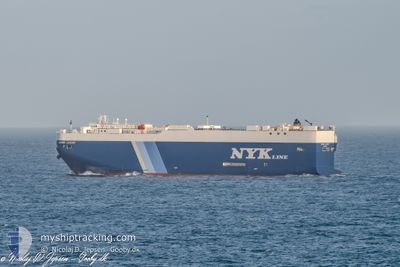
GEMINI LEADER
Vehicles Carrier
Current Trip
| Time Travelled | 24 days |
|---|---|
| Remaining Time | --- |
| Distance Travelled | 9464.56 nm |
| Remaining Distance | --- |
| AVG Speed | 16.1 Knots |
| MAX Speed | 20 Knots |
| AVG Wind | 14.2 knots |
| MAX Wind | 32 knots |
| MIN Temp | 12.7°C / 54.86°F |
| MAX Temp | 28.9°C / 84.02°F |
| Draught | 9.4 m |
| Position Received | 1 d ago |
Current Position
| Longitude | --- |
|---|---|
| Latitude | --- |
| Status | Under way using engine |
| Speed | 18.4 Knots |
| Course | 318.9° |
| Area | South Atlantic Ocean |
| Station | T-AIS |
| Position Received | 1 d ago |
Info
Information
The current position of GEMINI LEADER is in South Atlantic Ocean with coordinates -29.30769° / 12.52028° as reported on 2025-02-16 02:28 by AIS to our vessel tracker app. The vessel's current speed is 18.4 Knots and is heading at the port of SAGUNTO. The estimated time of arrival as calculated by MyShipTracking vessel tracking app is 2025-03-01 05:00 LT
The vessel GEMINI LEADER (IMO: 9519121, MMSI: 371862000) is a Vehicles Carrier that was built in 2009 ( 16 years old ). It's sailing under the flag of [PA] Panama.
In this page you can find informations about the vessels current position, last detected port calls, and current voyage information. If the vessels is not in coverage by AIS you will find the latest position.
The current position of GEMINI LEADER is detected by our AIS receivers and we are not responsible for the reliability of the data. The last position was recorded while the vessel was in Coverage by the Ais receivers of our vessel tracking app.
The current draught of GEMINI LEADER as reported by AIS is 9.4 meters
Weather
| Temperature | 21.5°C / 70.7°F |
|---|---|
| Wind Speed | 15 knots |
| Direction | 139° SE |
| Pressure | 1012.9 hPa |
| Humidity | 74.2 % |
| Cloud Coverage | 72 % |
Featured Company
Last Port Calls
| Port | Arrival | Departure | Time In Port |
|---|---|---|---|
| 2025-01-23 20:09 | 2025-01-24 14:29 | 18 h | |
| 2025-01-21 08:25 | 2025-01-23 16:55 | 2 d | |
| 2025-01-20 12:05 | 2025-01-20 20:13 | 8 h | |
| 2025-01-18 06:21 | 2025-01-18 15:37 | 9 h | |
| 2025-01-08 06:18 | 2025-01-08 14:12 | 7 h | |
| 2024-12-31 12:09 | 2025-01-01 01:16 | 13 h | |
| 2024-12-26 00:25 | 2024-12-27 19:45 | 1 d | |
| 2024-12-14 01:09 | 2024-12-19 05:09 | 5 d | |
| 2024-12-02 17:30 | 2024-12-03 06:33 | 13 h |
Last Trips
| Origin | Departure | Destination | Arrival | Distance | |
|---|---|---|---|---|---|
| 2025-01-23 16:55 | 2025-01-23 20:09 | 43.68 nm | |||
| 2025-01-20 20:13 | 2025-01-21 08:25 | 44.23 nm | |||
| 2025-01-18 15:37 | 2025-01-20 12:05 | 46.09 nm | |||
| 2025-01-08 14:12 | 2025-01-18 06:21 | 2863.42 nm | |||
| 2025-01-01 01:16 | 2025-01-08 06:18 | 1644.92 nm | |||
| 2024-12-27 19:45 | 2024-12-31 12:09 | 1238.00 nm | |||
| 2024-12-19 05:09 | 2024-12-26 00:25 | 1409.74 nm | |||
| 2024-12-03 06:33 | 2024-12-14 01:09 | 3862.84 nm | |||
| 2024-11-29 23:40 | 2024-12-02 17:30 | 867.81 nm |
Events
| Time | Event | Details | Position / Dest | Info |
|---|---|---|---|---|
| 2025-02-16 02:32 | Status Changed | Default Under way using engine |
-29.29060 / 12.50335
ES SAG
|
Speed: 18.4 kn Course: 318.9° |
| 2025-02-16 02:28 | Change Sea Area | Namibian part of the South Atlantic Ocean South African part of the South Atlantic Ocean |
-29.30769 / 12.52028
South Atlantic Ocean
ES SAG
|
Speed: 18.4 kn Course: 318.9° |
| 2025-02-16 02:28 | Status Changed | Under way using engine Default |
-29.30769 / 12.52028
ES SAG
|
Speed: 18.3 kn Course: 318° |
| 2025-02-16 02:28 | IN Coverage |
-29.30769 / 12.52028
South Atlantic Ocean
ES SAG
|
Speed: 18.4 kn Course: 318.9° |
|
| 2025-02-16 02:28 | OUT of Coverage |
-29.30769 / 12.52028
South Atlantic Ocean
ES SAG
|
Speed: 18.4 kn Course: 318.9° |
|
| 2025-02-15 01:13 | Status Changed | Default Under way using engine |
-34.72175 / 18.22788
ES SAG
|
Speed: 16.4 kn Course: 290° |
| 2025-02-15 01:08 | Status Changed | Under way using engine Default |
-34.72960 / 18.25245
ES SAG
|
Speed: 16.5 kn Course: 291° |
| 2025-02-15 01:08 | OUT of Coverage |
-34.72960 / 18.25245
South Atlantic Ocean
ES SAG
|
Speed: 16.4 kn Course: 290° |
|
| 2025-02-15 00:47 | Status Changed | Default Under way using engine |
-34.76417 / 18.36367
ES SAG
|
Speed: 16.3 kn Course: 290° |
| 2025-02-15 00:43 | Change Sea Area | South African part of the South Atlantic Ocean Malaysian part of the Malacca Strait |
-34.76985 / 18.38197
South Atlantic Ocean
ES SAG
|
Speed: 16.3 kn Course: 290° |