
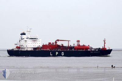
GAZ SERENITY
Tanker
Current Trip
OPL LACONIC GULF
| Time Travelled | 2 days |
|---|---|
| Remaining Time | --- |
| Distance Travelled | 330.78 nm |
| Remaining Distance | --- |
| AVG Speed | 10.9 Knots |
| MAX Speed | 12.6 Knots |
| AVG Wind | 5.5 knots |
| MAX Wind | 11 knots |
| MIN Temp | 13.9°C / 57.02°F |
| MAX Temp | 15.7°C / 60.26°F |
| Draught | 7.6 m |
| Position Received | 1 d ago |
Current Position
| Longitude | --- |
|---|---|
| Latitude | --- |
| Status | Under way using engine |
| Speed | 12.1 Knots |
| Course | 145.3° |
| Area | Ionian Sea |
| Station | T-AIS |
| Position Received | 1 d ago |
Info
Information
The current position of GAZ SERENITY is in Ionian Sea with coordinates 37.21555° / 20.75151° as reported on 2025-03-06 05:45 by AIS to our vessel tracker app. The vessel's current speed is 12.1 Knots
The vessel GAZ SERENITY (IMO: 9448499, MMSI: 372961000) is a Tanker It's sailing under the flag of [PA] Panama.
In this page you can find informations about the vessels current position, last detected port calls, and current voyage information. If the vessels is not in coverage by AIS you will find the latest position.
The current position of GAZ SERENITY is detected by our AIS receivers and we are not responsible for the reliability of the data. The last position was recorded while the vessel was in Coverage by the Ais receivers of our vessel tracking app.
The current draught of GAZ SERENITY as reported by AIS is 7.6 meters
Weather
| Temperature | 14.7°C / 58.46°F |
|---|---|
| Wind Speed | 1 knots |
| Direction | 71° ENE |
| Pressure | 1021 hPa |
| Humidity | 50 % |
| Cloud Coverage | 26 % |
Featured Company
Most Visited Ports (Last year)
| Port | Arrivals | |
|---|---|---|
| 6 | ||
| 6 | ||
| 5 | ||
| 3 | ||
| 2 | ||
| 2 |
Events
| Time | Event | Details | Position / Dest | Info |
|---|---|---|---|---|
| 2025-03-07 07:25 | STOP Moving |
36.16676 / 22.43692
OPL LACONIC GULF
|
Speed: 0.3 kn Course: 3° |
|
| 2025-03-07 04:58 | START Moving |
36.20597 / 22.24369
OPL LACONIC GULF
|
Speed: 3.4 kn Course: 97° |
|
| 2025-03-06 18:30 | STOP Moving |
36.19549 / 22.30700
OPL LACONIC GULF
|
Speed: 0.3 kn Course: 307° |
|
| 2025-03-06 06:07 | Status Changed | Default Under way using engine |
37.17099 / 20.79625
OPL LACONIC GULF
|
Speed: 12.1 kn Course: 145.3° |
| 2025-03-06 05:45 | OUT of Coverage |
37.21555 / 20.75151
Ionian Sea
OPL LACONIC GULF
|
Speed: 12.1 kn Course: 145.3° |
|
| 2025-03-05 23:59 | Status Changed | Under way using engine Default |
38.14489 / 19.92822
OPL LACONIC GULF
|
Speed: 12 kn Course: 158° |
| 2025-03-05 23:44 | Status Changed | Default Under way using engine |
38.19218 / 19.90188
OPL LACONIC GULF
|
Speed: 12 kn Course: 157.7° |
| 2025-03-05 23:00 | Draught Changed | 7.6 7.9 |
38.32941 / 19.82836
OPL LACONIC GULF
|
Speed: 11.9 kn Course: 160.4° |
| 2025-03-05 23:00 | Destination Changed | OPL LACONIC GULF ALVOA |
38.32941 / 19.82836
OPL LACONIC GULF
|
Speed: 11.9 kn Course: 160.4° |
| 2025-03-05 23:00 | ETA Changed | 2025/03/06 17:30 2025/03/04 17:30 |
38.32941 / 19.82836
OPL LACONIC GULF
|
Speed: 11.9 kn Course: 160.4° |