
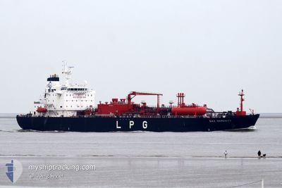
GAZ SERENITY
Tanker
Current Trip
| Time Travelled | 5 days |
|---|---|
| Remaining Time | 1 day |
| Distance Travelled | 1196.01 nm |
| Remaining Distance | 394.78 nm |
| AVG Speed | 11.5 Knots |
| MAX Speed | 15.8 Knots |
| AVG Wind | 14.2 knots |
| MAX Wind | 26.2 knots |
| MIN Temp | 13.8°C / 56.84°F |
| MAX Temp | 17.6°C / 63.68°F |
| Dybgang | 8.7 m |
| Position Modtaget | 19 m siden |
Current Position
| Longitude | --- |
|---|---|
| Latitude | --- |
| Status | Restricted manoeuverability |
| Fart | 0.5 Knots |
| Kurs | 19° |
| Område | Mediterranean Sea - Eastern Basin |
| Station | T-AIS |
| Position Modtaget | 19 m siden |
Info
Information
The current position of GAZ SERENITY is in Mediterranean Sea - Eastern Basin with coordinates 36.15994° / 22.45987° as reported on 2024-12-18 13:06 by AIS to our vessel tracker app. The vessel's current speed is 0.5 Knots and is heading at the port of VALLETTA. The estimated time of arrival as calculated by MyShipTracking vessel tracking app is 2024-12-19 16:26 LT
The vessel GAZ SERENITY (IMO: 9448499, MMSI: 372961000) is a Tanker It's sailing under the flag of [PA] Panama.
In this page you can find informations about the vessels current position, last detected port calls, and current voyage information. If the vessels is not in coverage by AIS you will find the latest position.
The current position of GAZ SERENITY is detected by our AIS receivers and we are not responsible for the reliability of the data. The last position was recorded while the vessel was in Coverage by the Ais receivers of our vessel tracking app.
The current draught of GAZ SERENITY as reported by AIS is 8.7 meters
Weather
| Temperature | 16.7°C / 62.06°F |
|---|---|
| Wind Speed | 7 knots |
| Direction | 70° ENE |
| Pressure | 1023.8 hPa |
| Humidity | 65.4 % |
| Cloud Coverage | --- |
Featured Company
Last Port Calls
| Port | Arrival | Departure | Time In Port |
|---|---|---|---|
| 2024-12-11 18:37 | 2024-12-12 18:45 | 1 d | |
| 2024-11-23 06:42 | 2024-11-24 18:58 | 1 d | |
| 2024-11-01 14:54 | 2024-11-02 15:30 | 1 d | |
| 2024-10-28 07:20 | 2024-10-28 22:00 | 14 h | |
| 2024-10-25 05:10 | 2024-10-26 09:37 | 1 d | |
| 2024-10-21 06:10 | 2024-10-22 06:56 | 1 d | |
| 2024-10-16 23:48 | 2024-10-18 14:11 | 1 d | |
| 2024-10-06 15:51 | 2024-10-06 16:14 | 22 m |
Most Visited Ports (Last year)
| Port | Arrivals | |
|---|---|---|
| 7 | ||
| 5 | ||
| 4 | ||
| 3 | ||
| 3 | ||
| 2 |
Last Trips
| Origin | Departure | Destination | Arrival | Distance | |
|---|---|---|---|---|---|
| 2024-11-24 20:58 | 2024-12-11 19:37 | 2340.67 nm | |||
| 2024-11-02 16:30 | 2024-11-23 08:42 | 2616.69 nm | |||
| 2024-10-28 23:00 | 2024-11-01 15:54 | 1143.85 nm | |||
| 2024-10-26 11:37 | 2024-10-28 08:20 | 15.82 nm | |||
| 2024-10-22 08:56 | 2024-10-25 07:10 | 750.73 nm | |||
| 2024-10-18 15:11 | 2024-10-21 08:10 | 657.22 nm | |||
| 2024-10-06 17:14 | 2024-10-17 00:48 | 411.03 nm | |||
| 2024-09-28 15:45 | 2024-10-06 16:51 | 1661.21 nm |
Events
| Tid | Hændelsen | Detaljer | Position / Dest | Info |
|---|---|---|---|---|
| 2024-12-18 13:15 | Status er ændret | Default Restricted manoeuverability |
36.15894 / 22.46111
MTMLA FOR ORDERS
|
Fart: 0.5 kn Kurs: 19° |
| 2024-12-18 12:43 | Status er ændret | Restricted manoeuverability Default |
36.16278 / 22.45652
MTMLA FOR ORDERS
|
Fart: 0.6 kn Kurs: 19° |
| 2024-12-18 12:31 | Indenfor Dækning |
36.16278 / 22.45652
Mediterranean Sea - Eastern Basin
|
Fart: 0.6 kn Kurs: 135.1° |
|
| 2024-12-18 10:33 | STOP Sejllads |
36.17686 / 22.44160
MTMLA FOR ORDERS
|
Fart: 0.3 kn Kurs: 16° |
|
| 2024-12-18 05:46 | Status er ændret | Default Under way using engine |
36.36560 / 22.65476
MTMLA FOR ORDERS
|
Fart: 1.3 kn Kurs: 151° |
| 2024-12-18 05:30 | Ændre havområde | Greek part of the Mediterranean Sea - Eastern Basin Maltese part of the Mediterranean Sea - Eastern Basin |
36.36989 / 22.65574
Mediterranean Sea - Eastern Basin
|
Fart: 1.3 kn Kurs: 127° |
| 2024-12-18 05:30 | Status er ændret | Under way using engine Default |
36.36989 / 22.65574
MTMLA FOR ORDERS
|
Fart: 7.3 kn Kurs: 72° |
| 2024-12-18 05:30 | Udenfor Dækning |
36.36989 / 22.65574
Mediterranean Sea - Eastern Basin
|
Fart: 1.3 kn Kurs: 127° |
|
| 2024-12-18 05:13 | Indenfor Dækning |
36.36989 / 22.65574
Mediterranean Sea - Eastern Basin
|
Fart: 1.3 kn Kurs: 127° |
|
| 2024-12-16 12:13 | START Sejllads | 15.03 nm, East of MARSAXLOKK |
35.91639 / 14.83320
MTMLA FOR ORDERS
|
Fart: 4.2 kn Kurs: 60° |