
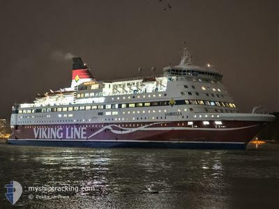
GABRIELLA
Ro-Ro/Passenger Ship
Current Trip
| Trip Time | 4 h, 56 mins |
|---|---|
| Trip Distance | 75.35 nm |
| AVG Speed | 15.3 Knots |
| MAX Speed | 22 Knots |
| Draught | 6.4 m |
| AVG Wind | 15.3 knots |
| MAX Wind | 25.5 knots |
| MIN Temp | -1.1°C / 30.02°F |
| MAX Temp | 2°C / 35.6°F |
| Position Received | Now |
Current Position
| Longitude | --- |
|---|---|
| Latitude | --- |
| Status | Under way using engine |
| Speed | |
| Course | 111° |
| Area | Baltic Sea |
| Station | T-AIS |
| Position Received | Now |
Info
Information
The current position of GABRIELLA is in Baltic Sea with coordinates 59.31699° / 18.09472° as reported on 2026-01-08 18:35 by AIS to our vessel tracker app. The vessel's current speed is 0 Knots and is currently inside the port of STOCKHOLM.
The vessel GABRIELLA (IMO: 8917601, MMSI: 230361000) is a Ro-Ro/Passenger Ship that was built in 1992 ( 34 years old ). It's sailing under the flag of [FI] Finland.
In this page you can find informations about the vessels current position, last detected port calls, and current voyage information. If the vessels is not in coverage by AIS you will find the latest position.
The current position of GABRIELLA is detected by our AIS receivers and we are not responsible for the reliability of the data. The last position was recorded while the vessel was in Coverage by the Ais receivers of our vessel tracking app.
The current draught of GABRIELLA as reported by AIS is 6.4 meters
Weather
| Temperature | -3.7°C / 25.34°F |
|---|---|
| Wind Speed | 5 knots |
| Direction | 153° SSE |
| Pressure | 1016.3 hPa |
| Humidity | 80.9 % |
| Cloud Coverage | 100 % |
Featured Company
Last Port Calls
| Port | Arrival | Departure | Time In Port |
|---|---|---|---|
| 2026-01-08 18:25 | |||
| 2026-01-08 14:09 | 2026-01-08 14:29 | 20 m | |
| 2026-01-08 07:22 | 2026-01-08 08:51 | 1 h | |
| 2026-01-08 03:15 | 2026-01-08 03:25 | 9 m | |
| 2026-01-07 18:30 | 2026-01-07 20:17 | 1 h | |
| 2026-01-07 14:09 | 2026-01-07 14:29 | 20 m | |
| 2026-01-07 07:28 | 2026-01-07 08:50 | 1 h | |
| 2026-01-07 03:09 | 2026-01-07 03:30 | 20 m | |
| 2026-01-06 09:35 | 2026-01-06 20:09 | 10 h | |
| 2026-01-06 04:20 | 2026-01-06 04:36 | 15 m |
Last Trips
| Origin | Departure | Destination | Arrival | Distance | |
|---|---|---|---|---|---|
| 2026-01-08 14:29 | 2026-01-08 18:25 | 75.35 nm | |||
| 2026-01-08 08:51 | 2026-01-08 14:09 | 90.48 nm | |||
| 2026-01-08 03:25 | 2026-01-08 07:22 | 65.35 nm | |||
| 2026-01-07 20:17 | 2026-01-08 03:15 | 90.48 nm | |||
| 2026-01-07 14:29 | 2026-01-07 18:30 | 78.48 nm | |||
| 2026-01-07 08:50 | 2026-01-07 14:09 | 90.51 nm | |||
| 2026-01-07 03:30 | 2026-01-07 07:28 | 66.19 nm | |||
| 2026-01-06 20:09 | 2026-01-07 03:09 | 91.40 nm | |||
| 2026-01-06 04:36 | 2026-01-06 09:35 | 77.72 nm | |||
| 2026-01-05 17:19 | 2026-01-06 04:20 | 183.63 nm |
Events
| Time | Event | Details | Position / Dest | Info |
|---|---|---|---|---|
| 2026-01-08 17:48 | STOP Moving |
59.31711 / 18.09437
[SE] STOCKHOLM
|
Speed: 0.3 kn Course: 110° |
|
| 2026-01-08 17:25 | PORT ARRIVAL |
|
59.32076 / 18.16120
[SE] STOCKHOLM
|
Speed: 10.8 kn Course: 240.5° |
| 2026-01-08 13:34 | Change Sea Area | Swedish part of the Baltic Sea Swedish part of the Gulf of Bothnia |
59.81593 / 19.46134
Baltic Sea
FITKU<>FIMHQ<>SESTO
|
Speed: 21 kn Course: 224.4° |
| 2026-01-08 13:25 | Change Sea Area | Swedish part of the Gulf of Bothnia Finnish part of the Gulf of Bothnia |
59.85350 / 19.53317
Gulf of Bothnia
FITKU<>FIMHQ<>SESTO
|
Speed: 20.5 kn Course: 223.9° |
| 2026-01-08 12:40 | Status Changed | Under way using engine Default |
60.03593 / 19.88398
FITKU<>FIMHQ<>SESTO
|
Speed: 0.3 kn Course: 182° |
| 2026-01-08 12:40 | START Moving | 3.11 nm, South West of KORRVIK |
60.03593 / 19.88398
FITKU<>FIMHQ<>SESTO
|
Speed: 18.5 kn Course: 212° |
| 2026-01-08 12:29 | PORT DEPARTURE |
|
60.03593 / 19.88398
FITKU<>FIMHQ<>SESTO
|
Speed: 0.3 kn Course: 182° |
| 2026-01-08 12:09 | Status Changed | Default Under way using engine |
60.09103 / 19.92778
[FI] MARIEHAMN
|
Speed: 6.7 kn Course: 0.5° |
| 2026-01-08 12:09 | STOP Moving |
60.09103 / 19.92778
[FI] MARIEHAMN
|
Speed: 0.2 kn Course: 182° |
|
| 2026-01-08 12:09 | PORT ARRIVAL |
|
60.09103 / 19.92778
[FI] MARIEHAMN
|
Speed: 6.7 kn Course: 0.5° |