
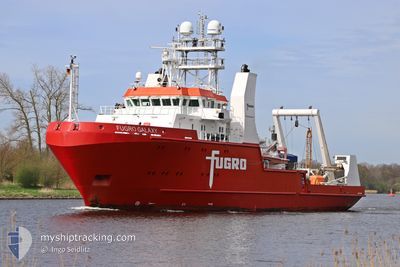
FUGRO GALAXY
Research/Survey Vessel
Current Trip
SURVEY SITE
| Time Travelled | 5 days |
|---|---|
| Remaining Time | --- |
| Distance Travelled | 478.57 nm |
| Remaining Distance | --- |
| AVG Speed | 4.5 Knots |
| MAX Speed | 13.6 Knots |
| AVG Wind | 14 knots |
| MAX Wind | 26 knots |
| MIN Temp | 8.5°C / 47.3°F |
| MAX Temp | 13.2°C / 55.76°F |
| Draught | 5.3 m |
| Position Received | Now |
Current Position
| Longitude | 5.19129° |
|---|---|
| Latitude | 56.35121° |
| Status | Restricted manoeuverability |
| Speed | 0.5 Knots |
| Course | 112° |
| Area | North Sea |
| Station | T-AIS |
| Position Received | Now |
Info
Information
The current position of FUGRO GALAXY is in North Sea with coordinates 56.35121° / 5.19129° as reported on 2024-05-14 18:49 by AIS to our vessel tracker app. The vessel's current speed is 0.5 Knots
The vessel FUGRO GALAXY (IMO: 9583445, MMSI: 311049200) is a Research/Survey Vessel that was built in 2011 ( 13 years old ). It's sailing under the flag of [BS] Bahamas.
In this page you can find informations about the vessels current position, last detected port calls, and current voyage information. If the vessels is not in coverage by AIS you will find the latest position.
The current position of FUGRO GALAXY is detected by our AIS receivers and we are not responsible for the reliability of the data. The last position was recorded while the vessel was in Coverage by the Ais receivers of our vessel tracking app.
The current draught of FUGRO GALAXY as reported by AIS is 5.3 meters
Weather
| Temperature | 13.1°C / 55.58°F |
|---|---|
| Wind Speed | 21 knots |
| Direction | 113° ESE |
| Pressure | 1010 hPa |
| Humidity | 81.6 % |
| Cloud Coverage | 3 % |
Featured Company
Last Port Calls
| Port | Arrival | Departure | Time In Port |
|---|---|---|---|
| 2024-05-06 11:40 | 2024-05-09 14:08 | 3 d | |
| 2024-04-23 07:08 | 2024-04-25 14:42 | 2 d | |
| 2024-04-08 03:08 | 2024-04-17 21:38 | 9 d | |
| 2024-03-31 05:03 | 2024-04-01 17:10 | 1 d | |
| 2024-03-25 08:02 | 2024-03-28 17:52 | 3 d | |
| 2024-03-12 15:52 |
Most Visited Ports (Last year)
| Port | Arrivals | |
|---|---|---|
| 9 | ||
| 4 | ||
| 3 | ||
| 3 | ||
| 3 | ||
| 2 |
Last Trips
| Origin | Departure | Destination | Arrival | Distance | |
|---|---|---|---|---|---|
| 2024-04-25 16:42 | 2024-05-06 13:40 | 983.10 nm | |||
| 2024-04-17 23:38 | 2024-04-23 09:08 | 508.08 nm | |||
| 2024-04-01 19:10 | 2024-04-08 05:08 | 732.44 nm | |||
| 2024-03-28 18:52 | 2024-03-31 07:03 | 89.52 nm | |||
| 2024-03-12 16:52 | 2024-03-25 09:02 | 1369.28 nm |
Events
| Time | Event | Details | Position / Dest | Info |
|---|---|---|---|---|
| 2024-05-14 18:29 | STOP Moving |
56.35111 / 5.18658
SURVEY SITE
|
Speed: 0.3 kn Course: 119° |
|
| 2024-05-14 18:29 | START Moving |
56.35111 / 5.18644
SURVEY SITE
|
Speed: 9.4 kn Course: 17.3° |
|
| 2024-05-14 08:42 | STOP Moving |
56.36973 / 5.07531
SURVEY SITE
|
Speed: 0.2 kn Course: 123° |
|
| 2024-05-14 08:42 | START Moving |
56.36975 / 5.07525
SURVEY SITE
|
Speed: 13.6 kn Course: 34.8° |
|
| 2024-05-14 07:36 | STOP Moving |
56.37294 / 5.06601
SURVEY SITE
|
Speed: 0.3 kn Course: 124° |
|
| 2024-05-14 07:33 | START Moving |
56.37313 / 5.06559
SURVEY SITE
|
Speed: 11.8 kn Course: 196.4° |
|
| 2024-05-14 01:45 | STOP Moving |
56.39344 / 5.02702
SURVEY SITE
|
Speed: 0.1 kn Course: 131° |
|
| 2024-05-14 00:17 | START Moving |
56.35759 / 5.13477
SURVEY SITE
|
Speed: 3.1 kn Course: 295° |
|
| 2024-05-13 19:24 | STOP Moving |
56.36963 / 5.07119
SURVEY SITE
|
Speed: 0.3 kn Course: 129° |
|
| 2024-05-13 18:42 | START Moving |
56.37109 / 5.05849
SURVEY SITE
|
Speed: 10.5 kn Course: 18.1° |