

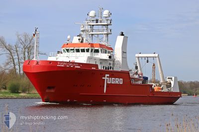
FUGRO GALAXY
Research/Survey Vessel

Current Trip
SURVEY OPS
| Time Travelled | 4 days |
|---|---|
| Remaining Time | --- |
| Distance Travelled | 345.78 nm |
| Remaining Distance | --- |
| AVG Speed | 6.5 Knots |
| MAX Speed | 9.5 Knots |
| AVG Wind | 12.2 knots |
| MAX Wind | 16 knots |
| MIN Temp | 6.1°C / 42.98°F |
| MAX Temp | 7.9°C / 46.22°F |
| Dybgang | 5.4 m |
| Position Modtaget | 1 d siden |
Current Position
| Longitude | --- |
|---|---|
| Latitude | --- |
| Status | Restricted manoeuverability |
| Fart | 3.7 Knots |
| Kurs | 1° |
| Område | North Sea |
| Station | T-AIS |
| Position Modtaget | 1 d siden |
Information
The current position of FUGRO GALAXY is in North Sea with coordinates 54.72958° / 5.53246° as reported on 2025-03-09 05:10 by AIS to our vessel tracker app. The vessel's current speed is 3.7 Knots
The vessel FUGRO GALAXY (IMO: 9583445, MMSI: 311049200) is a Research/Survey Vessel that was built in 2011 ( 14 år gamle ). It's sailing under the flag of [BS] Bahamas.
In this page you can find informations about the vessels current position, last detected port calls, and current voyage information. If the vessels is not in coverage by AIS you will find the latest position.
The current position of FUGRO GALAXY is detected by our AIS receivers and we are not responsible for the reliability of the data. The last position was recorded while the vessel was in Coverage by the Ais receivers of our vessel tracking app.
The current draught of FUGRO GALAXY as reported by AIS is 5.4 meters
Weather
| Temperature | 6.5°C / 43.7°F |
|---|---|
| Wind Speed | 7 knots |
| Direction | 26° NNE |
| Pressure | 1004.2 hPa |
| Humidity | 87 % |
| Cloud Coverage | --- |


Featured Company
Most Visited Ports (Last year)
| Port | Arrivals | |
|---|---|---|
| 8 | ||
| 7 | ||
| 4 | ||
| 3 | ||
| 1 | ||
| 1 |
Events
| Tid | Hændelsen | Detaljer | Position / Dest | Info |
|---|---|---|---|---|
| 2025-03-09 20:16 | START Sejllads |
54.55227 / 5.68880
SURVEY OPS
|
Fart: 3.2 kn Kurs: 54° |
|
| 2025-03-09 15:56 | STOP Sejllads |
54.52208 / 5.63559
SURVEY OPS
|
Fart: 0.1 kn Kurs: 334° |
|
| 2025-03-09 05:13 | Status er ændret | Default Restricted manoeuverability |
54.73162 / 5.53502
SURVEY OPS
|
Fart: 3.7 kn Kurs: 1° |
| 2025-03-09 05:10 | Udenfor Dækning |
54.72958 / 5.53246
North Sea
|
Fart: 3.7 kn Kurs: 358.7° |
|
| 2025-03-09 05:08 | Status er ændret | Restricted manoeuverability Default |
54.72813 / 5.53252
SURVEY OPS
|
Fart: 3.2 kn Kurs: 311° |
| 2025-03-09 04:59 | Status er ændret | Default Restricted manoeuverability |
54.72239 / 5.54386
SURVEY OPS
|
Fart: 3.2 kn Kurs: 311° |
| 2025-03-09 04:07 | Status er ændret | Restricted manoeuverability Default |
54.69220 / 5.60583
SURVEY OPS
|
Fart: 3.2 kn Kurs: 310° |
| 2025-03-09 04:00 | Indenfor Dækning |
54.69220 / 5.60583
North Sea
|
Fart: 3.2 kn Kurs: 309.9° |
|
| 2025-03-09 00:27 | Status er ændret | Default Restricted manoeuverability |
54.68901 / 5.63197
SURVEY OPS
|
Fart: 4.2 kn Kurs: 2° |
| 2025-03-09 00:16 | Udenfor Dækning |
54.68825 / 5.61624
North Sea
|
Fart: 4.2 kn Kurs: 350.1° |