
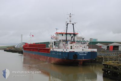
FLUVIUS TAVY
General Cargo
Current Trip
| Time Travelled | 15 h, 3 mins |
|---|---|
| Remaining Time | --- |
| Distance Travelled | 158.16 nm |
| Remaining Distance | --- |
| AVG Speed | 10.2 Knots |
| MAX Speed | 12.3 Knots |
| AVG Wind | 12.2 knots |
| MAX Wind | 24.6 knots |
| MIN Temp | 8.5°C / 47.3°F |
| MAX Temp | 10.3°C / 50.54°F |
| Draught | 3.6 m |
| Position Received | 6 h, 27 m ago |
Current Position
| Longitude | -5.53008° |
|---|---|
| Latitude | 51.59051° |
| Status | Under way using engine |
| Speed | 9.9 Knots |
| Course | 289° |
| Area | Celtic Sea |
| Station | T-AIS |
| Position Received | 6 h, 27 m ago |
Info
Information
The current position of FLUVIUS TAVY is in Celtic Sea with coordinates 51.59051° / -5.53008° as reported on 2024-05-02 06:36 by AIS to our vessel tracker app. The vessel's current speed is 9.9 Knots and is heading at the port of GLENSANDA. The estimated time of arrival as calculated by MyShipTracking vessel tracking app is 2024-05-03 13:30 LT
The vessel FLUVIUS TAVY (IMO: 9501710, MMSI: 314426000) is a General Cargo that was built in 2009 ( 15 years old ). It's sailing under the flag of [BB] Barbados.
In this page you can find informations about the vessels current position, last detected port calls, and current voyage information. If the vessels is not in coverage by AIS you will find the latest position.
The current position of FLUVIUS TAVY is detected by our AIS receivers and we are not responsible for the reliability of the data. The last position was recorded while the vessel was in Coverage by the Ais receivers of our vessel tracking app.
The current draught of FLUVIUS TAVY as reported by AIS is 3.6 meters
Weather
| Temperature | 10.1°C / 50.18°F |
|---|---|
| Wind Speed | 12 knots |
| Direction | 359° N |
| Pressure | 1003.5 hPa |
| Humidity | 93.8 % |
| Cloud Coverage | 100 % |
Featured Company
Last Port Calls
| Port | Arrival | Departure | Time In Port |
|---|---|---|---|
| 2024-04-30 20:52 | 2024-05-01 22:01 | 1 d | |
| 2024-04-27 09:30 | 2024-04-27 23:18 | 13 h | |
| 2024-04-22 19:12 | 2024-04-24 18:51 | 1 d | |
| 2024-04-19 06:24 | 2024-04-20 03:19 | 20 h | |
| 2024-04-13 12:18 | 2024-04-16 15:00 | 3 d | |
| 2024-04-12 23:34 | 2024-04-13 09:57 | 10 h | |
| 2024-04-01 20:55 | 2024-04-09 17:30 | 7 d | |
| 2024-03-26 17:35 | 2024-03-27 22:10 | 1 d | |
| 2024-03-25 03:59 | 2024-03-25 14:06 | 10 h | |
| 2024-03-18 23:37 | 2024-03-19 17:15 | 17 h |
Most Visited Ports (Last year)
| Port | Arrivals | |
|---|---|---|
| 7 | ||
| 7 | ||
| 5 | ||
| 3 | ||
| 3 | ||
| 2 |
Last Trips
| Origin | Departure | Destination | Arrival | Distance | |
|---|---|---|---|---|---|
| 2024-04-28 01:18 | 2024-04-30 21:52 | 630.31 nm | |||
| 2024-04-24 19:51 | 2024-04-27 11:30 | 652.58 nm | |||
| 2024-04-20 05:19 | 2024-04-22 20:12 | 613.65 nm | |||
| 2024-04-16 16:00 | 2024-04-19 08:24 | 698.16 nm | |||
| 2024-04-09 19:30 | 2024-04-13 13:18 | 794.40 nm | |||
| 2024-04-09 19:30 | 2024-04-13 00:34 | 773.78 nm | |||
| 2024-03-27 23:10 | 2024-04-01 22:55 | 923.49 nm | |||
| 2024-03-25 15:06 | 2024-03-26 18:35 | 7.70 nm | |||
| 2024-03-19 18:15 | 2024-03-25 04:59 | 558.26 nm | |||
| 2024-03-15 18:48 | 2024-03-19 00:37 | 766.88 nm |
Events
| Time | Event | Details | Position / Dest | Info |
|---|---|---|---|---|
| 2024-05-02 06:42 | Status Changed | Default Under way using engine |
51.59568 / -5.55561
GBCDF>GBGSA
|
Speed: 9.9 kn Course: 289° |
| 2024-05-02 06:36 | OUT of Coverage |
51.59051 / -5.53008
Celtic Sea
GBCDF>GBGSA
|
Speed: 9.9 kn Course: 289° |
|
| 2024-05-02 04:11 | Change Sea Area | United Kingdom part of the Celtic Sea United Kingdom part of the Bristol Channel |
51.47882 / -4.87097
Celtic Sea
GBCDF>GBGSA
|
Speed: 11.7 kn Course: 275.3° |
| 2024-05-02 03:52 | Draught Changed | 3.6 3 |
51.47276 / -4.76957
GBCDF>GBGSA
|
Speed: 11.6 kn Course: 274.9° |
| 2024-05-02 03:52 | ETA Changed | 2024/05/03 13:30 |
51.47276 / -4.76957
GBCDF>GBGSA
|
Speed: 11.6 kn Course: 274.9° |
| 2024-05-02 03:51 | Status Changed | Under way using engine Default |
51.47276 / -4.76957
GBCDF>GBGSA
|
Speed: 11.8 kn Course: 275° |
| 2024-05-02 03:10 | Status Changed | Default Under way using engine |
51.45981 / -4.55359
GBCDF>GBGSA
|
Speed: 12.1 kn Course: 276.4° |
| 2024-05-02 03:03 | Status Changed | Under way using engine Default |
51.45697 / -4.51256
GBCDF>GBGSA
|
Speed: 12.2 kn Course: 277° |
| 2024-05-02 03:03 | IN Coverage |
51.45697 / -4.51256
Bristol Channel
|
Speed: 12.1 kn Course: 276.4° |
|
| 2024-05-02 00:46 | OUT of Coverage |
51.39722 / -3.79808
Bristol Channel
|
Speed: 11.1 kn Course: 275° |